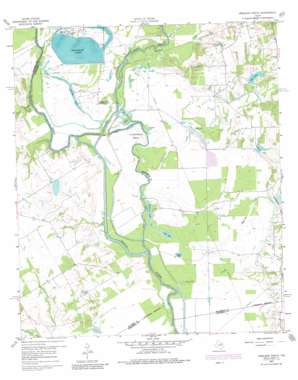
Creslenn Ranch Topo Map Texas
To zoom in, hover over the map of Creslenn Ranch
USGS Topo Quad 32096a1 - 1:24,000 scale
| Topo Map Name: | Creslenn Ranch |
| USGS Topo Quad ID: | 32096a1 |
| Print Size: | ca. 21 1/4" wide x 27" high |
| Southeast Coordinates: | 32° N latitude / 96° W longitude |
| Map Center Coordinates: | 32.0625° N latitude / 96.0625° W longitude |
| U.S. State: | TX |
| Filename: | o32096a1.jpg |
| Download Map JPG Image: | Creslenn Ranch topo map 1:24,000 scale |
| Map Type: | Topographic |
| Topo Series: | 7.5´ |
| Map Scale: | 1:24,000 |
| Source of Map Images: | United States Geological Survey (USGS) |
| Alternate Map Versions: |
Creslenn Ranch TX 1960, updated 1961 Download PDF Buy paper map Creslenn Ranch TX 1960, updated 1975 Download PDF Buy paper map Creslenn Ranch TX 1960, updated 1981 Download PDF Buy paper map Creslenn Ranch TX 2010 Download PDF Buy paper map Creslenn Ranch TX 2012 Download PDF Buy paper map Creslenn Ranch TX 2016 Download PDF Buy paper map |
1:24,000 Topo Quads surrounding Creslenn Ranch
> Back to 32096a1 at 1:100,000 scale
> Back to 32096a1 at 1:250,000 scale
> Back to U.S. Topo Maps home
Creslenn Ranch topo map: Gazetteer
Creslenn Ranch: Airports
Texas Utilities Company Airport elevation 88m 288′Creslenn Ranch: Bends
Cottonwood Bend elevation 82m 269′Creslenn Ranch: Channels
The Cutoff elevation 78m 255′Creslenn Ranch: Dams
Creslenn Ranch Dam elevation 79m 259′Soil Conservation Service Site 1 Dam elevation 93m 305′
Soil Conservation Service Site 3 Dam elevation 94m 308′
Soil Conservation Service Site 4 Dam elevation 95m 311′
Trinidad Levee elevation 85m 278′
Creslenn Ranch: Lakes
Gallimo Lake elevation 82m 269′Jackson Lake elevation 81m 265′
Long Lake elevation 78m 255′
Morrison Lake elevation 81m 265′
Round Lake elevation 79m 259′
Stephens Lake elevation 79m 259′
Creslenn Ranch: Oilfields
South Malakoff Oil Field elevation 102m 334′Creslenn Ranch: Parks
Creslenn Park elevation 80m 262′Creslenn Ranch: Reservoirs
Creslenn Ranch Lake elevation 79m 259′Hall Lake elevation 95m 311′
Soil Conservation Service Site 1 Reservoir elevation 93m 305′
Soil Conservation Service Site 3 Reservoir elevation 94m 308′
Soil Conservation Service Site 4 Reservoir elevation 95m 311′
Trinidad Lake elevation 87m 285′
Creslenn Ranch: Streams
Cedar Creek elevation 75m 246′McAllister Slough elevation 80m 262′
Rush Creek elevation 74m 242′
Turkey Creek elevation 80m 262′
Walnut Creek elevation 79m 259′
Creslenn Ranch digital topo map on disk
Buy this Creslenn Ranch topo map showing relief, roads, GPS coordinates and other geographical features, as a high-resolution digital map file on DVD:


