Kerens Topo Map Texas
To zoom in, hover over the map of Kerens
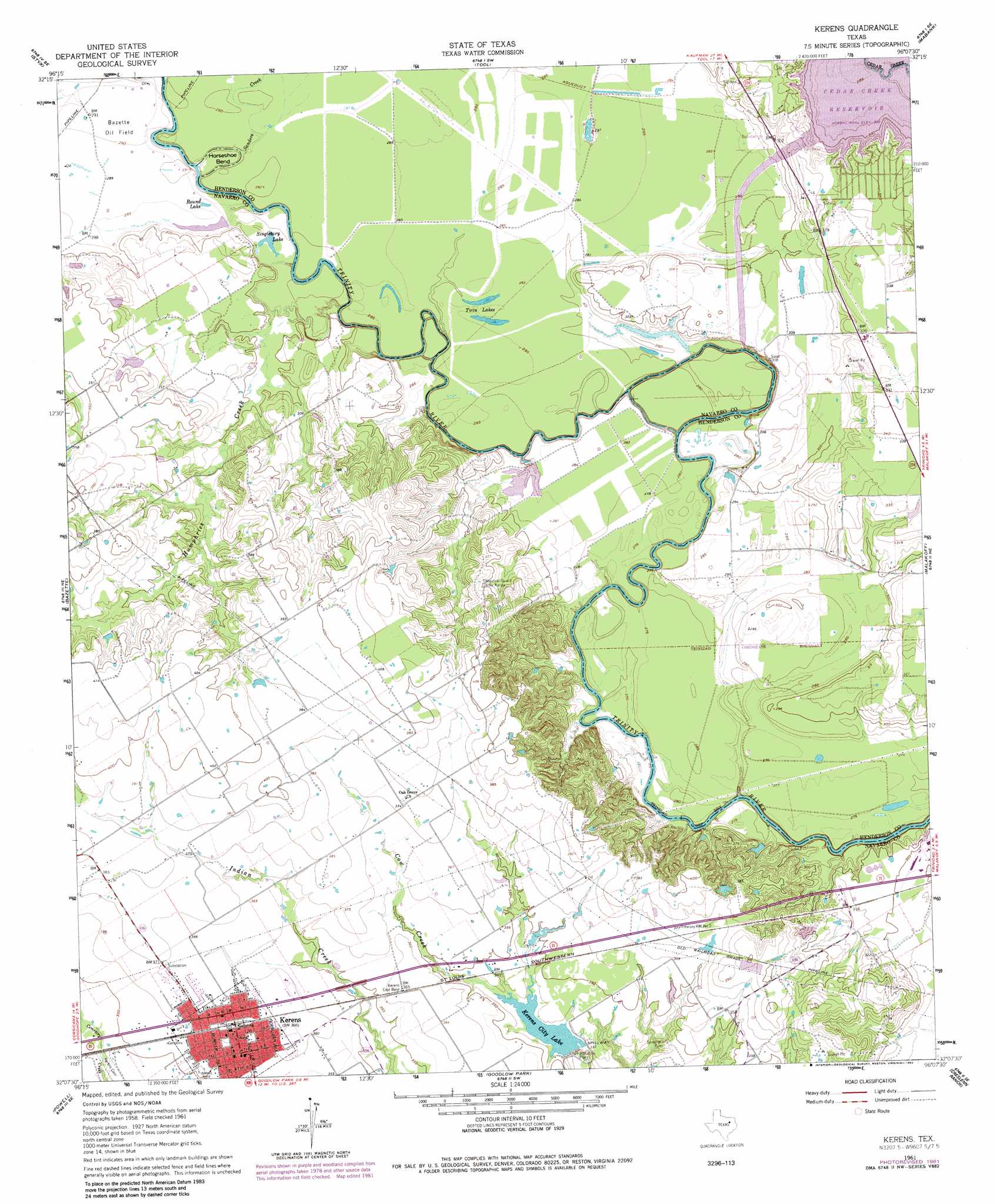
USGS Topo Quad 32096b2 - 1:24,000 scale
| Topo Map Name: | Kerens |
| USGS Topo Quad ID: | 32096b2 |
| Print Size: | ca. 21 1/4" wide x 27" high |
| Southeast Coordinates: | 32.125° N latitude / 96.125° W longitude |
| Map Center Coordinates: | 32.1875° N latitude / 96.1875° W longitude |
| U.S. State: | TX |
| Filename: | o32096b2.jpg |
| Download Map JPG Image: | Kerens topo map 1:24,000 scale |
| Map Type: | Topographic |
| Topo Series: | 7.5´ |
| Map Scale: | 1:24,000 |
| Source of Map Images: | United States Geological Survey (USGS) |
| Alternate Map Versions: |
Kerens TX 1961, updated 1962 Download PDF Buy paper map Kerens TX 1961, updated 1970 Download PDF Buy paper map Kerens TX 1961, updated 1973 Download PDF Buy paper map Kerens TX 2010 Download PDF Buy paper map Kerens TX 2012 Download PDF Buy paper map Kerens TX 2016 Download PDF Buy paper map |
1:24,000 Topo Quads surrounding Kerens
Rosser |
Grays Prairie |
Kemp |
Prairieville |
Phalba |
Rosser Sw |
Styx |
Tool |
Mabank |
Stockard |
Chatfield |
Bazette |
Kerens |
Malakoff |
Mallard Hill |
Corsicana |
Powell |
Goodlow Park |
Creslenn Ranch |
Cross Roads |
Richland |
Streetman |
Winkler |
Roustabout Camp |
Cayuga |
> Back to 32096a1 at 1:100,000 scale
> Back to 32096a1 at 1:250,000 scale
> Back to U.S. Topo Maps home
Kerens topo map: Gazetteer
Kerens: Bends
Horseshoe Bend elevation 85m 278′Kerens: Dams
Kerens City Lake Dam elevation 95m 311′Kerens: Lakes
Round Lake elevation 87m 285′Singletary Lake elevation 87m 285′
Kerens: Oilfields
Bazette Oil Field elevation 89m 291′Kerens: Populated Places
Kerens elevation 113m 370′Samaria elevation 108m 354′
Kerens: Reservoirs
Kerens City Lake elevation 101m 331′Twin Lakes elevation 87m 285′
Kerens: Streams
Humphries Creek elevation 80m 262′Sanders Creek elevation 85m 278′
Kerens digital topo map on disk
Buy this Kerens topo map showing relief, roads, GPS coordinates and other geographical features, as a high-resolution digital map file on DVD: