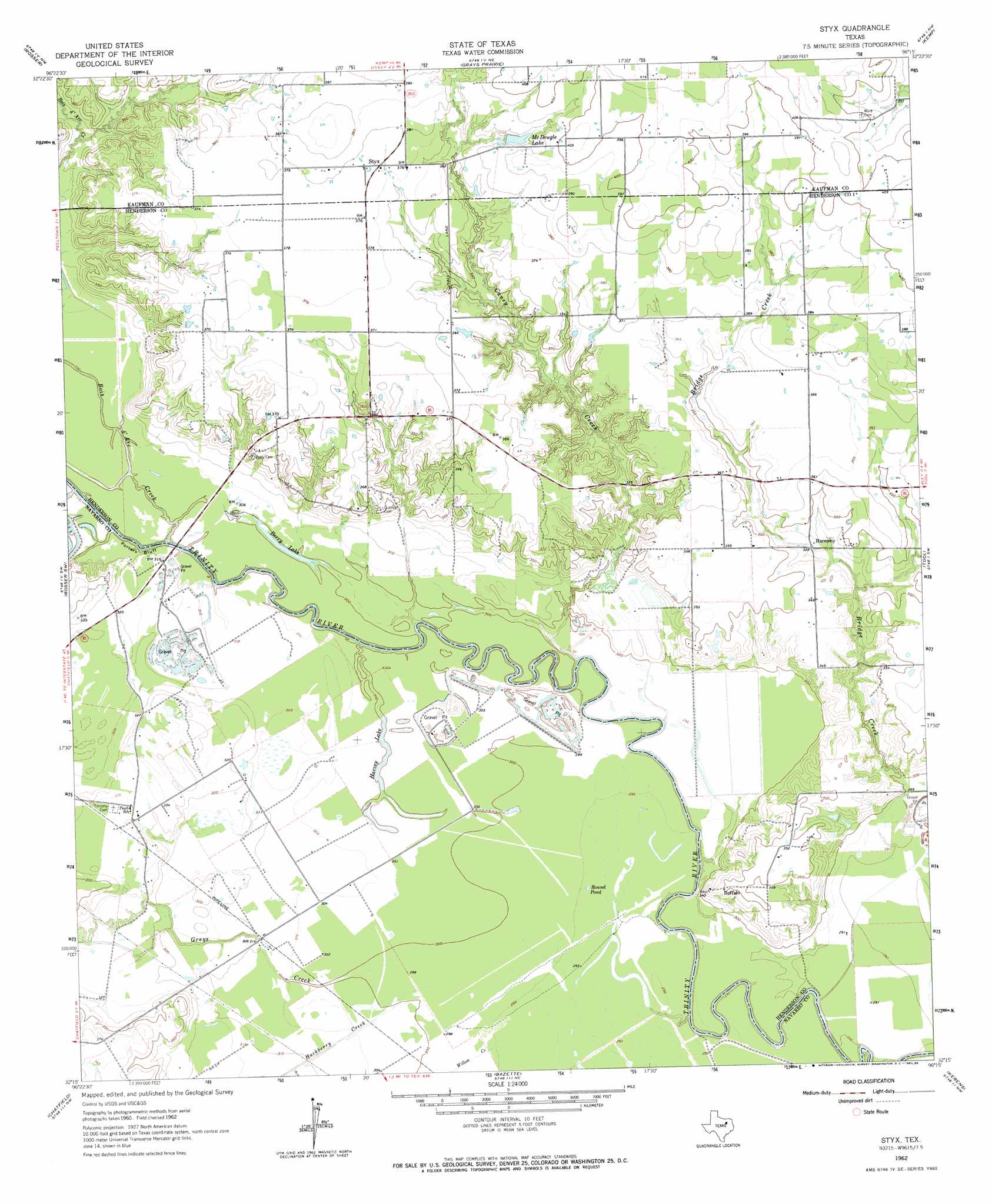
Styx Topo Map Texas
To zoom in, hover over the map of Styx
USGS Topo Quad 32096c3 - 1:24,000 scale
| Topo Map Name: | Styx |
| USGS Topo Quad ID: | 32096c3 |
| Print Size: | ca. 21 1/4" wide x 27" high |
| Southeast Coordinates: | 32.25° N latitude / 96.25° W longitude |
| Map Center Coordinates: | 32.3125° N latitude / 96.3125° W longitude |
| U.S. State: | TX |
| Filename: | o32096c3.jpg |
| Download Map JPG Image: | Styx topo map 1:24,000 scale |
| Map Type: | Topographic |
| Topo Series: | 7.5´ |
| Map Scale: | 1:24,000 |
| Source of Map Images: | United States Geological Survey (USGS) |
| Alternate Map Versions: |
Styx TX 1962, updated 1965 Download PDF Buy paper map Styx TX 1962, updated 1986 Download PDF Buy paper map Styx TX 2010 Download PDF Buy paper map Styx TX 2012 Download PDF Buy paper map Styx TX 2016 Download PDF Buy paper map |
1:24,000 Topo Quads surrounding Styx
India |
Scurry |
Kaufman |
Ola |
Cedarvale |
Bristol |
Rosser |
Grays Prairie |
Kemp |
Prairieville |
Ennis East |
Rosser Sw |
Styx |
Tool |
Mabank |
Emhouse |
Chatfield |
Bazette |
Kerens |
Malakoff |
Corbet |
Corsicana |
Powell |
Goodlow Park |
Creslenn Ranch |
> Back to 32096a1 at 1:100,000 scale
> Back to 32096a1 at 1:250,000 scale
> Back to U.S. Topo Maps home
Styx topo map: Gazetteer
Styx: Cliffs
Porters Bluff elevation 91m 298′Styx: Lakes
Berry Lake elevation 91m 298′Harvey Lake elevation 91m 298′
McDougle Lake elevation 115m 377′
Round Pond elevation 90m 295′
Styx: Populated Places
Aley elevation 109m 357′Buffalo elevation 107m 351′
Harmony elevation 100m 328′
Styx elevation 114m 374′
Styx: Streams
Bois d'Arc Creek elevation 86m 282′Caney Creek elevation 83m 272′
Grays Creek elevation 91m 298′
Hackberry Creek elevation 91m 298′
Willow Creek elevation 90m 295′
Styx digital topo map on disk
Buy this Styx topo map showing relief, roads, GPS coordinates and other geographical features, as a high-resolution digital map file on DVD: