Ennis East Topo Map Texas
To zoom in, hover over the map of Ennis East
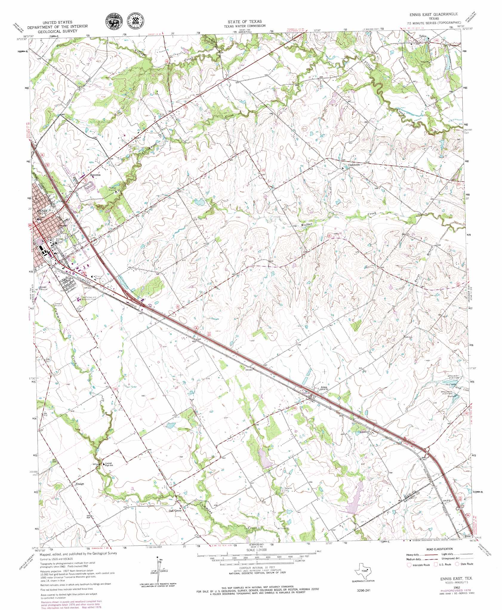
USGS Topo Quad 32096c5 - 1:24,000 scale
| Topo Map Name: | Ennis East |
| USGS Topo Quad ID: | 32096c5 |
| Print Size: | ca. 21 1/4" wide x 27" high |
| Southeast Coordinates: | 32.25° N latitude / 96.5° W longitude |
| Map Center Coordinates: | 32.3125° N latitude / 96.5625° W longitude |
| U.S. State: | TX |
| Filename: | o32096c5.jpg |
| Download Map JPG Image: | Ennis East topo map 1:24,000 scale |
| Map Type: | Topographic |
| Topo Series: | 7.5´ |
| Map Scale: | 1:24,000 |
| Source of Map Images: | United States Geological Survey (USGS) |
| Alternate Map Versions: |
Ennis East TX 1962, updated 1965 Download PDF Buy paper map Ennis East TX 1962, updated 1979 Download PDF Buy paper map Ennis East TX 1962, updated 1979 Download PDF Buy paper map Ennis East TX 2010 Download PDF Buy paper map Ennis East TX 2012 Download PDF Buy paper map Ennis East TX 2016 Download PDF Buy paper map |
1:24,000 Topo Quads surrounding Ennis East
Lancaster |
Ferris |
India |
Scurry |
Kaufman |
Waxahachie |
Palmer |
Bristol |
Rosser |
Grays Prairie |
Forreston |
Ennis West |
Ennis East |
Rosser Sw |
Styx |
Avalon |
Cryer Creek |
Emhouse |
Chatfield |
Bazette |
Frost |
Blooming Grove |
Corbet |
Corsicana |
Powell |
> Back to 32096a1 at 1:100,000 scale
> Back to 32096a1 at 1:250,000 scale
> Back to U.S. Topo Maps home
Ennis East topo map: Gazetteer
Ennis East: Dams
Soil Conservation Service Site 125 Dam elevation 131m 429′Soil Conservation Service Site 126 Dam elevation 129m 423′
Ennis East: Parks
Fairview Park elevation 152m 498′Lummus Memorial Park elevation 152m 498′
Roger Maise Park elevation 153m 501′
Ennis East: Populated Places
Alma elevation 143m 469′Creechville elevation 131m 429′
Ensign elevation 142m 465′
Oak Grove elevation 133m 436′
Sonoma elevation 152m 498′
Telico elevation 121m 396′
Ennis East: Reservoirs
Soil Conservation Service Site 125 Reservoir elevation 131m 429′Soil Conservation Service Site 126 Reservoir elevation 129m 423′
Ennis East: Streams
Burns Branch elevation 107m 351′Cottonwood Creek elevation 113m 370′
Fourmile Creek elevation 122m 400′
Ennis East digital topo map on disk
Buy this Ennis East topo map showing relief, roads, GPS coordinates and other geographical features, as a high-resolution digital map file on DVD: