Kaufman Topo Map Texas
To zoom in, hover over the map of Kaufman
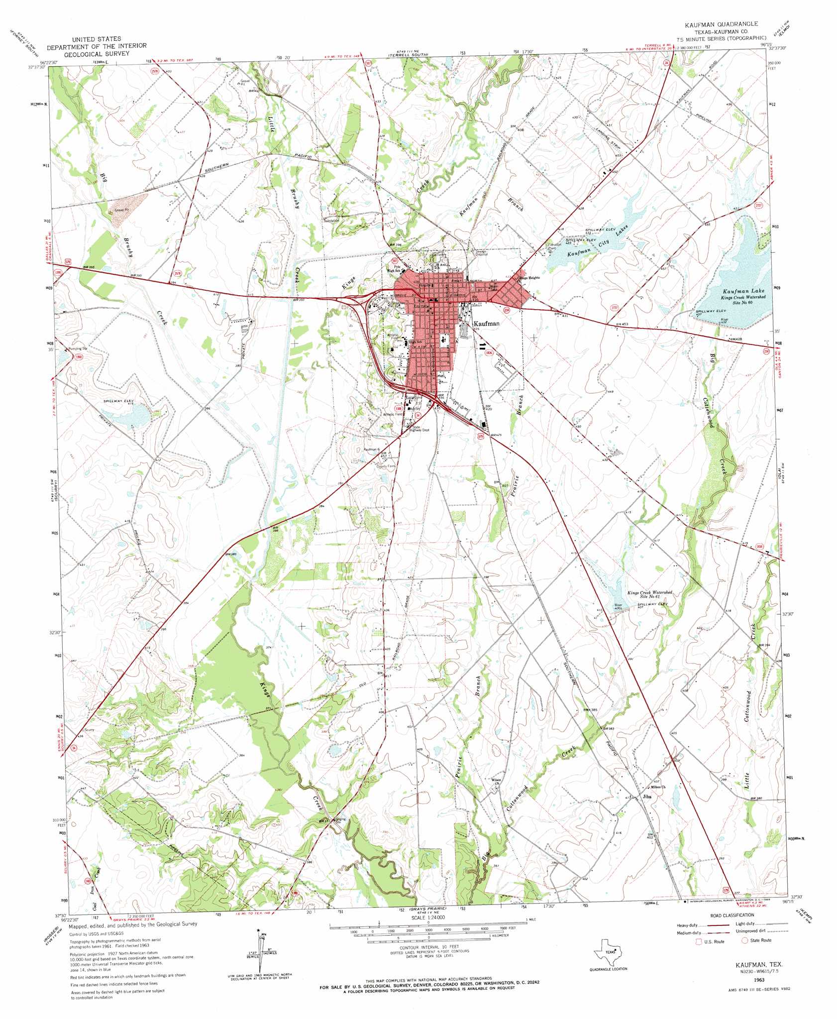
USGS Topo Quad 32096e3 - 1:24,000 scale
| Topo Map Name: | Kaufman |
| USGS Topo Quad ID: | 32096e3 |
| Print Size: | ca. 21 1/4" wide x 27" high |
| Southeast Coordinates: | 32.5° N latitude / 96.25° W longitude |
| Map Center Coordinates: | 32.5625° N latitude / 96.3125° W longitude |
| U.S. State: | TX |
| Filename: | o32096e3.jpg |
| Download Map JPG Image: | Kaufman topo map 1:24,000 scale |
| Map Type: | Topographic |
| Topo Series: | 7.5´ |
| Map Scale: | 1:24,000 |
| Source of Map Images: | United States Geological Survey (USGS) |
| Alternate Map Versions: |
Kaufman TX 1963, updated 1965 Download PDF Buy paper map Kaufman TX 2010 Download PDF Buy paper map Kaufman TX 2012 Download PDF Buy paper map Kaufman TX 2016 Download PDF Buy paper map |
1:24,000 Topo Quads surrounding Kaufman
Mesquite |
Forney North |
Terrell North |
Poetry |
Ables Springs |
Seagoville |
Forney South |
Terrell South |
Elmo |
Wills Point |
India |
Scurry |
Kaufman |
Ola |
Cedarvale |
Bristol |
Rosser |
Grays Prairie |
Kemp |
Prairieville |
Ennis East |
Rosser Sw |
Styx |
Tool |
Mabank |
> Back to 32096e1 at 1:100,000 scale
> Back to 32096a1 at 1:250,000 scale
> Back to U.S. Topo Maps home
Kaufman topo map: Gazetteer
Kaufman: Airports
Moore Airport elevation 124m 406′Thompson Ranch Airport elevation 120m 393′
Kaufman: Dams
Kaufman City Lake Dam 1 elevation 129m 423′Kaufman City Lake Dam 2 elevation 131m 429′
Soil Conservation Service Site 60 Dam elevation 133m 436′
Soil Conservation Service Site 61 Dam elevation 124m 406′
Soil Conservation Service Site 63 Dam elevation 116m 380′
Soil Conservation Service Site 65 Dam elevation 114m 374′
Soil Conservation Service Site 66 Dam elevation 114m 374′
Starbrand Lake Dam elevation 120m 393′
Kaufman: Parks
Lions Stadium elevation 134m 439′Shannon Park elevation 139m 456′
Kaufman: Populated Places
Jiba elevation 126m 413′Kaufman elevation 140m 459′
Oak Grove elevation 128m 419′
Kaufman: Reservoirs
Kaufman City Lakes elevation 127m 416′Kaufman Lake elevation 134m 439′
Kings Creek Watershed Site Number Sixtyone elevation 124m 406′
Lake 1 elevation 129m 423′
Lake 2 elevation 131m 429′
Soil Conservation Service Site 60 Reservoir elevation 133m 436′
Soil Conservation Service Site 61 Reservoir elevation 124m 406′
Soil Conservation Service Site 63 Reservoir elevation 116m 380′
Soil Conservation Service Site 65 Reservoir elevation 114m 374′
Soil Conservation Service Site 66 Reservoir elevation 114m 374′
Starbrand Lake elevation 120m 393′
Kaufman: Streams
Big Brushy Creek elevation 113m 370′Kaufman Branch elevation 118m 387′
Little Brushy Creek elevation 116m 380′
Prairie Branch elevation 110m 360′
Kaufman digital topo map on disk
Buy this Kaufman topo map showing relief, roads, GPS coordinates and other geographical features, as a high-resolution digital map file on DVD: