Ferris Topo Map Texas
To zoom in, hover over the map of Ferris
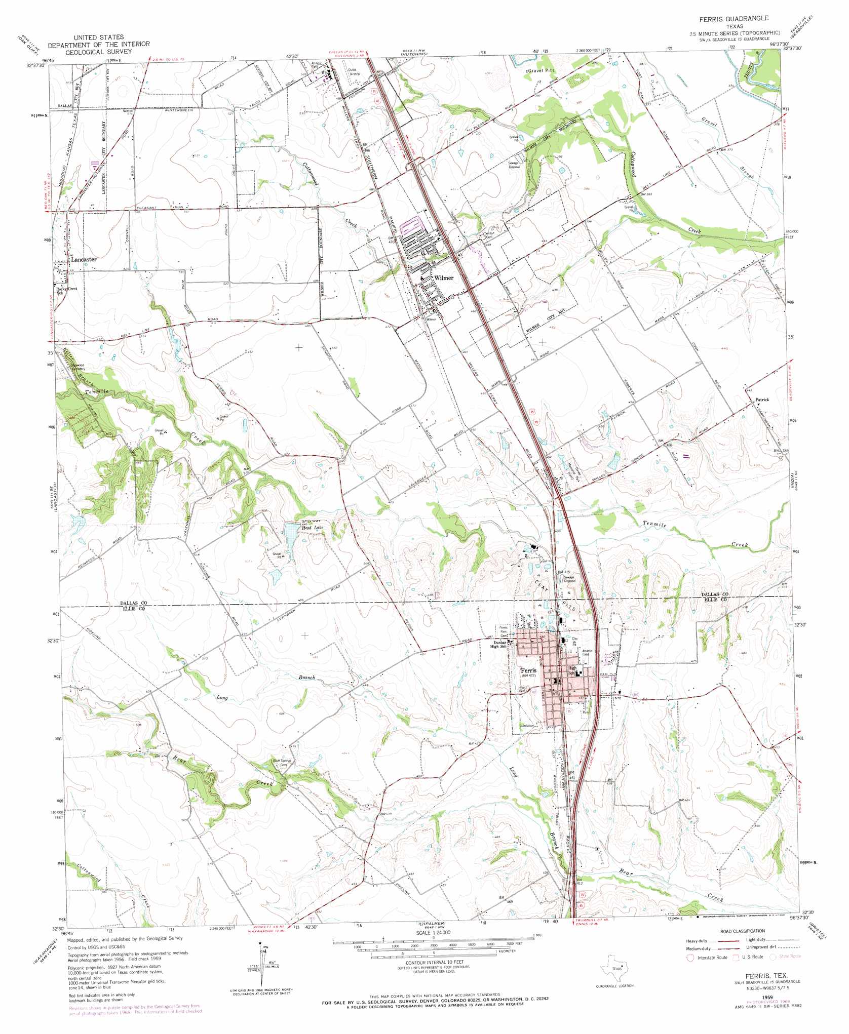
USGS Topo Quad 32096e6 - 1:24,000 scale
| Topo Map Name: | Ferris |
| USGS Topo Quad ID: | 32096e6 |
| Print Size: | ca. 21 1/4" wide x 27" high |
| Southeast Coordinates: | 32.5° N latitude / 96.625° W longitude |
| Map Center Coordinates: | 32.5625° N latitude / 96.6875° W longitude |
| U.S. State: | TX |
| Filename: | o32096e6.jpg |
| Download Map JPG Image: | Ferris topo map 1:24,000 scale |
| Map Type: | Topographic |
| Topo Series: | 7.5´ |
| Map Scale: | 1:24,000 |
| Source of Map Images: | United States Geological Survey (USGS) |
| Alternate Map Versions: |
Ferris TX 1959, updated 1960 Download PDF Buy paper map Ferris TX 1959, updated 1969 Download PDF Buy paper map Ferris TX 1959, updated 1969 Download PDF Buy paper map Ferris TX 2010 Download PDF Buy paper map Ferris TX 2012 Download PDF Buy paper map Ferris TX 2016 Download PDF Buy paper map |
1:24,000 Topo Quads surrounding Ferris
Irving |
Dallas |
White Rock Lake |
Mesquite |
Forney North |
Duncanville |
Oak Cliff |
Hutchins |
Seagoville |
Forney South |
Cedar Hill |
Lancaster |
Ferris |
India |
Scurry |
Midlothian |
Waxahachie |
Palmer |
Bristol |
Rosser |
Boz |
Forreston |
Ennis West |
Ennis East |
Rosser Sw |
> Back to 32096e1 at 1:100,000 scale
> Back to 32096a1 at 1:250,000 scale
> Back to U.S. Topo Maps home
Ferris topo map: Gazetteer
Ferris: Airports
Lancaster Airport elevation 149m 488′Ferris: Dams
Head Lake Dam elevation 131m 429′Ferris: Parks
Adams Street Park elevation 143m 469′Cottonwood Park elevation 142m 465′
Ferris Memorial Park elevation 145m 475′
Yellow Jacket Stadium elevation 142m 465′
Ferris: Populated Places
Ferris elevation 142m 465′Patrick elevation 135m 442′
Wilmer elevation 142m 465′
Ferris: Reservoirs
Head Lake elevation 135m 442′Ferris: Streams
Keller Branch elevation 134m 439′Long Branch elevation 122m 400′
Ferris digital topo map on disk
Buy this Ferris topo map showing relief, roads, GPS coordinates and other geographical features, as a high-resolution digital map file on DVD: