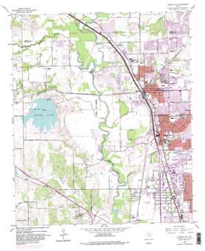
Carrollton Topo Map Texas
To zoom in, hover over the map of Carrollton
USGS Topo Quad 32096h8 - 1:24,000 scale
| Topo Map Name: | Carrollton |
| USGS Topo Quad ID: | 32096h8 |
| Print Size: | ca. 21 1/4" wide x 27" high |
| Southeast Coordinates: | 32.875° N latitude / 96.875° W longitude |
| Map Center Coordinates: | 32.9375° N latitude / 96.9375° W longitude |
| U.S. State: | TX |
| Filename: | o32096h8.jpg |
| Download Map JPG Image: | Carrollton topo map 1:24,000 scale |
| Map Type: | Topographic |
| Topo Series: | 7.5´ |
| Map Scale: | 1:24,000 |
| Source of Map Images: | United States Geological Survey (USGS) |
| Alternate Map Versions: |
Carrollton TX 1959, updated 1960 Download PDF Buy paper map Carrollton TX 1959, updated 1966 Download PDF Buy paper map Carrollton TX 1959, updated 1969 Download PDF Buy paper map Carrollton TX 1959, updated 1974 Download PDF Buy paper map Carrollton TX 1959, updated 1982 Download PDF Buy paper map Carrollton TX 1959, updated 1982 Download PDF Buy paper map Carrollton TX 1959, updated 1986 Download PDF Buy paper map Carrollton TX 1959, updated 1986 Download PDF Buy paper map Carrollton TX 2010 Download PDF Buy paper map Carrollton TX 2012 Download PDF Buy paper map Carrollton TX 2016 Download PDF Buy paper map |
1:24,000 Topo Quads surrounding Carrollton
> Back to 32096e1 at 1:100,000 scale
> Back to 32096a1 at 1:250,000 scale
> Back to U.S. Topo Maps home
Carrollton topo map: Gazetteer
Carrollton: Airports
Toyota of Dallas Incorporated Heliport elevation 140m 459′Carrollton: Bridges
Keenan Bridge elevation 126m 413′Carrollton: Crossings
Interchange 26 elevation 151m 495′Interchange 27A and 27B and 27C elevation 137m 449′
Interchange 28 elevation 131m 429′
Interchange 29 elevation 149m 488′
Interchange 31 elevation 158m 518′
Interchange 31B elevation 161m 528′
Interchange 33 elevation 160m 524′
Interchange 438 elevation 131m 429′
Interchange 439 elevation 137m 449′
Interchange 440A and 440B elevation 137m 449′
Interchange 440C and 440D elevation 139m 456′
Interchange 441 elevation 140m 459′
Interchange 442 elevation 142m 465′
Interchange 443A elevation 140m 459′
Interchange 443B elevation 138m 452′
Interchange 443C elevation 138m 452′
Interchange 444 elevation 140m 459′
Interchange 445 elevation 137m 449′
Interchange 446 elevation 137m 449′
Carrollton: Dams
Cabell Lake Dam elevation 146m 479′Carrollton Dam elevation 130m 426′
North Lake Dam elevation 142m 465′
Carrollton: Lakes
Sandy Lake elevation 136m 446′Carrollton: Parks
Crown Park elevation 137m 449′DeWitt-Perry Middle School Football Field elevation 157m 515′
Farmers Branch Historical Park elevation 141m 462′
Josey Ranch Athletic Complex elevation 140m 459′
North Lake Park elevation 162m 531′
Oran Good Park elevation 146m 479′
Porter Park elevation 144m 472′
R J McInnish Park elevation 136m 446′
Rawhide Park elevation 146m 479′
Showman Park elevation 158m 518′
Standridge Stadium elevation 132m 433′
Thomas Park elevation 140m 459′
Valley Mill Park elevation 148m 485′
Vivian Field Stadium elevation 143m 469′
Watterworth Park elevation 142m 465′
Carrollton: Populated Places
Bethel elevation 153m 501′Carrollton elevation 161m 528′
Farmers Branch elevation 141m 462′
Gribble elevation 134m 439′
Highland elevation 131m 429′
Trinity Mills elevation 137m 449′
Carrollton: Post Offices
Carrollton Post Office elevation 156m 511′Coppell Post Office elevation 155m 508′
Farmers Branch Post Office elevation 156m 511′
Northaven Post Office elevation 144m 472′
Valley Ranch Post Office elevation 140m 459′
Carrollton: Reservoirs
Cabell Lake elevation 146m 479′North Lake elevation 151m 495′
Carrollton: Streams
Cooks Branch elevation 125m 410′Cottonwood Branch elevation 132m 433′
Cottonwood Branch elevation 128m 419′
Denton Creek elevation 133m 436′
Dudley Branch elevation 132m 433′
Farmers Branch elevation 127m 416′
Furneaux Creek elevation 133m 436′
Grapevine Creek elevation 125m 410′
Hutton Branch elevation 125m 410′
Mud Springs elevation 140m 459′
Perry Branch elevation 137m 449′
Rawhide Creek elevation 130m 426′
South Fork Grapevine Creek elevation 134m 439′
South Fork Hackberry Creek elevation 131m 429′
Timber Creek elevation 132m 433′
Carrollton: Trails
Elm Fork Nature Preserve Trail elevation 136m 446′Spring Trail Park Trail elevation 127m 416′
Carrollton digital topo map on disk
Buy this Carrollton topo map showing relief, roads, GPS coordinates and other geographical features, as a high-resolution digital map file on DVD:


