Brazos Point Topo Map Texas
To zoom in, hover over the map of Brazos Point
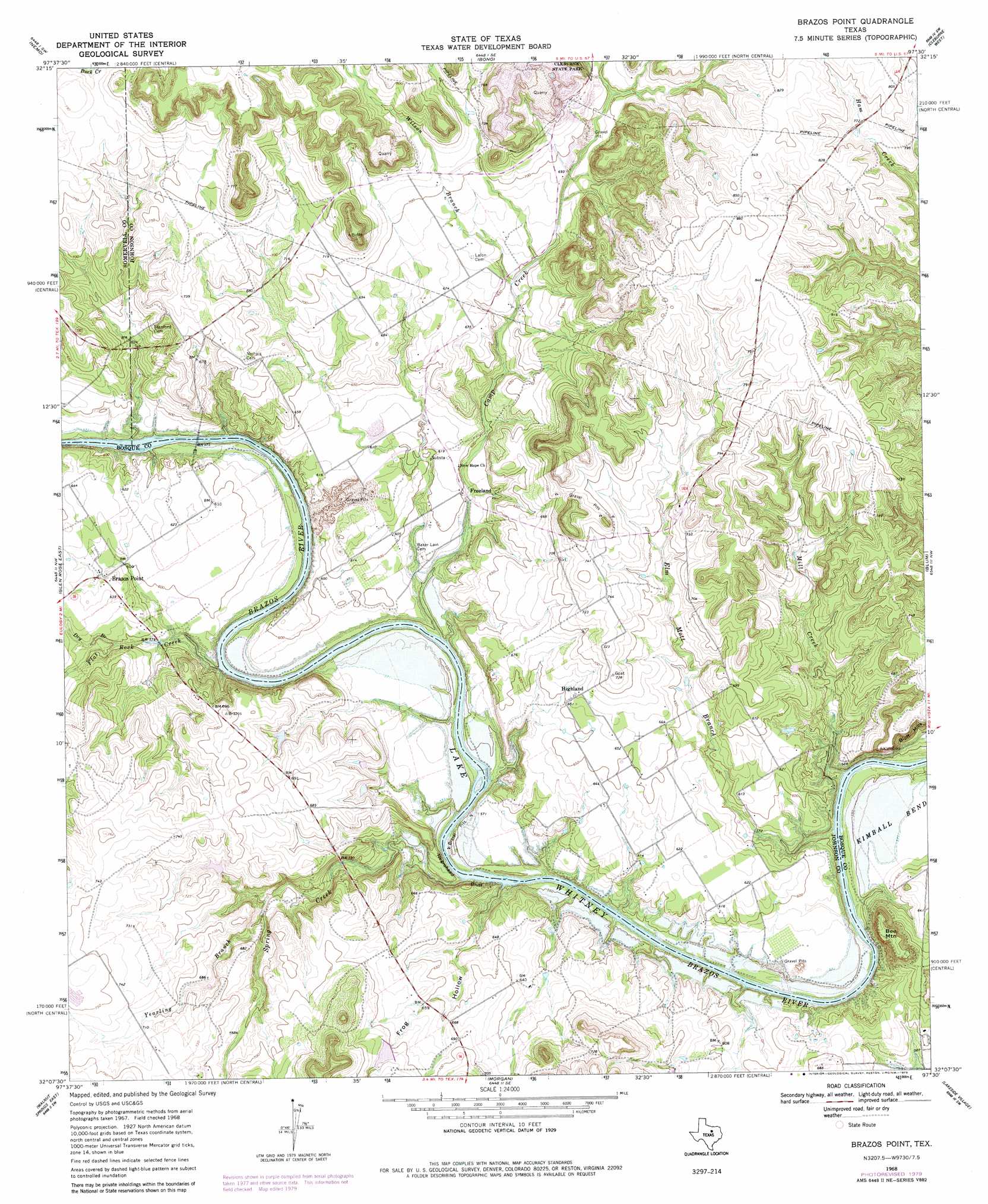
USGS Topo Quad 32097b5 - 1:24,000 scale
| Topo Map Name: | Brazos Point |
| USGS Topo Quad ID: | 32097b5 |
| Print Size: | ca. 21 1/4" wide x 27" high |
| Southeast Coordinates: | 32.125° N latitude / 97.5° W longitude |
| Map Center Coordinates: | 32.1875° N latitude / 97.5625° W longitude |
| U.S. State: | TX |
| Filename: | o32097b5.jpg |
| Download Map JPG Image: | Brazos Point topo map 1:24,000 scale |
| Map Type: | Topographic |
| Topo Series: | 7.5´ |
| Map Scale: | 1:24,000 |
| Source of Map Images: | United States Geological Survey (USGS) |
| Alternate Map Versions: |
Brazos Point TX 1968, updated 1971 Download PDF Buy paper map Brazos Point TX 1968, updated 1979 Download PDF Buy paper map Brazos Point TX 2010 Download PDF Buy paper map Brazos Point TX 2013 Download PDF Buy paper map Brazos Point TX 2016 Download PDF Buy paper map |
1:24,000 Topo Quads surrounding Brazos Point
Granbury |
Acton |
Godley |
Joshua |
Keene |
Hill City |
Nemo |
Bono |
Cleburne West |
Cleburne East |
Glen Rose West |
Glen Rose East |
Brazos Point |
Blum |
Covington |
Walnut Springs West |
Walnut Springs East |
Morgan |
Lakeside Village |
Blanton |
Iredell |
Meridian |
Pilot Knob |
Allen Bend |
Whitney |
> Back to 32097a1 at 1:100,000 scale
> Back to 32096a1 at 1:250,000 scale
> Back to U.S. Topo Maps home
Brazos Point topo map: Gazetteer
Brazos Point: Cliffs
Negrohead Bluff elevation 162m 531′Brazos Point: Dams
Houston Lake Number 1 Dam elevation 193m 633′Houston Lake Number 2 Dam elevation 199m 652′
Mokszycki Lake Dam elevation 218m 715′
Brazos Point: Populated Places
Brazos Point elevation 191m 626′Freeland elevation 177m 580′
Highland elevation 206m 675′
Brazos Point: Reservoirs
Houston Lake Number 1 elevation 193m 633′Houston Lake Number 2 elevation 199m 652′
Mokszycki Lake elevation 218m 715′
Brazos Point: Streams
Camp Creek elevation 166m 544′Dry Branch elevation 180m 590′
Elm Mott Branch elevation 161m 528′
Flat Rock Creek elevation 166m 544′
Mill Creek elevation 161m 528′
Spring Creek elevation 161m 528′
West Fork Camp Creek elevation 217m 711′
Wilson Branch elevation 196m 643′
Yearling Branch elevation 179m 587′
Brazos Point: Summits
Bee Mountain elevation 232m 761′Brazos Point: Valleys
Frog Hollow elevation 170m 557′Brazos Point digital topo map on disk
Buy this Brazos Point topo map showing relief, roads, GPS coordinates and other geographical features, as a high-resolution digital map file on DVD: