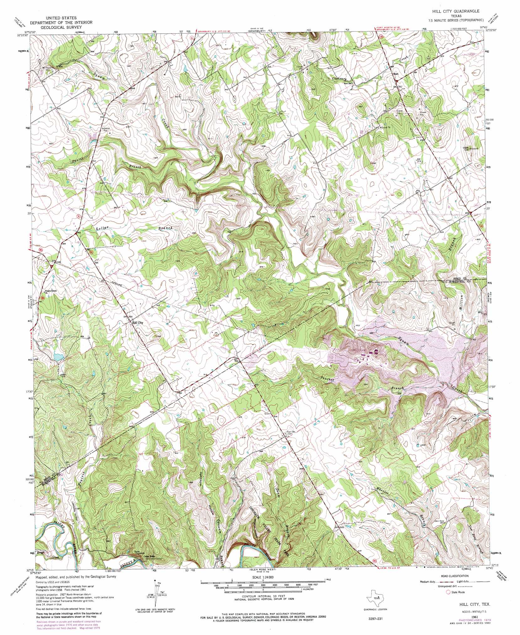
Hill City Topo Map Texas
To zoom in, hover over the map of Hill City
USGS Topo Quad 32097c7 - 1:24,000 scale
| Topo Map Name: | Hill City |
| USGS Topo Quad ID: | 32097c7 |
| Print Size: | ca. 21 1/4" wide x 27" high |
| Southeast Coordinates: | 32.25° N latitude / 97.75° W longitude |
| Map Center Coordinates: | 32.3125° N latitude / 97.8125° W longitude |
| U.S. State: | TX |
| Filename: | o32097c7.jpg |
| Download Map JPG Image: | Hill City topo map 1:24,000 scale |
| Map Type: | Topographic |
| Topo Series: | 7.5´ |
| Map Scale: | 1:24,000 |
| Source of Map Images: | United States Geological Survey (USGS) |
| Alternate Map Versions: |
Hill City TX 1961, updated 1963 Download PDF Buy paper map Hill City TX 1961, updated 1974 Download PDF Buy paper map Hill City TX 1961, updated 1979 Download PDF Buy paper map Hill City TX 2010 Download PDF Buy paper map Hill City TX 2013 Download PDF Buy paper map Hill City TX 2016 Download PDF Buy paper map |
1:24,000 Topo Quads surrounding Hill City
Lipan |
Dennis |
Tin Top |
Chapin |
Cresson |
Bluff Dale Ne |
Tolar |
Granbury |
Acton |
Godley |
Bluff Dale |
Paluxy |
Hill City |
Nemo |
Bono |
Johnsville |
Chalk Mountain |
Glen Rose West |
Glen Rose East |
Brazos Point |
Clairette |
Camp Branch |
Walnut Springs West |
Walnut Springs East |
Morgan |
> Back to 32097a1 at 1:100,000 scale
> Back to 32096a1 at 1:250,000 scale
> Back to U.S. Topo Maps home
Hill City topo map: Gazetteer
Hill City: Airports
Running M Ranch Airport elevation 246m 807′Hill City: Dams
Safe Shutdown Impoundment Dam elevation 235m 770′Squaw Creek Dam elevation 204m 669′
Hill City: Parks
Dinosaur Valley State Park elevation 253m 830′Hill City: Populated Places
Hill City elevation 293m 961′Neri elevation 269m 882′
Hill City: Reservoirs
Safe Shutdown Impoundment elevation 235m 770′Squaw Creek Reservoir elevation 204m 669′
Hill City: Streams
Denio Branch elevation 201m 659′Lollar Branch elevation 235m 770′
Million Branch elevation 198m 649′
Opossum Branch elevation 205m 672′
Panter Branch elevation 236m 774′
Panther Branch elevation 235m 770′
Rough Creek elevation 219m 718′
Hill City: Trails
Dinosaur Valley State Park Trail elevation 253m 830′Hill City: Valleys
Opossum Hollow elevation 224m 734′Wildcat Hollow elevation 202m 662′
Hill City digital topo map on disk
Buy this Hill City topo map showing relief, roads, GPS coordinates and other geographical features, as a high-resolution digital map file on DVD: