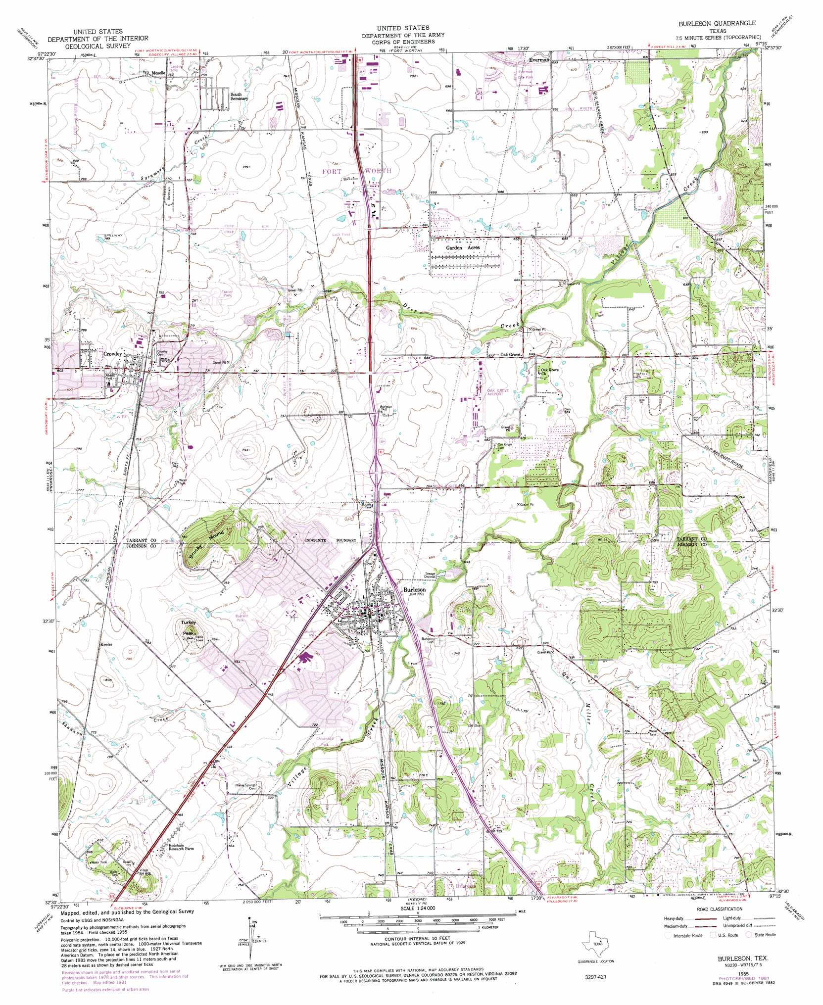
Burleson Topo Map Texas
To zoom in, hover over the map of Burleson
USGS Topo Quad 32097e3 - 1:24,000 scale
| Topo Map Name: | Burleson |
| USGS Topo Quad ID: | 32097e3 |
| Print Size: | ca. 21 1/4" wide x 27" high |
| Southeast Coordinates: | 32.5° N latitude / 97.25° W longitude |
| Map Center Coordinates: | 32.5625° N latitude / 97.3125° W longitude |
| U.S. State: | TX |
| Filename: | o32097e3.jpg |
| Download Map JPG Image: | Burleson topo map 1:24,000 scale |
| Map Type: | Topographic |
| Topo Series: | 7.5´ |
| Map Scale: | 1:24,000 |
| Source of Map Images: | United States Geological Survey (USGS) |
| Alternate Map Versions: |
Burleson TX 1955, updated 1956 Download PDF Buy paper map Burleson TX 1955, updated 1969 Download PDF Buy paper map Burleson TX 1955, updated 1974 Download PDF Buy paper map Burleson TX 1955, updated 1982 Download PDF Buy paper map Burleson TX 2010 Download PDF Buy paper map Burleson TX 2012 Download PDF Buy paper map Burleson TX 2016 Download PDF Buy paper map |
1:24,000 Topo Quads surrounding Burleson
Springtown Se |
Lake Worth |
Haltom City |
Hurst |
Euless |
Aledo |
Benbrook |
Fort Worth |
Kennedale |
Arlington |
Cresson |
Primrose |
Burleson |
Mansfield |
Britton |
Godley |
Joshua |
Keene |
Alvarado |
Venus |
Bono |
Cleburne West |
Cleburne East |
Grandview |
Maypearl |
> Back to 32097e1 at 1:100,000 scale
> Back to 32096a1 at 1:250,000 scale
> Back to U.S. Topo Maps home
Burleson topo map: Gazetteer
Burleson: Airports
Bransom Farm Airport elevation 247m 810′Fort Worth Spinks Airport elevation 209m 685′
Luck Field elevation 216m 708′
Rafter J Airport elevation 210m 688′
Burleson: Parks
Bartlett Park elevation 225m 738′Bicentennial Park elevation 212m 695′
Burleson Stadium elevation 243m 797′
Chisenhall Park elevation 216m 708′
Elk Stadium elevation 221m 725′
J E Marr Stadium elevation 202m 662′
Johnson Park elevation 203m 666′
T Park elevation 217m 711′
Burleson: Populated Places
Briaroaks elevation 225m 738′Burleson elevation 217m 711′
Cross Timber elevation 216m 708′
Crowley elevation 237m 777′
Garden Acres elevation 207m 679′
Keeler elevation 241m 790′
Oak Grove elevation 199m 652′
Wooded Hills elevation 235m 770′
Burleson: Streams
Deer Creek elevation 188m 616′Quil Miller Creek elevation 198m 649′
Shannon Creek elevation 216m 708′
Burleson: Summits
Brushy Mound elevation 275m 902′Turkey Peak elevation 266m 872′
Burleson digital topo map on disk
Buy this Burleson topo map showing relief, roads, GPS coordinates and other geographical features, as a high-resolution digital map file on DVD: