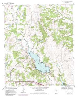
Lake Weatherford Topo Map Texas
To zoom in, hover over the map of Lake Weatherford
USGS Topo Quad 32097g6 - 1:24,000 scale
| Topo Map Name: | Lake Weatherford |
| USGS Topo Quad ID: | 32097g6 |
| Print Size: | ca. 21 1/4" wide x 27" high |
| Southeast Coordinates: | 32.75° N latitude / 97.625° W longitude |
| Map Center Coordinates: | 32.8125° N latitude / 97.6875° W longitude |
| U.S. State: | TX |
| Filename: | o32097g6.jpg |
| Download Map JPG Image: | Lake Weatherford topo map 1:24,000 scale |
| Map Type: | Topographic |
| Topo Series: | 7.5´ |
| Map Scale: | 1:24,000 |
| Source of Map Images: | United States Geological Survey (USGS) |
| Alternate Map Versions: |
Lake Weatherford TX 1959, updated 1960 Download PDF Buy paper map Lake Weatherford TX 1959, updated 1992 Download PDF Buy paper map Lake Weatherford TX 2010 Download PDF Buy paper map Lake Weatherford TX 2012 Download PDF Buy paper map Lake Weatherford TX 2016 Download PDF Buy paper map |
1:24,000 Topo Quads surrounding Lake Weatherford
> Back to 32097e1 at 1:100,000 scale
> Back to 32096a1 at 1:250,000 scale
> Back to U.S. Topo Maps home
Lake Weatherford topo map: Gazetteer
Lake Weatherford: Airports
Blue Skies Airport elevation 291m 954′Cross Wind Airport elevation 313m 1026′
Valley Oaks Airport elevation 321m 1053′
Lake Weatherford: Dams
Lake Weatherford Dam elevation 275m 902′Moore Lake Dam elevation 283m 928′
Soil Conservation Service Site 16 Dam elevation 307m 1007′
Soil Conservation Service Site 16a Dam elevation 300m 984′
Soil Conservation Service Site 17 Dam elevation 295m 967′
Soil Conservation Service Site 18 Dam elevation 306m 1003′
Soil Conservation Service Site 19 Dam elevation 289m 948′
Soil Conservation Service Site 21 Dam elevation 298m 977′
Soil Conservation Service Site 22a Dam elevation 292m 958′
Lake Weatherford: Populated Places
Dicey elevation 280m 918′Hudson Oaks elevation 318m 1043′
Punkin Center elevation 298m 977′
Wampler elevation 322m 1056′
Willow Park elevation 284m 931′
Wright elevation 291m 954′
Lake Weatherford: Reservoirs
Lake Weatherford elevation 275m 902′Moore Lake elevation 283m 928′
Reservoir Number Eighteen elevation 305m 1000′
Reservoir Number Nineteen elevation 289m 948′
Reservoir Number Seventeen elevation 301m 987′
Reservoir Number Sixteen elevation 313m 1026′
Reservoir Number Twentyone elevation 306m 1003′
Reservoir Number Twentytwo A elevation 291m 954′
Soil Conservation Service Site 16 Reservoir elevation 307m 1007′
Soil Conservation Service Site 16a Reservoir elevation 300m 984′
Soil Conservation Service Site 17 Reservoir elevation 295m 967′
Soil Conservation Service Site 18 Reservoir elevation 306m 1003′
Soil Conservation Service Site 19 Reservoir elevation 289m 948′
Soil Conservation Service Site 21 Reservoir elevation 298m 977′
Soil Conservation Service Site 22a Reservoir elevation 292m 958′
Lake Weatherford: Springs
Indian Springs elevation 298m 977′Lake Weatherford: Streams
Brown Branch elevation 284m 931′Carter Creek elevation 293m 961′
Dobbs Branch elevation 283m 928′
Green Branch elevation 275m 902′
Hays Branch elevation 275m 902′
Indian Creek elevation 340m 1115′
McKnight Branch elevation 293m 961′
Patton Branch elevation 291m 954′
Rankin Branch elevation 283m 928′
Lake Weatherford digital topo map on disk
Buy this Lake Weatherford topo map showing relief, roads, GPS coordinates and other geographical features, as a high-resolution digital map file on DVD:


