Gorman Topo Map Texas
To zoom in, hover over the map of Gorman
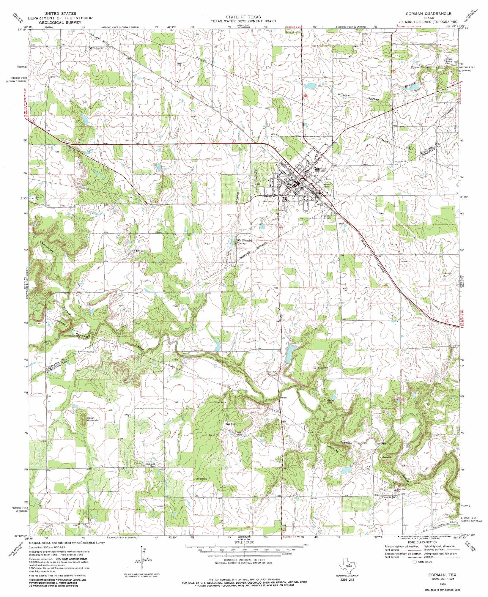
USGS Topo Quad 32098b6 - 1:24,000 scale
| Topo Map Name: | Gorman |
| USGS Topo Quad ID: | 32098b6 |
| Print Size: | ca. 21 1/4" wide x 27" high |
| Southeast Coordinates: | 32.125° N latitude / 98.625° W longitude |
| Map Center Coordinates: | 32.1875° N latitude / 98.6875° W longitude |
| U.S. State: | TX |
| Filename: | o32098b6.jpg |
| Download Map JPG Image: | Gorman topo map 1:24,000 scale |
| Map Type: | Topographic |
| Topo Series: | 7.5´ |
| Map Scale: | 1:24,000 |
| Source of Map Images: | United States Geological Survey (USGS) |
| Alternate Map Versions: |
Gorman TX 1968, updated 1972 Download PDF Buy paper map Gorman TX 1968, updated 1987 Download PDF Buy paper map Gorman TX 2010 Download PDF Buy paper map Gorman TX 2012 Download PDF Buy paper map Gorman TX 2016 Download PDF Buy paper map |
1:24,000 Topo Quads surrounding Gorman
Cisco North |
Eastland |
Ranger |
Bear Mountain |
Reddy Mountain |
Cisco South |
Carbon |
Kokomo |
Desdemona |
Huckabay Sw |
Union Center |
Hunting Shirt Creek |
Gorman |
Rucker |
Lingleville |
Rising Star |
Sipe Springs |
Duster |
De Leon |
Comyn |
May |
Star Mountain |
Sidney |
Comanche |
Proctor |
> Back to 32098a1 at 1:100,000 scale
> Back to 32098a1 at 1:250,000 scale
> Back to U.S. Topo Maps home
Gorman topo map: Gazetteer
Gorman: Airports
Gorman Airport elevation 438m 1437′Gorman: Dams
Birdsong Dam elevation 430m 1410′Davis Lake Dam elevation 401m 1315′
Peterson Dam elevation 412m 1351′
Pino Lake Dam elevation 412m 1351′
W E Dennis Dam elevation 390m 1279′
Warren Dam elevation 432m 1417′
Gorman: Populated Places
Ellison Springs (historical) elevation 405m 1328′Gorman elevation 443m 1453′
Gorman: Reservoirs
Birdsong Lake elevation 430m 1410′Davis Lake elevation 401m 1315′
Peterson Lake elevation 412m 1351′
Pino Lake elevation 412m 1351′
W E Dennis Reservoir elevation 390m 1279′
Warren Lake elevation 432m 1417′
Gorman: Springs
Ellison Spring elevation 405m 1328′Old Shinoak Springs elevation 420m 1377′
Gorman: Streams
Currycomb Branch elevation 394m 1292′Shinoak Branch elevation 392m 1286′
Gorman: Summits
Indian Mountain elevation 440m 1443′Gorman digital topo map on disk
Buy this Gorman topo map showing relief, roads, GPS coordinates and other geographical features, as a high-resolution digital map file on DVD: