Huckabay Sw Topo Map Texas
To zoom in, hover over the map of Huckabay Sw
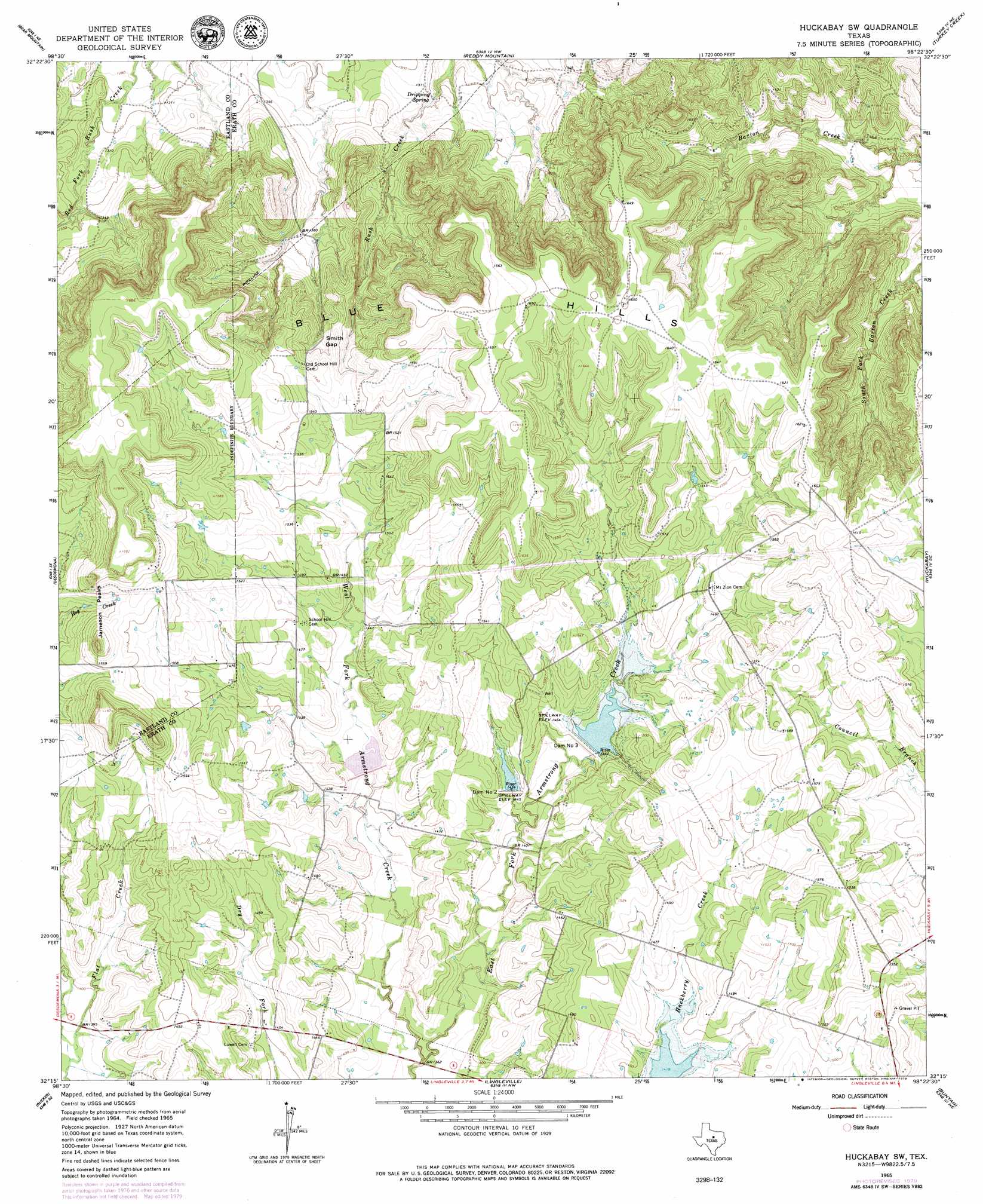
USGS Topo Quad 32098c4 - 1:24,000 scale
| Topo Map Name: | Huckabay Sw |
| USGS Topo Quad ID: | 32098c4 |
| Print Size: | ca. 21 1/4" wide x 27" high |
| Southeast Coordinates: | 32.25° N latitude / 98.375° W longitude |
| Map Center Coordinates: | 32.3125° N latitude / 98.4375° W longitude |
| U.S. State: | TX |
| Filename: | o32098c4.jpg |
| Download Map JPG Image: | Huckabay Sw topo map 1:24,000 scale |
| Map Type: | Topographic |
| Topo Series: | 7.5´ |
| Map Scale: | 1:24,000 |
| Source of Map Images: | United States Geological Survey (USGS) |
| Alternate Map Versions: |
Huckabay SW TX 1965, updated 1967 Download PDF Buy paper map Huckabay SW TX 2010 Download PDF Buy paper map Huckabay SW TX 2012 Download PDF Buy paper map Huckabay SW TX 2016 Download PDF Buy paper map |
1:24,000 Topo Quads surrounding Huckabay Sw
La Casa |
Strawn West |
Strawn East |
Gordon |
Santo |
Ranger |
Bear Mountain |
Reddy Mountain |
Turkey Creek |
Morgan Mill |
Kokomo |
Desdemona |
Huckabay Sw |
Huckabay |
Knob Hill |
Gorman |
Rucker |
Lingleville |
Bunyan |
Stephenville |
Duster |
De Leon |
Comyn |
Dublin |
Alexander |
> Back to 32098a1 at 1:100,000 scale
> Back to 32098a1 at 1:250,000 scale
> Back to U.S. Topo Maps home
Huckabay Sw topo map: Gazetteer
Huckabay Sw: Dams
Dam Number 2 elevation 439m 1440′Dam Number 3 elevation 445m 1459′
Soil Conservation Service Site 1 Dam elevation 427m 1400′
Soil Conservation Service Site 2 Dam elevation 440m 1443′
Soil Conservation Service Site 3 Dam elevation 442m 1450′
Huckabay Sw: Gaps
Smith Gap elevation 449m 1473′Huckabay Sw: Reservoirs
Soil Conservation Service Site 1 Reservoir elevation 427m 1400′Soil Conservation Service Site 2 Reservoir elevation 440m 1443′
Soil Conservation Service Site 3 Reservoir elevation 442m 1450′
Huckabay Sw: Springs
Dripping Spring elevation 392m 1286′Huckabay Sw: Streams
East Fork Armstrong Creek elevation 409m 1341′West Fork Armstrong Creek elevation 409m 1341′
Huckabay Sw: Summits
Blue Hills elevation 501m 1643′Jameson Peaks elevation 507m 1663′
Huckabay Sw digital topo map on disk
Buy this Huckabay Sw topo map showing relief, roads, GPS coordinates and other geographical features, as a high-resolution digital map file on DVD: