Desdemona Topo Map Texas
To zoom in, hover over the map of Desdemona
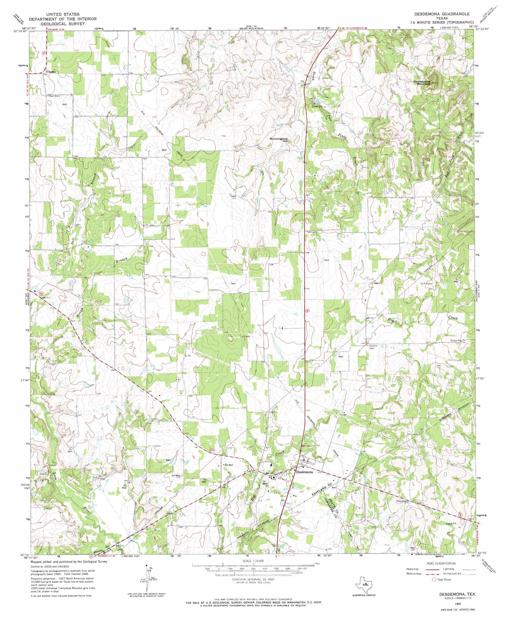
USGS Topo Quad 32098c5 - 1:24,000 scale
| Topo Map Name: | Desdemona |
| USGS Topo Quad ID: | 32098c5 |
| Print Size: | ca. 21 1/4" wide x 27" high |
| Southeast Coordinates: | 32.25° N latitude / 98.5° W longitude |
| Map Center Coordinates: | 32.3125° N latitude / 98.5625° W longitude |
| U.S. State: | TX |
| Filename: | o32098c5.jpg |
| Download Map JPG Image: | Desdemona topo map 1:24,000 scale |
| Map Type: | Topographic |
| Topo Series: | 7.5´ |
| Map Scale: | 1:24,000 |
| Source of Map Images: | United States Geological Survey (USGS) |
| Alternate Map Versions: |
Desdemona TX 1966, updated 1969 Download PDF Buy paper map Desdemona TX 2010 Download PDF Buy paper map Desdemona TX 2012 Download PDF Buy paper map Desdemona TX 2016 Download PDF Buy paper map |
1:24,000 Topo Quads surrounding Desdemona
Wayland |
La Casa |
Strawn West |
Strawn East |
Gordon |
Eastland |
Ranger |
Bear Mountain |
Reddy Mountain |
Turkey Creek |
Carbon |
Kokomo |
Desdemona |
Huckabay Sw |
Huckabay |
Hunting Shirt Creek |
Gorman |
Rucker |
Lingleville |
Bunyan |
Sipe Springs |
Duster |
De Leon |
Comyn |
Dublin |
> Back to 32098a1 at 1:100,000 scale
> Back to 32098a1 at 1:250,000 scale
> Back to U.S. Topo Maps home
Desdemona topo map: Gazetteer
Desdemona: Dams
Arnold Lake Dam elevation 408m 1338′Howard Wade Lake Dam elevation 404m 1325′
Love and Rodgers Dam Number 1 elevation 412m 1351′
Love and Rodgers Dam Number 3 elevation 423m 1387′
Pack Lake Dam elevation 415m 1361′
Perrin Dam elevation 425m 1394′
Desdemona: Populated Places
Chaney elevation 444m 1456′Desdemona elevation 414m 1358′
Desdemona: Reservoirs
Arnold Lake elevation 408m 1338′Howard Wade Lake elevation 404m 1325′
Love and Rodgers Lake Number 1 elevation 412m 1351′
Love and Rodgers Lake Number 3 elevation 423m 1387′
Pack Lake elevation 415m 1361′
Perrin Lake elevation 425m 1394′
Desdemona: Streams
Ellison Spring Branch elevation 383m 1256′Desdemona: Summits
Mockingbird Hill elevation 412m 1351′Rattlesnake Mountain elevation 482m 1581′
Desdemona digital topo map on disk
Buy this Desdemona topo map showing relief, roads, GPS coordinates and other geographical features, as a high-resolution digital map file on DVD: