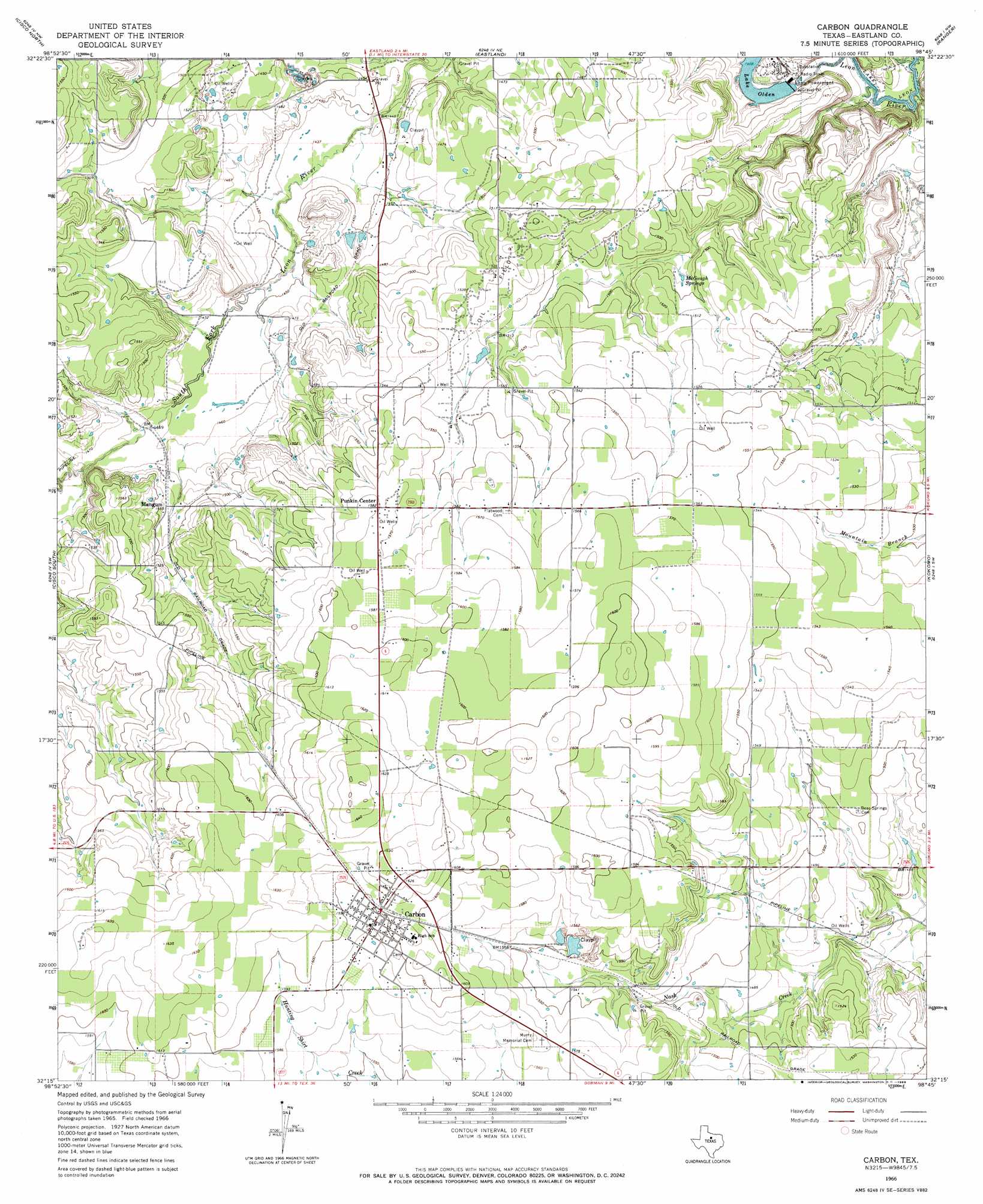
Carbon Topo Map Texas
To zoom in, hover over the map of Carbon
USGS Topo Quad 32098c7 - 1:24,000 scale
| Topo Map Name: | Carbon |
| USGS Topo Quad ID: | 32098c7 |
| Print Size: | ca. 21 1/4" wide x 27" high |
| Southeast Coordinates: | 32.25° N latitude / 98.75° W longitude |
| Map Center Coordinates: | 32.3125° N latitude / 98.8125° W longitude |
| U.S. State: | TX |
| Filename: | o32098c7.jpg |
| Download Map JPG Image: | Carbon topo map 1:24,000 scale |
| Map Type: | Topographic |
| Topo Series: | 7.5´ |
| Map Scale: | 1:24,000 |
| Source of Map Images: | United States Geological Survey (USGS) |
| Alternate Map Versions: |
Carbon TX 1966, updated 1969 Download PDF Buy paper map Carbon TX 2010 Download PDF Buy paper map Carbon TX 2012 Download PDF Buy paper map Carbon TX 2016 Download PDF Buy paper map |
1:24,000 Topo Quads surrounding Carbon
Indian Knoll |
Harpersville |
Wayland |
La Casa |
Strawn West |
Bernie Lake |
Cisco North |
Eastland |
Ranger |
Bear Mountain |
Scranton |
Cisco South |
Carbon |
Kokomo |
Desdemona |
Sabanno |
Union Center |
Hunting Shirt Creek |
Gorman |
Rucker |
Pioneer |
Rising Star |
Sipe Springs |
Duster |
De Leon |
> Back to 32098a1 at 1:100,000 scale
> Back to 32098a1 at 1:250,000 scale
> Back to U.S. Topo Maps home
Carbon topo map: Gazetteer
Carbon: Dams
Bryant Dam elevation 470m 1541′Buster Hanson Lake Dam elevation 466m 1528′
Carlton Dam elevation 453m 1486′
Hanson Dam elevation 488m 1601′
Lake Olden Dam elevation 429m 1407′
Little Lake Dam elevation 443m 1453′
Carbon: Populated Places
Carbon elevation 488m 1601′Mangum elevation 453m 1486′
Punkin Center elevation 482m 1581′
Carbon: Reservoirs
Bryant Lake elevation 470m 1541′Buster Hanson Lake elevation 466m 1528′
Carlton Lake elevation 453m 1486′
Hanson Lake elevation 488m 1601′
Lake Olden elevation 429m 1407′
Little Lake elevation 443m 1453′
Carbon: Springs
McGough Springs elevation 452m 1482′Carbon digital topo map on disk
Buy this Carbon topo map showing relief, roads, GPS coordinates and other geographical features, as a high-resolution digital map file on DVD: