Bluff Dale Ne Topo Map Texas
To zoom in, hover over the map of Bluff Dale Ne
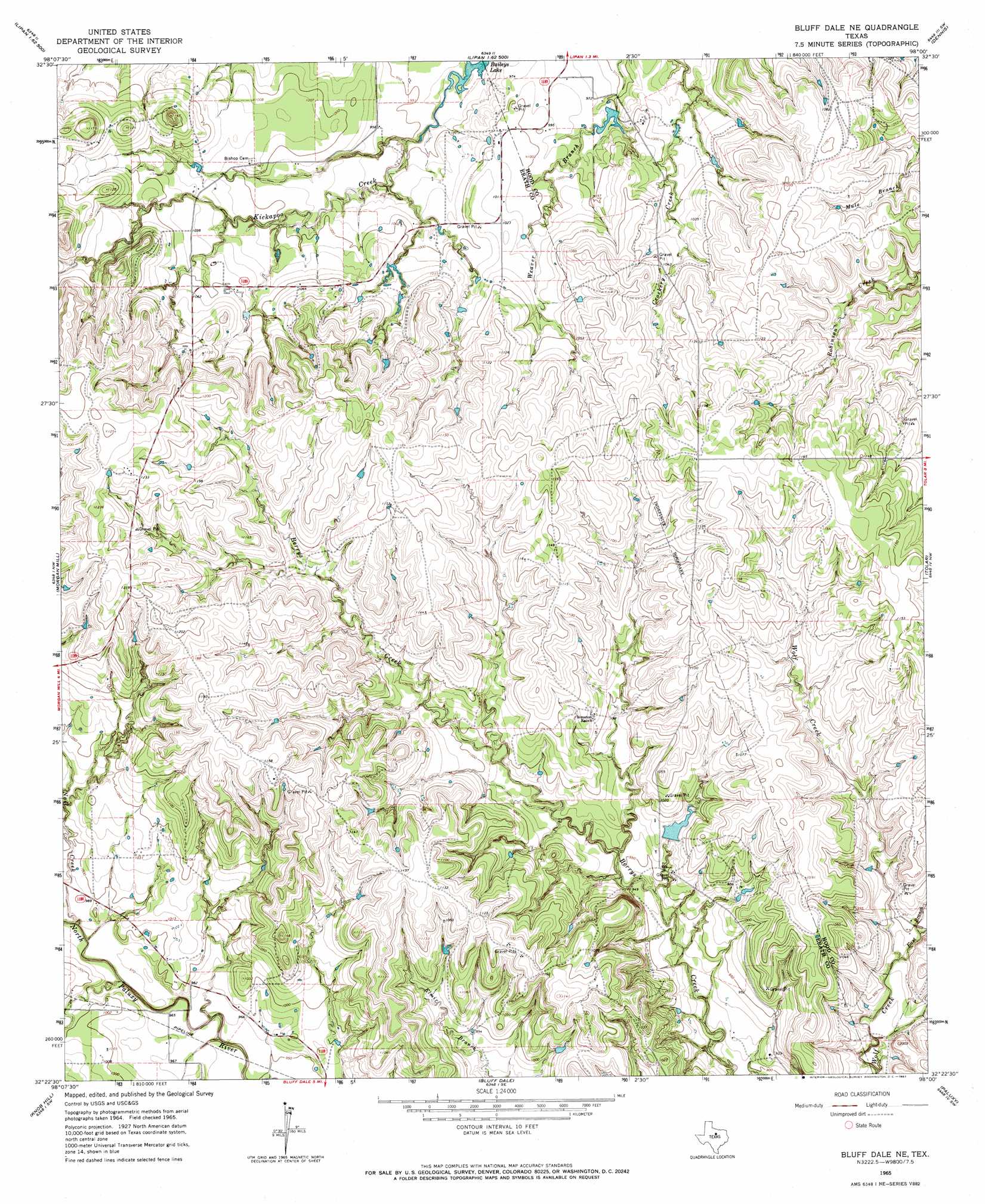
USGS Topo Quad 32098d1 - 1:24,000 scale
| Topo Map Name: | Bluff Dale Ne |
| USGS Topo Quad ID: | 32098d1 |
| Print Size: | ca. 21 1/4" wide x 27" high |
| Southeast Coordinates: | 32.375° N latitude / 98° W longitude |
| Map Center Coordinates: | 32.4375° N latitude / 98.0625° W longitude |
| U.S. State: | TX |
| Filename: | o32098d1.jpg |
| Download Map JPG Image: | Bluff Dale Ne topo map 1:24,000 scale |
| Map Type: | Topographic |
| Topo Series: | 7.5´ |
| Map Scale: | 1:24,000 |
| Source of Map Images: | United States Geological Survey (USGS) |
| Alternate Map Versions: |
Bluff Dale NE TX 1965, updated 1967 Download PDF Buy paper map Bluff Dale NE TX 2010 Download PDF Buy paper map Bluff Dale NE TX 2012 Download PDF Buy paper map Bluff Dale NE TX 2016 Download PDF Buy paper map |
1:24,000 Topo Quads surrounding Bluff Dale Ne
Lone Camp |
Brazos West |
Brazos East |
Brock |
Weatherford South |
Gordon |
Santo |
Lipan |
Dennis |
Tin Top |
Turkey Creek |
Morgan Mill |
Bluff Dale Ne |
Tolar |
Granbury |
Huckabay |
Knob Hill |
Bluff Dale |
Paluxy |
Hill City |
Bunyan |
Stephenville |
Johnsville |
Chalk Mountain |
Glen Rose West |
> Back to 32098a1 at 1:100,000 scale
> Back to 32098a1 at 1:250,000 scale
> Back to U.S. Topo Maps home
Bluff Dale Ne topo map: Gazetteer
Bluff Dale Ne: Dams
Engler Lake Dam elevation 295m 967′Nutt Lake Dam elevation 298m 977′
Soil Conservation Service Site Number 14 Dam elevation 296m 971′
Bluff Dale Ne: Lakes
Baileys Lake elevation 283m 928′Bluff Dale Ne: Reservoirs
Engler Lake elevation 295m 967′Nutt Lake elevation 298m 977′
Soil Conservation Service Site Number 14 Reservoir elevation 296m 971′
Bluff Dale Ne: Streams
East Branch Wolf Creek elevation 283m 928′Nail Creek elevation 292m 958′
Bluff Dale Ne digital topo map on disk
Buy this Bluff Dale Ne topo map showing relief, roads, GPS coordinates and other geographical features, as a high-resolution digital map file on DVD: