Reddy Mountain Topo Map Texas
To zoom in, hover over the map of Reddy Mountain
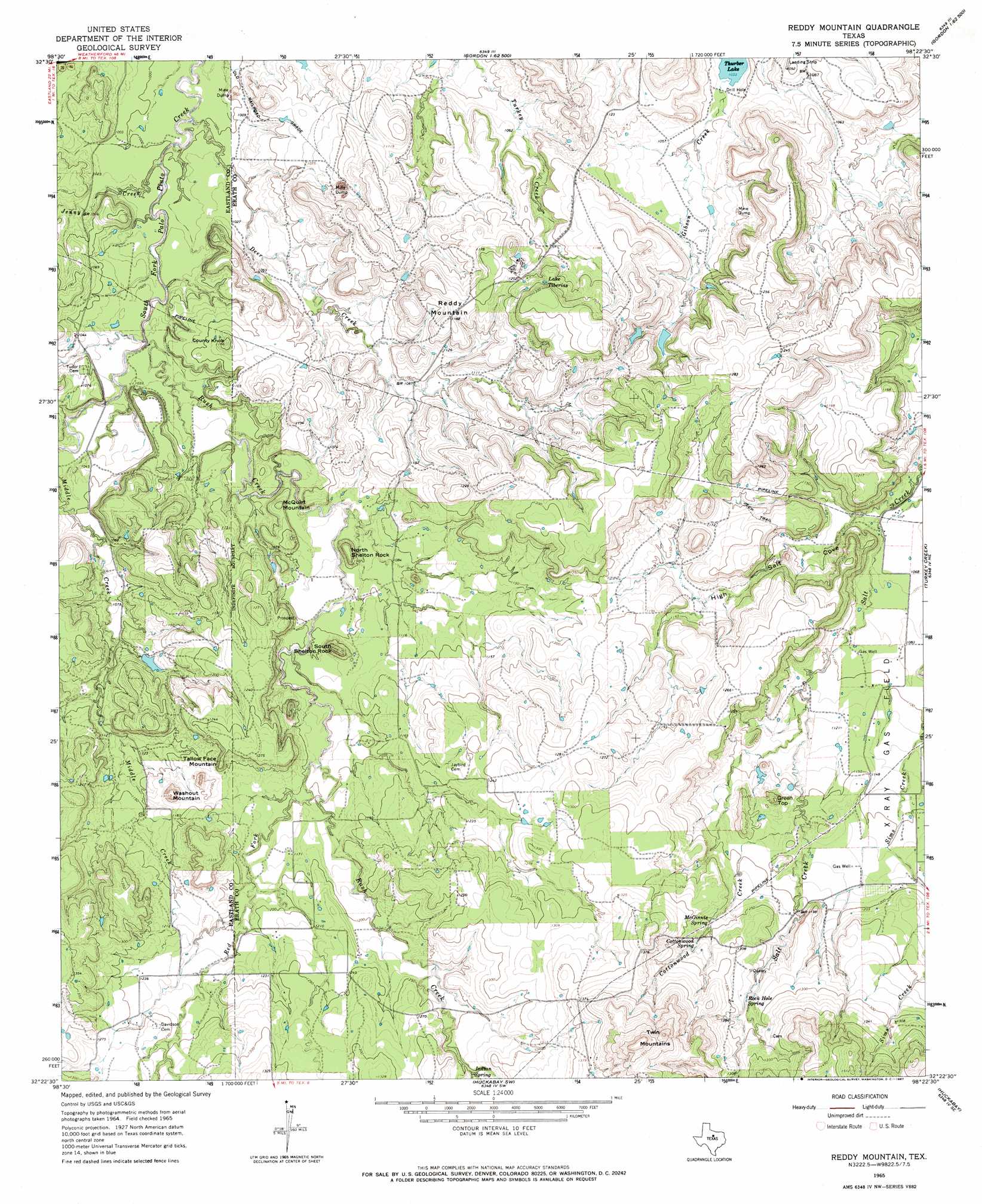
USGS Topo Quad 32098d4 - 1:24,000 scale
| Topo Map Name: | Reddy Mountain |
| USGS Topo Quad ID: | 32098d4 |
| Print Size: | ca. 21 1/4" wide x 27" high |
| Southeast Coordinates: | 32.375° N latitude / 98.375° W longitude |
| Map Center Coordinates: | 32.4375° N latitude / 98.4375° W longitude |
| U.S. State: | TX |
| Filename: | o32098d4.jpg |
| Download Map JPG Image: | Reddy Mountain topo map 1:24,000 scale |
| Map Type: | Topographic |
| Topo Series: | 7.5´ |
| Map Scale: | 1:24,000 |
| Source of Map Images: | United States Geological Survey (USGS) |
| Alternate Map Versions: |
Reddy Mountain TX 1965, updated 1967 Download PDF Buy paper map Reddy Mountain TX 2010 Download PDF Buy paper map Reddy Mountain TX 2012 Download PDF Buy paper map Reddy Mountain TX 2016 Download PDF Buy paper map |
1:24,000 Topo Quads surrounding Reddy Mountain
Caddo |
Caddo Ne |
Metcalf Gap |
Lone Camp |
Brazos West |
La Casa |
Strawn West |
Strawn East |
Gordon |
Santo |
Ranger |
Bear Mountain |
Reddy Mountain |
Turkey Creek |
Morgan Mill |
Kokomo |
Desdemona |
Huckabay Sw |
Huckabay |
Knob Hill |
Gorman |
Rucker |
Lingleville |
Bunyan |
Stephenville |
> Back to 32098a1 at 1:100,000 scale
> Back to 32098a1 at 1:250,000 scale
> Back to U.S. Topo Maps home
Reddy Mountain topo map: Gazetteer
Reddy Mountain: Dams
Thurber Lake Number 4 Dam elevation 353m 1158′Thurber Lake Number 5 Dam elevation 350m 1148′
Reddy Mountain: Lakes
Lake Tiberias elevation 379m 1243′Reddy Mountain: Reservoirs
Thurber Lake Number 4 elevation 353m 1158′Thurber Lake Number 5 elevation 350m 1148′
Reddy Mountain: Springs
Cottonwood Spring elevation 382m 1253′Indian Spring elevation 385m 1263′
McGinnis Spring elevation 376m 1233′
Rock Hole Spring elevation 386m 1266′
Reddy Mountain: Streams
Cottonwood Creek elevation 350m 1148′Deer Creek elevation 301m 987′
Jenny Creek elevation 306m 1003′
Middle Creek elevation 306m 1003′
Red Fork Rush Creek elevation 343m 1125′
Rush Creek elevation 303m 994′
Reddy Mountain: Summits
Country Knob elevation 358m 1174′Green Top elevation 381m 1250′
McQuirt Mountain elevation 355m 1164′
North Shelton Rock elevation 354m 1161′
Reddy Mountain elevation 362m 1187′
South Shelton Rock elevation 385m 1263′
Tallow Face Mountain elevation 385m 1263′
Twin Mountain elevation 499m 1637′
Washout Mountain elevation 393m 1289′
Reddy Mountain: Valleys
High Salt Cove elevation 324m 1062′Reddy Mountain digital topo map on disk
Buy this Reddy Mountain topo map showing relief, roads, GPS coordinates and other geographical features, as a high-resolution digital map file on DVD: