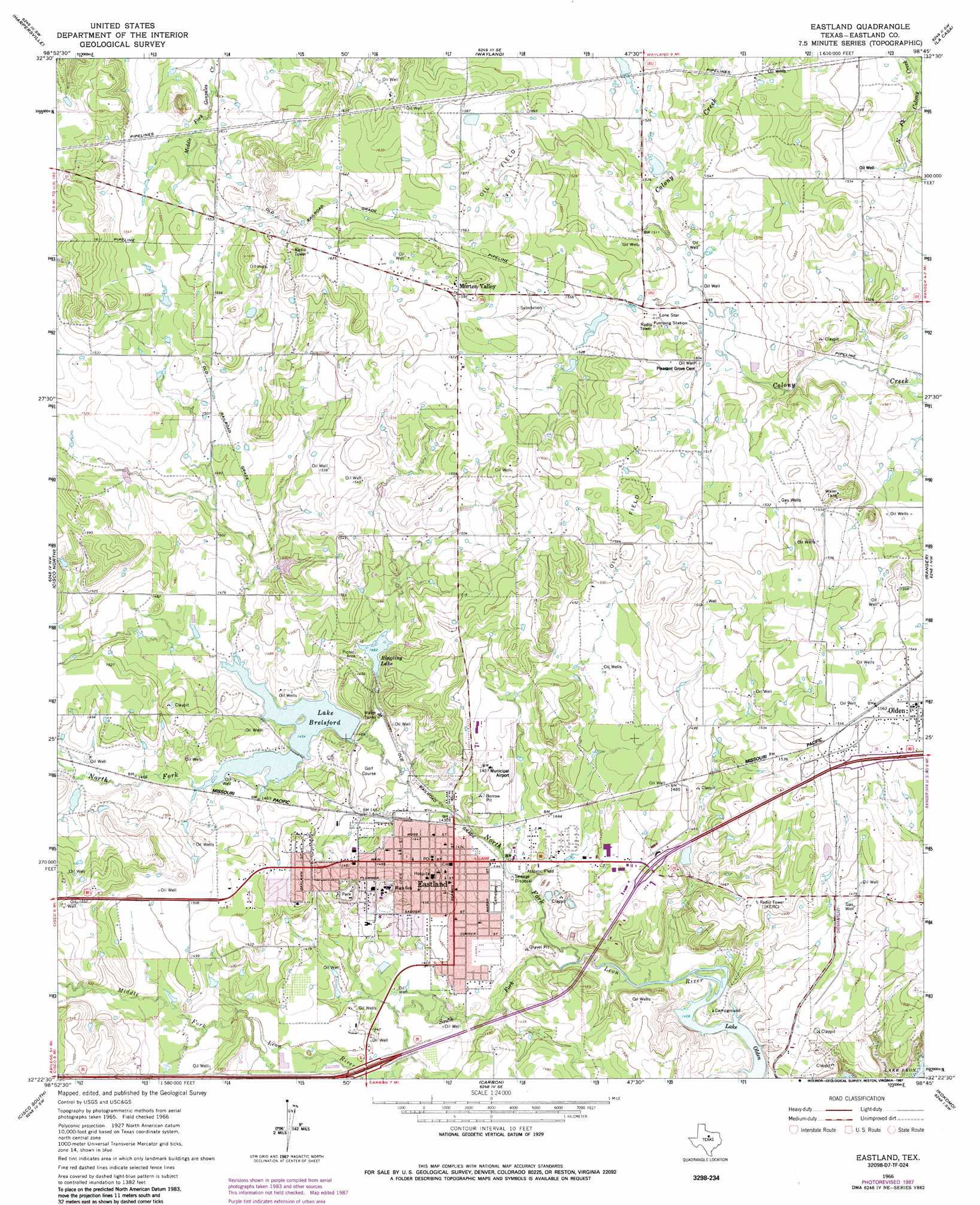
Eastland Topo Map Texas
To zoom in, hover over the map of Eastland
USGS Topo Quad 32098d7 - 1:24,000 scale
| Topo Map Name: | Eastland |
| USGS Topo Quad ID: | 32098d7 |
| Print Size: | ca. 21 1/4" wide x 27" high |
| Southeast Coordinates: | 32.375° N latitude / 98.75° W longitude |
| Map Center Coordinates: | 32.4375° N latitude / 98.8125° W longitude |
| U.S. State: | TX |
| Filename: | o32098d7.jpg |
| Download Map JPG Image: | Eastland topo map 1:24,000 scale |
| Map Type: | Topographic |
| Topo Series: | 7.5´ |
| Map Scale: | 1:24,000 |
| Source of Map Images: | United States Geological Survey (USGS) |
| Alternate Map Versions: |
Eastland TX 1966, updated 1969 Download PDF Buy paper map Eastland TX 1966, updated 1987 Download PDF Buy paper map Eastland TX 2010 Download PDF Buy paper map Eastland TX 2012 Download PDF Buy paper map Eastland TX 2016 Download PDF Buy paper map |
1:24,000 Topo Quads surrounding Eastland
Eolian |
Buck Mountain |
Necessity |
Caddo |
Caddo Ne |
Indian Knoll |
Harpersville |
Wayland |
La Casa |
Strawn West |
Bernie Lake |
Cisco North |
Eastland |
Ranger |
Bear Mountain |
Scranton |
Cisco South |
Carbon |
Kokomo |
Desdemona |
Sabanno |
Union Center |
Hunting Shirt Creek |
Gorman |
Rucker |
> Back to 32098a1 at 1:100,000 scale
> Back to 32098a1 at 1:250,000 scale
> Back to U.S. Topo Maps home
Eastland topo map: Gazetteer
Eastland: Airports
Eastland Municipal Airport elevation 443m 1453′Eastland: Dams
Borrow Pit Reservoir Dam elevation 457m 1499′East King Dam elevation 448m 1469′
Lake Eastland Dam elevation 453m 1486′
Old City Lake Dam elevation 449m 1473′
Ringling Lake Dam elevation 451m 1479′
West King Dam elevation 450m 1476′
Eastland: Populated Places
Eastland elevation 439m 1440′Morton Valley elevation 487m 1597′
Olden elevation 475m 1558′
Eastland: Reservoirs
Borrow Pit Reservoir elevation 457m 1499′East King Lake elevation 448m 1469′
Lake Brelsford elevation 443m 1453′
Lake Eastland elevation 453m 1486′
Old City Lake elevation 449m 1473′
Ringling Lake elevation 446m 1463′
West King Lake elevation 450m 1476′
Eastland: Streams
Middle Fork Leon River elevation 435m 1427′North Fork Leon River elevation 459m 1505′
South Fork Leon River elevation 454m 1489′
Eastland digital topo map on disk
Buy this Eastland topo map showing relief, roads, GPS coordinates and other geographical features, as a high-resolution digital map file on DVD: