La Casa Topo Map Texas
To zoom in, hover over the map of La Casa
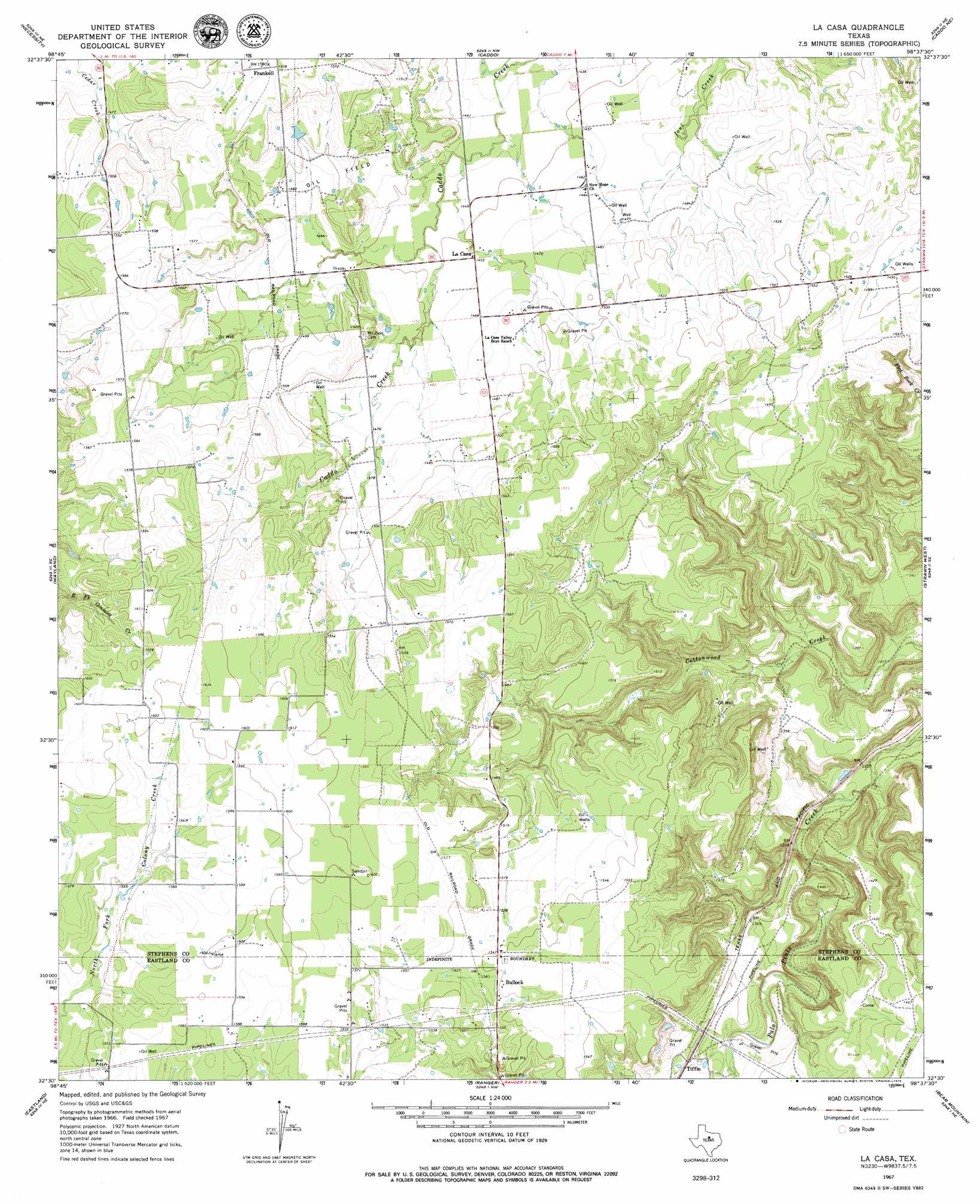
USGS Topo Quad 32098e6 - 1:24,000 scale
| Topo Map Name: | La Casa |
| USGS Topo Quad ID: | 32098e6 |
| Print Size: | ca. 21 1/4" wide x 27" high |
| Southeast Coordinates: | 32.5° N latitude / 98.625° W longitude |
| Map Center Coordinates: | 32.5625° N latitude / 98.6875° W longitude |
| U.S. State: | TX |
| Filename: | o32098e6.jpg |
| Download Map JPG Image: | La Casa topo map 1:24,000 scale |
| Map Type: | Topographic |
| Topo Series: | 7.5´ |
| Map Scale: | 1:24,000 |
| Source of Map Images: | United States Geological Survey (USGS) |
| Alternate Map Versions: |
La Casa TX 1967, updated 1971 Download PDF Buy paper map La Casa TX 1967, updated 1979 Download PDF Buy paper map La Casa TX 2010 Download PDF Buy paper map La Casa TX 2012 Download PDF Buy paper map La Casa TX 2016 Download PDF Buy paper map |
1:24,000 Topo Quads surrounding La Casa
Breckenridge |
Grand Lake |
Ivan South |
Brad |
Fortune Bend |
Buck Mountain |
Necessity |
Caddo |
Caddo Ne |
Metcalf Gap |
Harpersville |
Wayland |
La Casa |
Strawn West |
Strawn East |
Cisco North |
Eastland |
Ranger |
Bear Mountain |
Reddy Mountain |
Cisco South |
Carbon |
Kokomo |
Desdemona |
Huckabay Sw |
> Back to 32098e1 at 1:100,000 scale
> Back to 32098a1 at 1:250,000 scale
> Back to U.S. Topo Maps home
La Casa topo map: Gazetteer
La Casa: Dams
Glynn Wilson Dam elevation 478m 1568′J S McDowell Lake Dam elevation 420m 1377′
La Casa: Populated Places
Bullock elevation 472m 1548′Frankell elevation 481m 1578′
La Casa elevation 443m 1453′
La Casa: Reservoirs
Glynn Wilson Lake elevation 478m 1568′J S McDowell Reservoir elevation 420m 1377′
La Casa digital topo map on disk
Buy this La Casa topo map showing relief, roads, GPS coordinates and other geographical features, as a high-resolution digital map file on DVD: