Ivan South Topo Map Texas
To zoom in, hover over the map of Ivan South
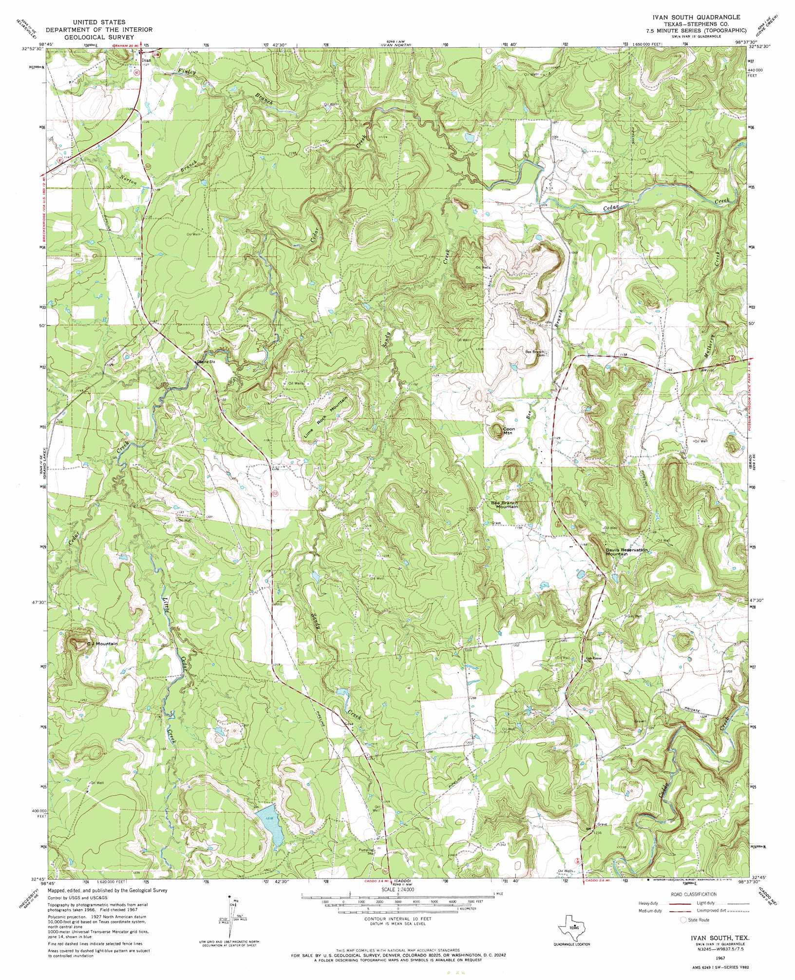
USGS Topo Quad 32098g6 - 1:24,000 scale
| Topo Map Name: | Ivan South |
| USGS Topo Quad ID: | 32098g6 |
| Print Size: | ca. 21 1/4" wide x 27" high |
| Southeast Coordinates: | 32.75° N latitude / 98.625° W longitude |
| Map Center Coordinates: | 32.8125° N latitude / 98.6875° W longitude |
| U.S. State: | TX |
| Filename: | o32098g6.jpg |
| Download Map JPG Image: | Ivan South topo map 1:24,000 scale |
| Map Type: | Topographic |
| Topo Series: | 7.5´ |
| Map Scale: | 1:24,000 |
| Source of Map Images: | United States Geological Survey (USGS) |
| Alternate Map Versions: |
Ivan South TX 1967, updated 1970 Download PDF Buy paper map Ivan South TX 2010 Download PDF Buy paper map Ivan South TX 2012 Download PDF Buy paper map Ivan South TX 2016 Download PDF Buy paper map |
1:24,000 Topo Quads surrounding Ivan South
Murray |
Tackett Mountain |
South Bend |
Graham |
Ross Mountain |
Crystal Falls |
Eliasville |
Ivan North |
Cove Creek |
Costello Island |
Breckenridge |
Grand Lake |
Ivan South |
Brad |
Fortune Bend |
Buck Mountain |
Necessity |
Caddo |
Caddo Ne |
Metcalf Gap |
Harpersville |
Wayland |
La Casa |
Strawn West |
Strawn East |
> Back to 32098e1 at 1:100,000 scale
> Back to 32098a1 at 1:250,000 scale
> Back to U.S. Topo Maps home
Ivan South topo map: Gazetteer
Ivan South: Dams
Monroe Veal Dam elevation 372m 1220′Stephens Company Water Company Lake Dam elevation 317m 1040′
Ivan South: Populated Places
Ivan elevation 343m 1125′Ivan South: Reservoirs
Stephens Company Water Company Reservoir elevation 317m 1040′Tullos Lake elevation 372m 1220′
Ivan South: Streams
Bee Branch elevation 317m 1040′Finley Branch elevation 319m 1046′
Little Cedar Creek elevation 339m 1112′
Mulberry Creek elevation 308m 1010′
Norton Branch elevation 332m 1089′
Sandy Creek elevation 317m 1040′
Ivan South: Summits
Bee Branch Mountain elevation 382m 1253′C J Mountain elevation 424m 1391′
Coon Mountain elevation 373m 1223′
Devils Reservation Mountain elevation 392m 1286′
Lime Rock Mountain elevation 391m 1282′
Ivan South digital topo map on disk
Buy this Ivan South topo map showing relief, roads, GPS coordinates and other geographical features, as a high-resolution digital map file on DVD: