Whitt Topo Map Texas
To zoom in, hover over the map of Whitt
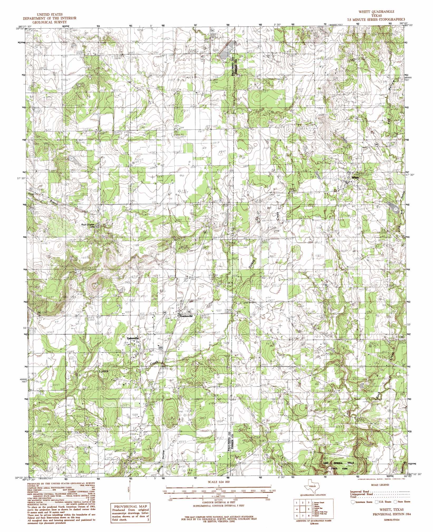
USGS Topo Quad 32098h1 - 1:24,000 scale
| Topo Map Name: | Whitt |
| USGS Topo Quad ID: | 32098h1 |
| Print Size: | ca. 21 1/4" wide x 27" high |
| Southeast Coordinates: | 32.875° N latitude / 98° W longitude |
| Map Center Coordinates: | 32.9375° N latitude / 98.0625° W longitude |
| U.S. State: | TX |
| Filename: | o32098h1.jpg |
| Download Map JPG Image: | Whitt topo map 1:24,000 scale |
| Map Type: | Topographic |
| Topo Series: | 7.5´ |
| Map Scale: | 1:24,000 |
| Source of Map Images: | United States Geological Survey (USGS) |
| Alternate Map Versions: |
Whitt TX 1984, updated 1984 Download PDF Buy paper map Whitt TX 2010 Download PDF Buy paper map Whitt TX 2012 Download PDF Buy paper map Whitt TX 2016 Download PDF Buy paper map |
1:24,000 Topo Quads surrounding Whitt
Senate |
Jacksboro |
Jacksboro Ne |
Wizard Wells |
Bridgeport West |
Long Hollow |
Bartons Chapel |
Perrin |
Gibtown |
Boonsville |
Graford West |
Graford East |
Whitt |
Adell |
Poolville |
Palo Pinto |
Mineral Wells West |
Mineral Wells East |
Garner |
Weatherford North |
Lone Camp |
Brazos West |
Brazos East |
Brock |
Weatherford South |
> Back to 32098e1 at 1:100,000 scale
> Back to 32098a1 at 1:250,000 scale
> Back to U.S. Topo Maps home
Whitt topo map: Gazetteer
Whitt: Airports
Beula Strip elevation 332m 1089′Rock Creek Ranch Airport elevation 340m 1115′
Whitt: Dams
Bailey Lake Dam elevation 346m 1135′Decker Lake Dam elevation 341m 1118′
Soil Conservation Service Site 8 Dam elevation 331m 1085′
Whitt: Lakes
Rock Crusher Lake elevation 338m 1108′Whitt: Populated Places
Peadenville elevation 318m 1043′Salesville elevation 308m 1010′
Whitt elevation 344m 1128′
Whitt: Reservoirs
Bailey Lake elevation 346m 1135′Decker Lake elevation 341m 1118′
Soil Conservation Service Site 8 Reservoir elevation 331m 1085′
Whitt: Valleys
Red Hollow elevation 313m 1026′Whitt digital topo map on disk
Buy this Whitt topo map showing relief, roads, GPS coordinates and other geographical features, as a high-resolution digital map file on DVD: