Graford West Topo Map Texas
To zoom in, hover over the map of Graford West
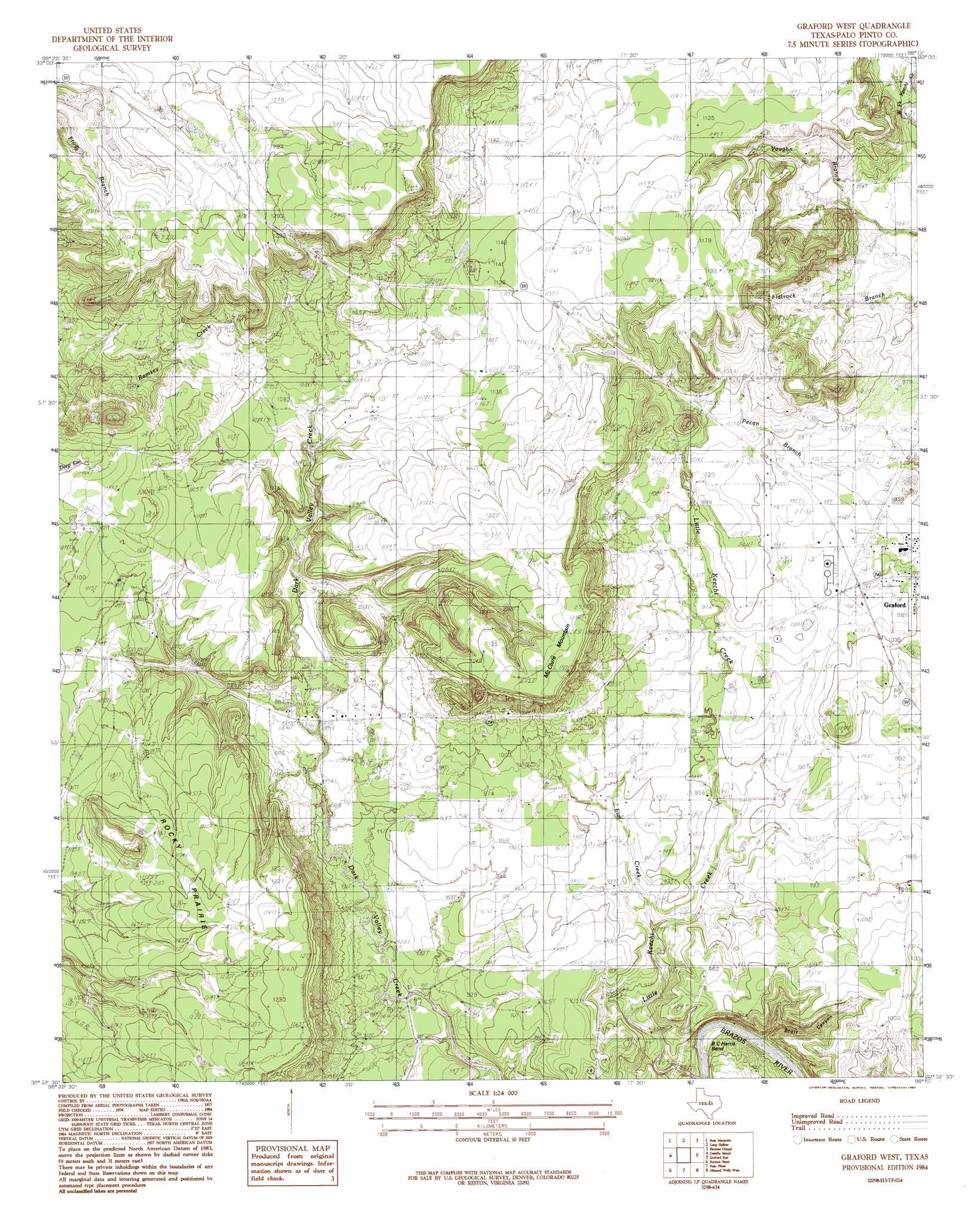
USGS Topo Quad 32098h3 - 1:24,000 scale
| Topo Map Name: | Graford West |
| USGS Topo Quad ID: | 32098h3 |
| Print Size: | ca. 21 1/4" wide x 27" high |
| Southeast Coordinates: | 32.875° N latitude / 98.25° W longitude |
| Map Center Coordinates: | 32.9375° N latitude / 98.3125° W longitude |
| U.S. State: | TX |
| Filename: | o32098h3.jpg |
| Download Map JPG Image: | Graford West topo map 1:24,000 scale |
| Map Type: | Topographic |
| Topo Series: | 7.5´ |
| Map Scale: | 1:24,000 |
| Source of Map Images: | United States Geological Survey (USGS) |
| Alternate Map Versions: |
Graford West TX 1984, updated 1984 Download PDF Buy paper map Graford West TX 1984, updated 1987 Download PDF Buy paper map Graford West TX 2010 Download PDF Buy paper map Graford West TX 2012 Download PDF Buy paper map Graford West TX 2016 Download PDF Buy paper map |
1:24,000 Topo Quads surrounding Graford West
Lake Eddleman |
Bryson |
Senate |
Jacksboro |
Jacksboro Ne |
Graham |
Ross Mountain |
Long Hollow |
Bartons Chapel |
Perrin |
Cove Creek |
Costello Island |
Graford West |
Graford East |
Whitt |
Brad |
Fortune Bend |
Palo Pinto |
Mineral Wells West |
Mineral Wells East |
Caddo Ne |
Metcalf Gap |
Lone Camp |
Brazos West |
Brazos East |
> Back to 32098e1 at 1:100,000 scale
> Back to 32098a1 at 1:250,000 scale
> Back to U.S. Topo Maps home
Graford West topo map: Gazetteer
Graford West: Areas
Rocky Prairie elevation 363m 1190′Graford West: Oilfields
Loyd-Dalton Oil Field elevation 295m 967′Graford West: Streams
Elm Creek elevation 274m 898′Graford West: Summits
McClure Mountain elevation 396m 1299′Graford West: Valleys
Scott Canyon elevation 268m 879′Graford West digital topo map on disk
Buy this Graford West topo map showing relief, roads, GPS coordinates and other geographical features, as a high-resolution digital map file on DVD: