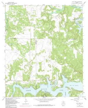
Cove Creek Topo Map Texas
To zoom in, hover over the map of Cove Creek
USGS Topo Quad 32098h5 - 1:24,000 scale
| Topo Map Name: | Cove Creek |
| USGS Topo Quad ID: | 32098h5 |
| Print Size: | ca. 21 1/4" wide x 27" high |
| Southeast Coordinates: | 32.875° N latitude / 98.5° W longitude |
| Map Center Coordinates: | 32.9375° N latitude / 98.5625° W longitude |
| U.S. State: | TX |
| Filename: | o32098h5.jpg |
| Download Map JPG Image: | Cove Creek topo map 1:24,000 scale |
| Map Type: | Topographic |
| Topo Series: | 7.5´ |
| Map Scale: | 1:24,000 |
| Source of Map Images: | United States Geological Survey (USGS) |
| Alternate Map Versions: |
Cove Creek TX 1967, updated 1970 Download PDF Buy paper map Cove Creek TX 1967, updated 1982 Download PDF Buy paper map Cove Creek TX 2010 Download PDF Buy paper map Cove Creek TX 2012 Download PDF Buy paper map Cove Creek TX 2016 Download PDF Buy paper map |
1:24,000 Topo Quads surrounding Cove Creek
> Back to 32098e1 at 1:100,000 scale
> Back to 32098a1 at 1:250,000 scale
> Back to U.S. Topo Maps home
Cove Creek topo map: Gazetteer
Cove Creek: Beaches
Sandy Beach elevation 305m 1000′Cove Creek: Bends
Long Bend elevation 315m 1033′Poor Bend elevation 306m 1003′
Salem Bend elevation 311m 1020′
Cove Creek: Channels
Broadway Channel elevation 303m 994′Cove Creek: Dams
Union Lake Dam elevation 341m 1118′Cove Creek: Reservoirs
Union Lake elevation 341m 1118′Cove Creek: Streams
Cedar Creek elevation 303m 994′Cove Creek elevation 304m 997′
Davis Creek elevation 303m 994′
Fox Hollow Creek elevation 303m 994′
Maloney Creek elevation 303m 994′
Pickard Creek elevation 304m 997′
Veale Creek elevation 303m 994′
Cove Creek: Summits
Caudill Mountain elevation 415m 1361′Cove Creek digital topo map on disk
Buy this Cove Creek topo map showing relief, roads, GPS coordinates and other geographical features, as a high-resolution digital map file on DVD:


