Ivan North Topo Map Texas
To zoom in, hover over the map of Ivan North
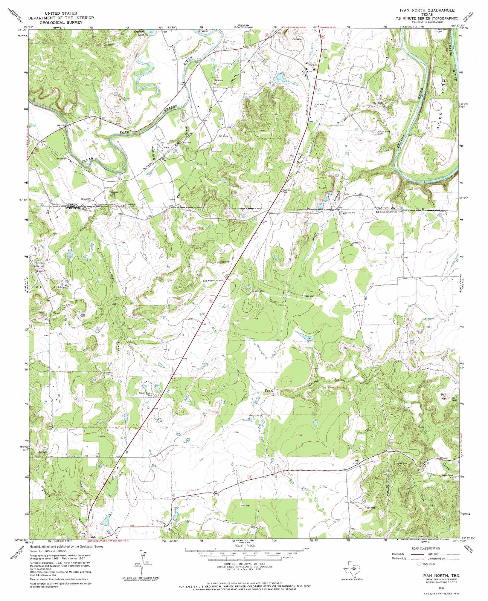
USGS Topo Quad 32098h6 - 1:24,000 scale
| Topo Map Name: | Ivan North |
| USGS Topo Quad ID: | 32098h6 |
| Print Size: | ca. 21 1/4" wide x 27" high |
| Southeast Coordinates: | 32.875° N latitude / 98.625° W longitude |
| Map Center Coordinates: | 32.9375° N latitude / 98.6875° W longitude |
| U.S. State: | TX |
| Filename: | o32098h6.jpg |
| Download Map JPG Image: | Ivan North topo map 1:24,000 scale |
| Map Type: | Topographic |
| Topo Series: | 7.5´ |
| Map Scale: | 1:24,000 |
| Source of Map Images: | United States Geological Survey (USGS) |
| Alternate Map Versions: |
Ivan North TX 1967, updated 1970 Download PDF Buy paper map Ivan North TX 2010 Download PDF Buy paper map Ivan North TX 2012 Download PDF Buy paper map Ivan North TX 2016 Download PDF Buy paper map |
1:24,000 Topo Quads surrounding Ivan North
Proffitt Crossing |
Proffitt |
Newcastle |
Lake Eddleman |
Bryson |
Murray |
Tackett Mountain |
South Bend |
Graham |
Ross Mountain |
Crystal Falls |
Eliasville |
Ivan North |
Cove Creek |
Costello Island |
Breckenridge |
Grand Lake |
Ivan South |
Brad |
Fortune Bend |
Buck Mountain |
Necessity |
Caddo |
Caddo Ne |
Metcalf Gap |
> Back to 32098e1 at 1:100,000 scale
> Back to 32098a1 at 1:250,000 scale
> Back to U.S. Topo Maps home
Ivan North topo map: Gazetteer
Ivan North: Bends
Brier Bend elevation 320m 1049′Ivan North: Dams
Scott Lake Dam elevation 330m 1082′Ivan North: Reservoirs
Scott Lake elevation 330m 1082′Ivan North: Streams
Duff Branch elevation 307m 1007′Elm Creek elevation 309m 1013′
McMillan Branch elevation 313m 1026′
Peveler Creek elevation 308m 1010′
Spring Branch elevation 308m 1010′
Ivan North: Summits
Ball Mountain elevation 360m 1181′Ivan North digital topo map on disk
Buy this Ivan North topo map showing relief, roads, GPS coordinates and other geographical features, as a high-resolution digital map file on DVD: