Crooked Creek Topo Map Texas
To zoom in, hover over the map of Crooked Creek
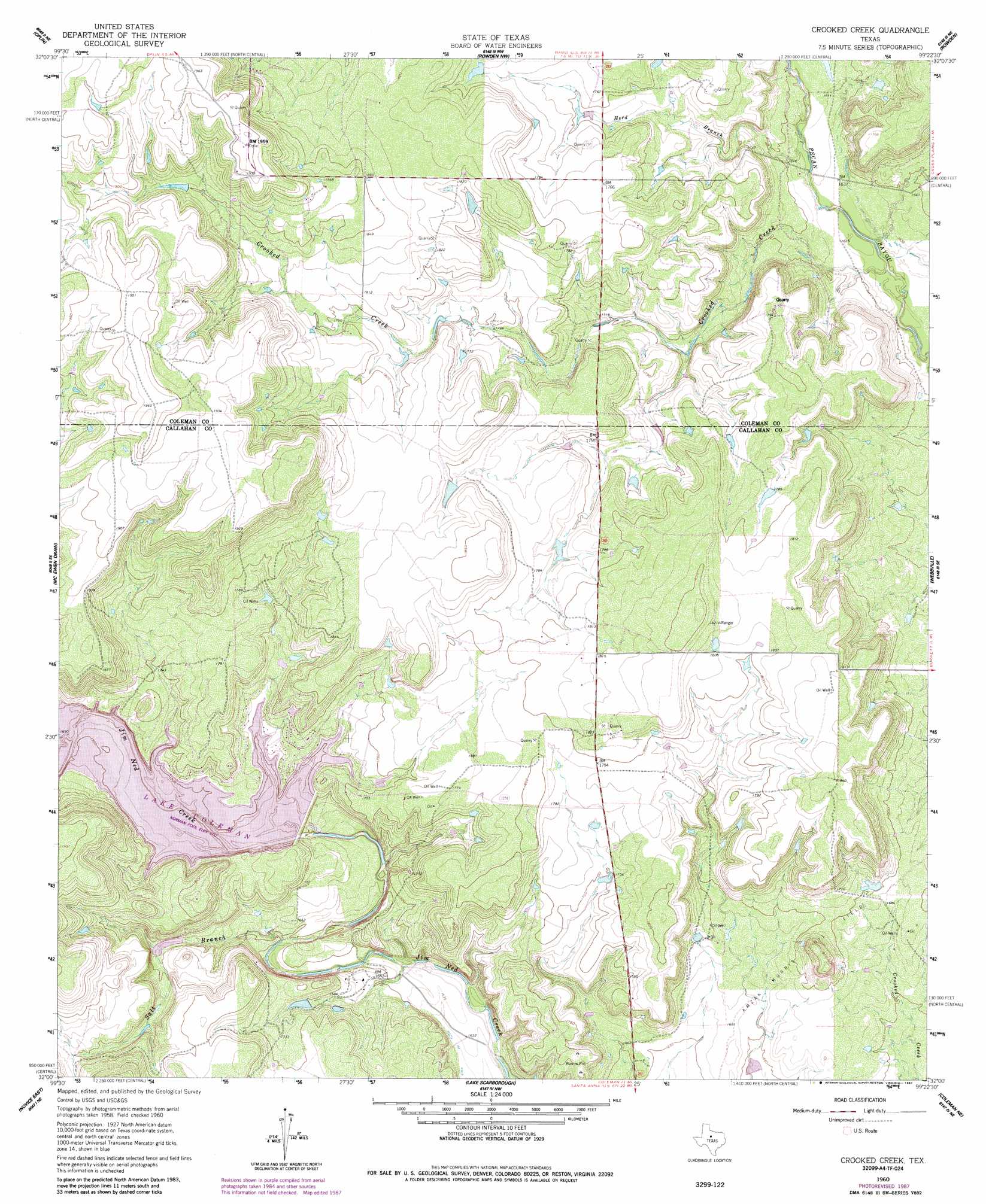
USGS Topo Quad 32099a4 - 1:24,000 scale
| Topo Map Name: | Crooked Creek |
| USGS Topo Quad ID: | 32099a4 |
| Print Size: | ca. 21 1/4" wide x 27" high |
| Southeast Coordinates: | 32° N latitude / 99.375° W longitude |
| Map Center Coordinates: | 32.0625° N latitude / 99.4375° W longitude |
| U.S. State: | TX |
| Filename: | o32099a4.jpg |
| Download Map JPG Image: | Crooked Creek topo map 1:24,000 scale |
| Map Type: | Topographic |
| Topo Series: | 7.5´ |
| Map Scale: | 1:24,000 |
| Source of Map Images: | United States Geological Survey (USGS) |
| Alternate Map Versions: |
Crooked Creek TX 1960, updated 1962 Download PDF Buy paper map Crooked Creek TX 1960, updated 1987 Download PDF Buy paper map Crooked Creek TX 2010 Download PDF Buy paper map Crooked Creek TX 2012 Download PDF Buy paper map Crooked Creek TX 2016 Download PDF Buy paper map |
1:24,000 Topo Quads surrounding Crooked Creek
Potosi |
Eula |
Cub Hollow |
Admiral |
Putnam South |
Lawn |
Oplin |
Rowden Nw |
Rowden |
Cross Plains North |
Goldsboro |
Mcewen Draw |
Crooked Creek |
Webbville |
Cross Cut |
Novice West |
Novice East |
Lake Scarborough |
Coleman Ne |
Burkett |
Talpa |
Valera |
Coleman |
Lake San Tana |
Thrifty |
> Back to 32099a1 at 1:100,000 scale
> Back to 32098a1 at 1:250,000 scale
> Back to U.S. Topo Maps home
Crooked Creek topo map: Gazetteer
Crooked Creek: Dams
Coleman Dam elevation 521m 1709′Soil Conservation Service Site 10 Dam elevation 523m 1715′
Soil Conservation Service Site 22 Dam elevation 511m 1676′
Soil Conservation Service Site 8 Dam elevation 497m 1630′
Soil Conservation Service Site 9 Dam elevation 524m 1719′
Crooked Creek: Reservoirs
Lake Coleman elevation 524m 1719′Soil Conservation Service Site 10 Reservoir elevation 523m 1715′
Soil Conservation Service Site 22 Reservoir elevation 511m 1676′
Soil Conservation Service Site 8 Reservoir elevation 497m 1630′
Crooked Creek: Streams
Crooked Creek elevation 493m 1617′Herd Branch elevation 497m 1630′
Mesquite Branch elevation 494m 1620′
Salt Branch elevation 499m 1637′
Crooked Creek digital topo map on disk
Buy this Crooked Creek topo map showing relief, roads, GPS coordinates and other geographical features, as a high-resolution digital map file on DVD: