Rowden Nw Topo Map Texas
To zoom in, hover over the map of Rowden Nw
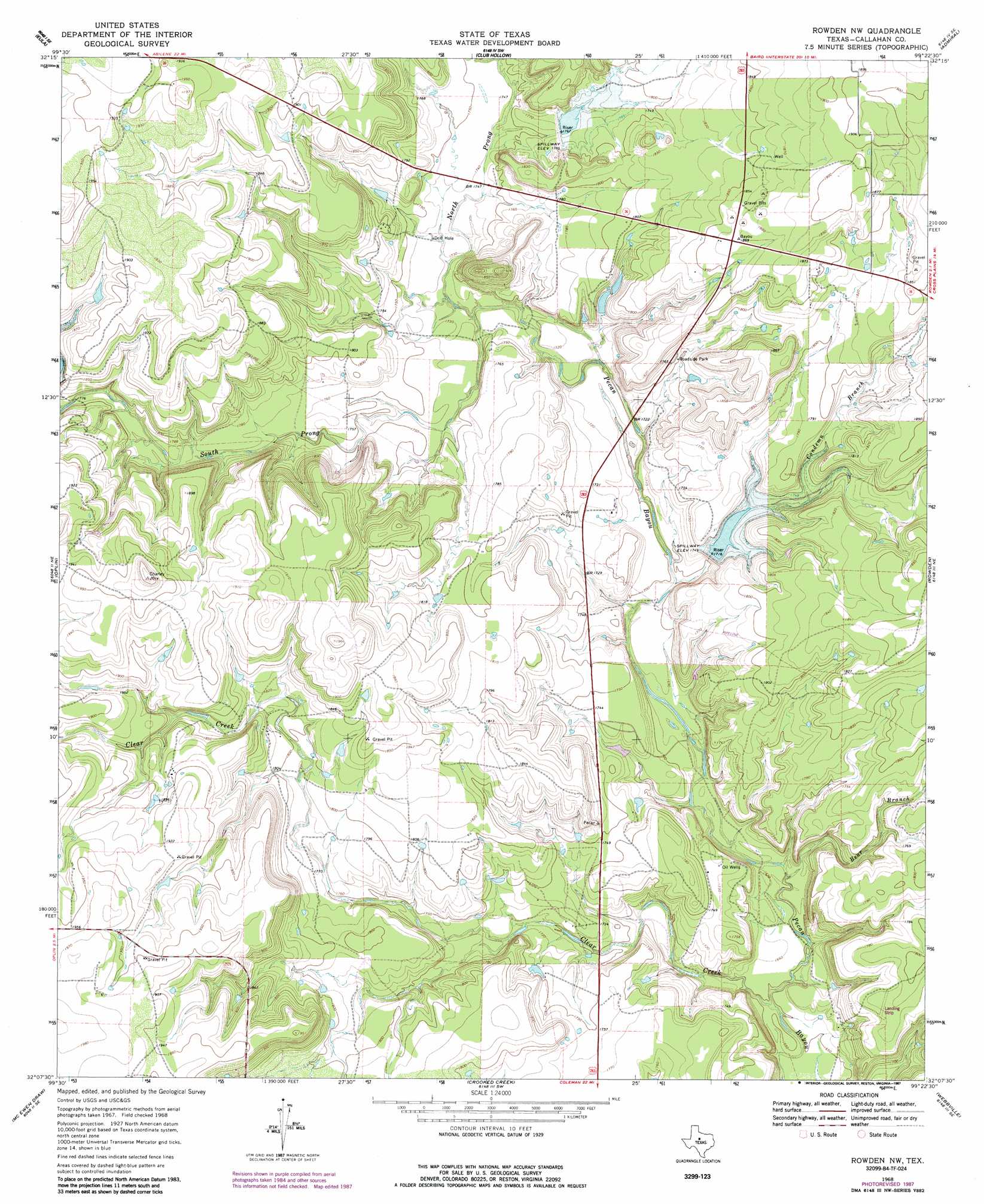
USGS Topo Quad 32099b4 - 1:24,000 scale
| Topo Map Name: | Rowden Nw |
| USGS Topo Quad ID: | 32099b4 |
| Print Size: | ca. 21 1/4" wide x 27" high |
| Southeast Coordinates: | 32.125° N latitude / 99.375° W longitude |
| Map Center Coordinates: | 32.1875° N latitude / 99.4375° W longitude |
| U.S. State: | TX |
| Filename: | o32099b4.jpg |
| Download Map JPG Image: | Rowden Nw topo map 1:24,000 scale |
| Map Type: | Topographic |
| Topo Series: | 7.5´ |
| Map Scale: | 1:24,000 |
| Source of Map Images: | United States Geological Survey (USGS) |
| Alternate Map Versions: |
Rowden NW TX 1968, updated 1971 Download PDF Buy paper map Rowden NW TX 1968, updated 1987 Download PDF Buy paper map Rowden NW TX 2010 Download PDF Buy paper map Rowden NW TX 2012 Download PDF Buy paper map Rowden NW TX 2016 Download PDF Buy paper map |
1:24,000 Topo Quads surrounding Rowden Nw
Abilene East |
Kirby Lake Ne |
Baird |
Jayell |
Putnam North |
Potosi |
Eula |
Cub Hollow |
Admiral |
Putnam South |
Lawn |
Oplin |
Rowden Nw |
Rowden |
Cross Plains North |
Goldsboro |
Mcewen Draw |
Crooked Creek |
Webbville |
Cross Cut |
Novice West |
Novice East |
Lake Scarborough |
Coleman Ne |
Burkett |
> Back to 32099a1 at 1:100,000 scale
> Back to 32098a1 at 1:250,000 scale
> Back to U.S. Topo Maps home
Rowden Nw topo map: Gazetteer
Rowden Nw: Dams
Soil Conservation Service Site 10 Dam elevation 542m 1778′Soil Conservation Service Site 12 Dam elevation 518m 1699′
Rowden Nw: Reservoirs
Soil Conservation Service Site 10 Reservoir elevation 542m 1778′Soil Conservation Service Site 12 Reservoir elevation 518m 1699′
Rowden Nw: Streams
Bear Branch elevation 503m 1650′Clear Creek elevation 500m 1640′
Condemn Branch elevation 521m 1709′
Lick Branch elevation 541m 1774′
North Prong Pecan Bayou elevation 525m 1722′
South Prong Pecan Bayou elevation 525m 1722′
Rowden Nw digital topo map on disk
Buy this Rowden Nw topo map showing relief, roads, GPS coordinates and other geographical features, as a high-resolution digital map file on DVD: