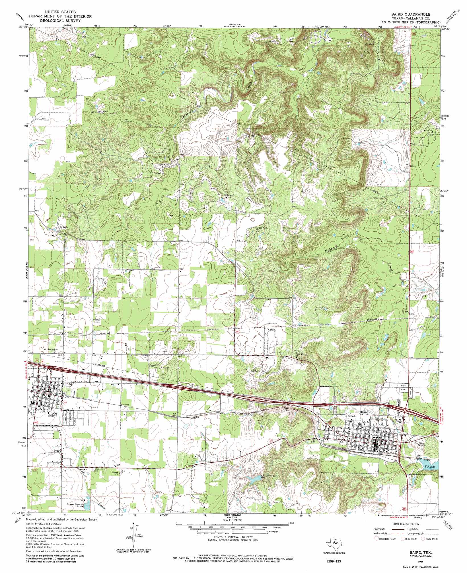
Baird Topo Map Texas
To zoom in, hover over the map of Baird
USGS Topo Quad 32099d4 - 1:24,000 scale
| Topo Map Name: | Baird |
| USGS Topo Quad ID: | 32099d4 |
| Print Size: | ca. 21 1/4" wide x 27" high |
| Southeast Coordinates: | 32.375° N latitude / 99.375° W longitude |
| Map Center Coordinates: | 32.4375° N latitude / 99.4375° W longitude |
| U.S. State: | TX |
| Filename: | o32099d4.jpg |
| Download Map JPG Image: | Baird topo map 1:24,000 scale |
| Map Type: | Topographic |
| Topo Series: | 7.5´ |
| Map Scale: | 1:24,000 |
| Source of Map Images: | United States Geological Survey (USGS) |
| Alternate Map Versions: |
Baird TX 1966, updated 1969 Download PDF Buy paper map Baird TX 1966, updated 1985 Download PDF Buy paper map Baird TX 2010 Download PDF Buy paper map Baird TX 2012 Download PDF Buy paper map Baird TX 2016 Download PDF Buy paper map |
1:24,000 Topo Quads surrounding Baird
Nugent |
Smokey Draw |
Acampo |
Albany |
Mccathrine Mountain |
Hamby |
Flattop |
Leeper Creek |
Snyder Lake |
Moran |
Abilene East |
Kirby Lake Ne |
Baird |
Jayell |
Putnam North |
Potosi |
Eula |
Cub Hollow |
Admiral |
Putnam South |
Lawn |
Oplin |
Rowden Nw |
Rowden |
Cross Plains North |
> Back to 32099a1 at 1:100,000 scale
> Back to 32098a1 at 1:250,000 scale
> Back to U.S. Topo Maps home
Baird topo map: Gazetteer
Baird: Dams
Latimer Lake Dam elevation 563m 1847′Baird: Parks
Bell Park elevation 519m 1702′The Bears Den Stadium elevation 526m 1725′
Baird: Populated Places
Baird elevation 525m 1722′Clyde elevation 607m 1991′
Baird: Reservoirs
Latimer Lake elevation 563m 1847′Baird digital topo map on disk
Buy this Baird topo map showing relief, roads, GPS coordinates and other geographical features, as a high-resolution digital map file on DVD: