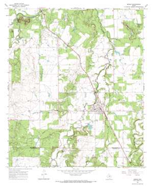
Moran Topo Map Texas
To zoom in, hover over the map of Moran
USGS Topo Quad 32099e2 - 1:24,000 scale
| Topo Map Name: | Moran |
| USGS Topo Quad ID: | 32099e2 |
| Print Size: | ca. 21 1/4" wide x 27" high |
| Southeast Coordinates: | 32.5° N latitude / 99.125° W longitude |
| Map Center Coordinates: | 32.5625° N latitude / 99.1875° W longitude |
| U.S. State: | TX |
| Filename: | o32099e2.jpg |
| Download Map JPG Image: | Moran topo map 1:24,000 scale |
| Map Type: | Topographic |
| Topo Series: | 7.5´ |
| Map Scale: | 1:24,000 |
| Source of Map Images: | United States Geological Survey (USGS) |
| Alternate Map Versions: |
Moran TX 1965, updated 1968 Download PDF Buy paper map Moran TX 2010 Download PDF Buy paper map Moran TX 2012 Download PDF Buy paper map Moran TX 2016 Download PDF Buy paper map |
1:24,000 Topo Quads surrounding Moran
> Back to 32099e1 at 1:100,000 scale
> Back to 32098a1 at 1:250,000 scale
> Back to U.S. Topo Maps home
Moran topo map: Gazetteer
Moran: Dams
Johnson Lake Dam elevation 401m 1315′Moran City Lake Dam elevation 410m 1345′
Wylie Lake Dam elevation 415m 1361′
Moran: Populated Places
Moran elevation 414m 1358′Sedwick elevation 421m 1381′
Moran: Reservoirs
Johnson Lake elevation 401m 1315′Moran City Lake elevation 410m 1345′
Moran Lake elevation 412m 1351′
Wylie Lake elevation 415m 1361′
Moran: Streams
Cordwood Creek elevation 398m 1305′Eubanks Creek elevation 410m 1345′
Post Oak Creek elevation 391m 1282′
Reynolds Creek elevation 398m 1305′
Moran: Summits
Greer Mountains elevation 456m 1496′Mugginsville Mountain elevation 431m 1414′
Round Top Mountain elevation 418m 1371′
Moran digital topo map on disk
Buy this Moran topo map showing relief, roads, GPS coordinates and other geographical features, as a high-resolution digital map file on DVD:


