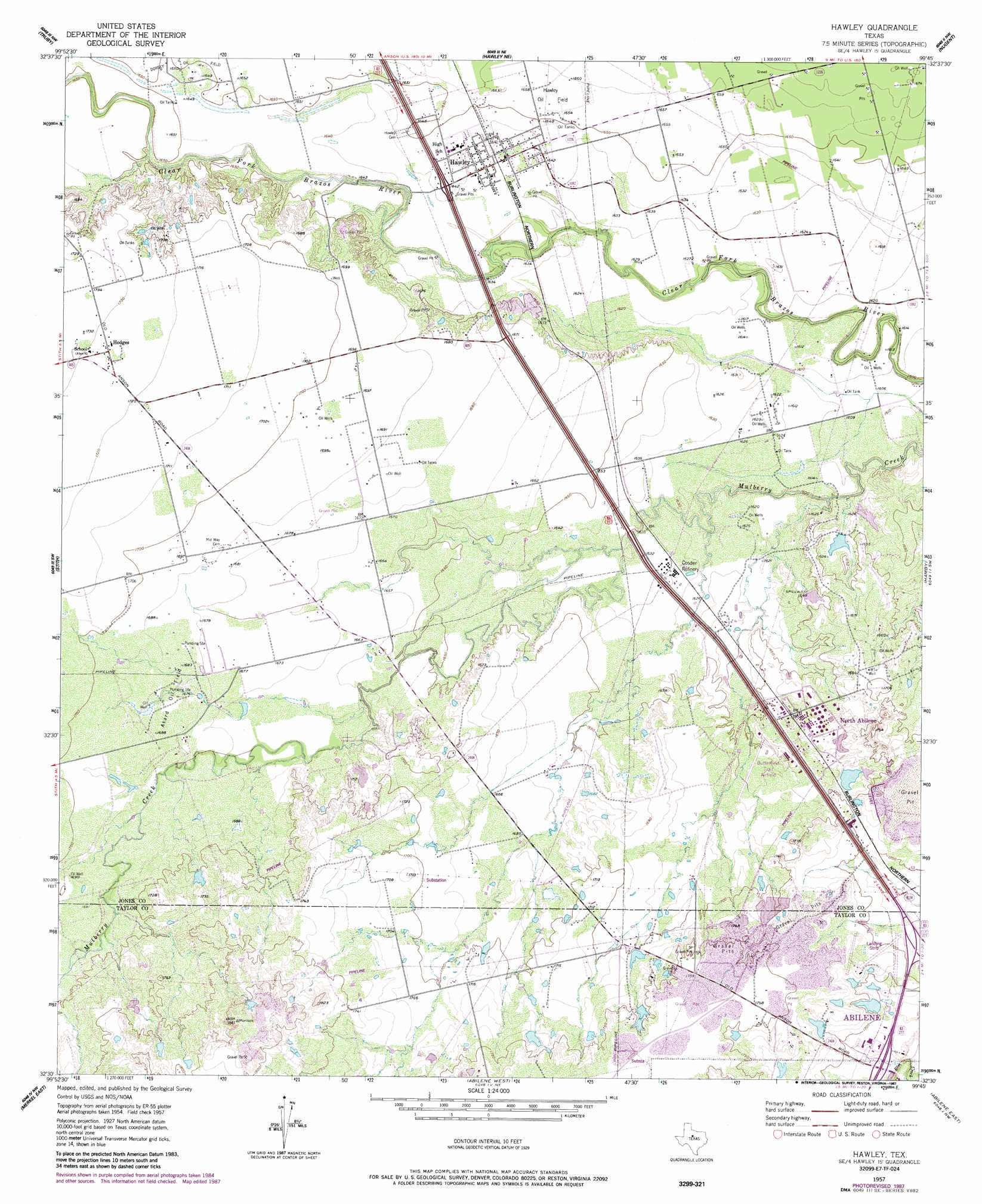
Hawley Topo Map Texas
To zoom in, hover over the map of Hawley
USGS Topo Quad 32099e7 - 1:24,000 scale
| Topo Map Name: | Hawley |
| USGS Topo Quad ID: | 32099e7 |
| Print Size: | ca. 21 1/4" wide x 27" high |
| Southeast Coordinates: | 32.5° N latitude / 99.75° W longitude |
| Map Center Coordinates: | 32.5625° N latitude / 99.8125° W longitude |
| U.S. State: | TX |
| Filename: | o32099e7.jpg |
| Download Map JPG Image: | Hawley topo map 1:24,000 scale |
| Map Type: | Topographic |
| Topo Series: | 7.5´ |
| Map Scale: | 1:24,000 |
| Source of Map Images: | United States Geological Survey (USGS) |
| Alternate Map Versions: |
Hawley TX 1957, updated 1958 Download PDF Buy paper map Hawley TX 1957, updated 1968 Download PDF Buy paper map Hawley TX 1957, updated 1975 Download PDF Buy paper map Hawley TX 1957, updated 1987 Download PDF Buy paper map Hawley TX 2010 Download PDF Buy paper map Hawley TX 2012 Download PDF Buy paper map Hawley TX 2016 Download PDF Buy paper map |
1:24,000 Topo Quads surrounding Hawley
Neinda |
Anson |
Funston |
Lueders West |
Lueders East |
Noodle Ne |
Truby |
Hawley Ne |
Nugent |
Smokey Draw |
Noodle |
Stith |
Hawley |
Hamby |
Flattop |
Merkel West |
Merkel East |
Abilene West |
Abilene East |
Kirby Lake Ne |
Mountain Pass |
View |
Buffalo Gap |
Potosi |
Eula |
> Back to 32099e1 at 1:100,000 scale
> Back to 32098a1 at 1:250,000 scale
> Back to U.S. Topo Maps home
Hawley topo map: Gazetteer
Hawley: Oilfields
Akard Oil Field elevation 513m 1683′Dorsey Oil Field elevation 503m 1650′
Hawley Oil Field elevation 505m 1656′
Hawley: Parks
Hawley Little League Park elevation 502m 1646′Hawley: Populated Places
Hawley elevation 500m 1640′Hodges elevation 527m 1729′
North Abilene elevation 506m 1660′
Hawley digital topo map on disk
Buy this Hawley topo map showing relief, roads, GPS coordinates and other geographical features, as a high-resolution digital map file on DVD: