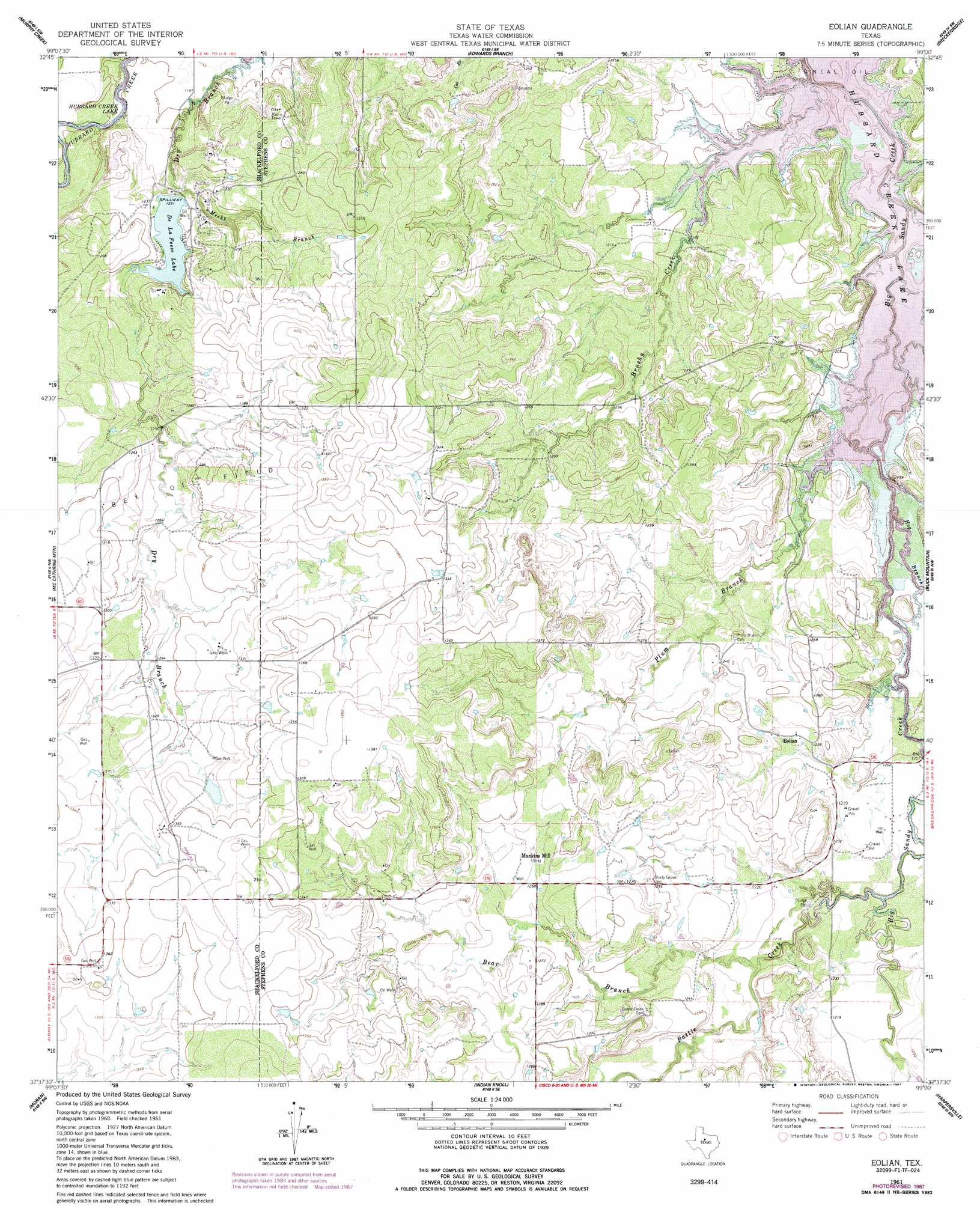
Eolian Topo Map Texas
To zoom in, hover over the map of Eolian
USGS Topo Quad 32099f1 - 1:24,000 scale
| Topo Map Name: | Eolian |
| USGS Topo Quad ID: | 32099f1 |
| Print Size: | ca. 21 1/4" wide x 27" high |
| Southeast Coordinates: | 32.625° N latitude / 99° W longitude |
| Map Center Coordinates: | 32.6875° N latitude / 99.0625° W longitude |
| U.S. State: | TX |
| Filename: | o32099f1.jpg |
| Download Map JPG Image: | Eolian topo map 1:24,000 scale |
| Map Type: | Topographic |
| Topo Series: | 7.5´ |
| Map Scale: | 1:24,000 |
| Source of Map Images: | United States Geological Survey (USGS) |
| Alternate Map Versions: |
Eolian TX 1961, updated 1962 Download PDF Buy paper map Eolian TX 1961, updated 1985 Download PDF Buy paper map Eolian TX 1961, updated 1987 Download PDF Buy paper map Eolian TX 2010 Download PDF Buy paper map Eolian TX 2012 Download PDF Buy paper map Eolian TX 2016 Download PDF Buy paper map |
1:24,000 Topo Quads surrounding Eolian
Collins Creek |
Fort Griffin |
Lusk |
Crystal Falls |
Eliasville |
Round Hill |
Murphy Creek |
Edwards Branch |
Breckenridge |
Grand Lake |
Albany |
Mccathrine Mountain |
Eolian |
Buck Mountain |
Necessity |
Snyder Lake |
Moran |
Indian Knoll |
Harpersville |
Wayland |
Jayell |
Putnam North |
Bernie Lake |
Cisco North |
Eastland |
> Back to 32099e1 at 1:100,000 scale
> Back to 32098a1 at 1:250,000 scale
> Back to U.S. Topo Maps home
Eolian topo map: Gazetteer
Eolian: Dams
Elliot Lake Dam elevation 402m 1318′Lake de La Fosse Dam elevation 371m 1217′
Eolian: Oilfields
Ibex Oil Field elevation 387m 1269′O'Neal Oil Field elevation 361m 1184′
Eolian: Populated Places
Eolian elevation 374m 1227′Mankins Mill elevation 389m 1276′
Eolian: Reservoirs
De LaFosse Lake elevation 373m 1223′Elliot Lake elevation 402m 1318′
Lake de La Fosse elevation 371m 1217′
Eolian: Streams
Battle Creek elevation 363m 1190′Bear Branch elevation 369m 1210′
Brushy Creek elevation 361m 1184′
Hog Branch elevation 361m 1184′
Meeks Branch elevation 369m 1210′
Plum Branch elevation 361m 1184′
Eolian digital topo map on disk
Buy this Eolian topo map showing relief, roads, GPS coordinates and other geographical features, as a high-resolution digital map file on DVD: