Albany Topo Map Texas
To zoom in, hover over the map of Albany
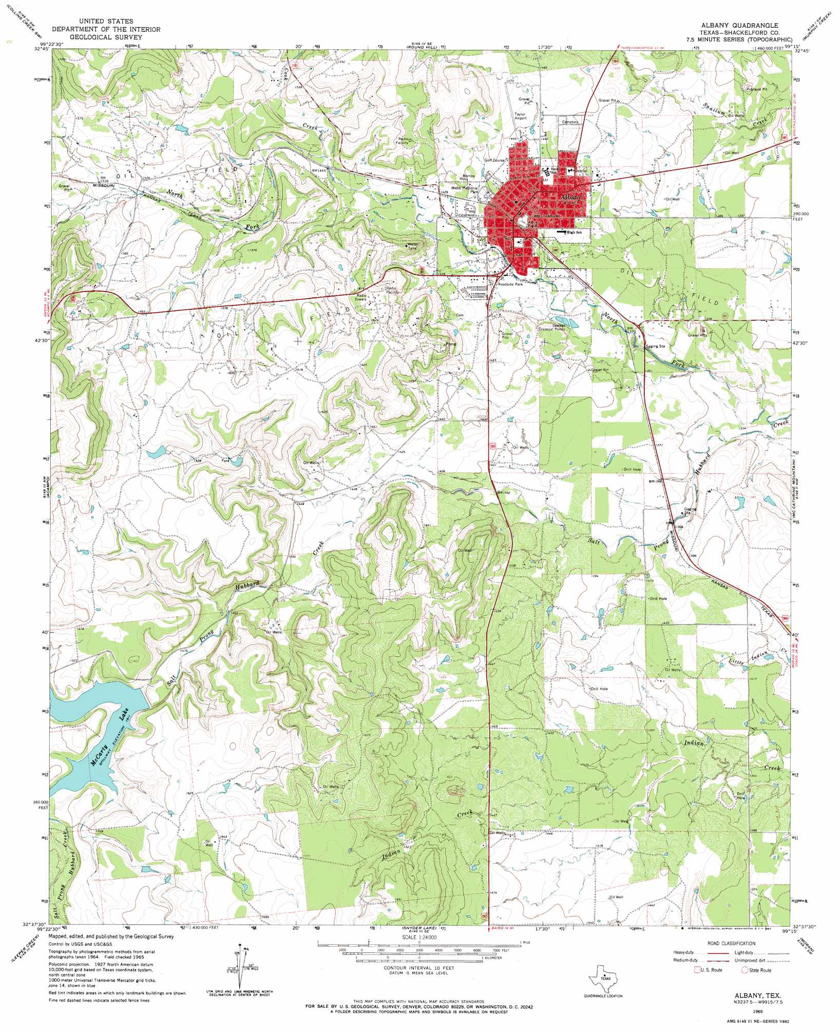
USGS Topo Quad 32099f3 - 1:24,000 scale
| Topo Map Name: | Albany |
| USGS Topo Quad ID: | 32099f3 |
| Print Size: | ca. 21 1/4" wide x 27" high |
| Southeast Coordinates: | 32.625° N latitude / 99.25° W longitude |
| Map Center Coordinates: | 32.6875° N latitude / 99.3125° W longitude |
| U.S. State: | TX |
| Filename: | o32099f3.jpg |
| Download Map JPG Image: | Albany topo map 1:24,000 scale |
| Map Type: | Topographic |
| Topo Series: | 7.5´ |
| Map Scale: | 1:24,000 |
| Source of Map Images: | United States Geological Survey (USGS) |
| Alternate Map Versions: |
Albany TX 1965, updated 1967 Download PDF Buy paper map Albany TX 2010 Download PDF Buy paper map Albany TX 2012 Download PDF Buy paper map Albany TX 2016 Download PDF Buy paper map |
1:24,000 Topo Quads surrounding Albany
Lueders Ne |
Antelope Hills |
Collins Creek |
Fort Griffin |
Lusk |
Lueders East |
Collins Creek Sw |
Round Hill |
Murphy Creek |
Edwards Branch |
Smokey Draw |
Acampo |
Albany |
Mccathrine Mountain |
Eolian |
Flattop |
Leeper Creek |
Snyder Lake |
Moran |
Indian Knoll |
Kirby Lake Ne |
Baird |
Jayell |
Putnam North |
Bernie Lake |
> Back to 32099e1 at 1:100,000 scale
> Back to 32098a1 at 1:250,000 scale
> Back to U.S. Topo Maps home
Albany topo map: Gazetteer
Albany: Airports
Albany Municipal Airport elevation 433m 1420′Taylor Airport elevation 448m 1469′
Albany: Dams
McCarty Lake Dam elevation 461m 1512′Albany: Parks
Webb Memorial Park elevation 436m 1430′Albany: Populated Places
Albany elevation 431m 1414′Albany: Reservoirs
McCarty Lake elevation 463m 1519′Albany: Streams
Cook Creek elevation 439m 1440′North Fork Salt Prong Hubbard Creek elevation 402m 1318′
Albany digital topo map on disk
Buy this Albany topo map showing relief, roads, GPS coordinates and other geographical features, as a high-resolution digital map file on DVD: