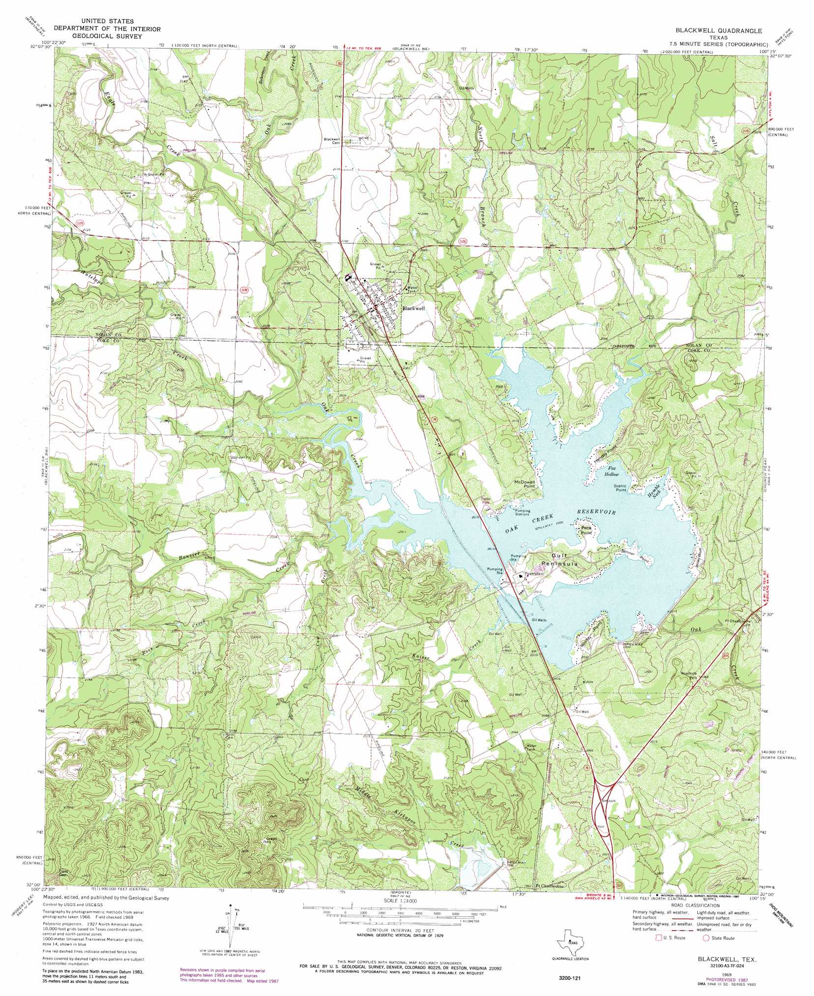
Blackwell Topo Map Texas
To zoom in, hover over the map of Blackwell
USGS Topo Quad 32100a3 - 1:24,000 scale
| Topo Map Name: | Blackwell |
| USGS Topo Quad ID: | 32100a3 |
| Print Size: | ca. 21 1/4" wide x 27" high |
| Southeast Coordinates: | 32° N latitude / 100.25° W longitude |
| Map Center Coordinates: | 32.0625° N latitude / 100.3125° W longitude |
| U.S. State: | TX |
| Filename: | o32100a3.jpg |
| Download Map JPG Image: | Blackwell topo map 1:24,000 scale |
| Map Type: | Topographic |
| Topo Series: | 7.5´ |
| Map Scale: | 1:24,000 |
| Source of Map Images: | United States Geological Survey (USGS) |
| Alternate Map Versions: |
Blackwell TX 1969, updated 1972 Download PDF Buy paper map Blackwell TX 1969, updated 1987 Download PDF Buy paper map Blackwell TX 2010 Download PDF Buy paper map Blackwell TX 2012 Download PDF Buy paper map Blackwell TX 2016 Download PDF Buy paper map |
1:24,000 Topo Quads surrounding Blackwell
Bench Mountain |
Lake Trammell |
Holder Creek |
Nolan |
Mountain Pass |
Dew Drop Creek |
Maryneal |
Blackwell Ne |
Hylton |
Shep |
Sanco |
Blackwell Sw |
Blackwell |
Church Peak |
Wingate |
Edith |
Robert Lee |
Bronte |
Hog Mountain |
Wilmeth |
Millican Mountains |
Cement Mountain |
Shawville |
Maverick |
Herring Ranch |
> Back to 32100a1 at 1:100,000 scale
> Back to 32100a1 at 1:250,000 scale
> Back to U.S. Topo Maps home
Blackwell topo map: Gazetteer
Blackwell: Bays
Fox Hollow elevation 610m 2001′Humble Neck elevation 610m 2001′
Blackwell: Capes
Bonner Point elevation 611m 2004′Gulf Peninsula elevation 621m 2037′
Hendry Point elevation 614m 2014′
McDowell Point elevation 616m 2020′
Pace Point elevation 613m 2011′
Rocky Point elevation 615m 2017′
Scenic Point elevation 616m 2020′
Blackwell: Cliffs
Wiley Bluff elevation 620m 2034′Blackwell: Dams
Oak Creek Dam elevation 595m 1952′Soil Conservation Service Site 4 Dam elevation 602m 1975′
Blackwell: Gaps
Coxs Gap elevation 724m 2375′Blackwell: Populated Places
Blackwell elevation 648m 2125′Fort Chadbourne elevation 598m 1961′
Blackwell: Reservoirs
Oak Creek Reservoir elevation 610m 2001′Soil Conservation Service Site 4 Reservoir elevation 602m 1975′
Blackwell: Streams
Antelope Creek elevation 615m 2017′Bouzier Creek elevation 610m 2001′
Cow Creek elevation 616m 2020′
Eagle Creek elevation 615m 2017′
Kaiser Creek elevation 614m 2014′
North Branch Oak Creek elevation 610m 2001′
Robertson Creek elevation 634m 2080′
Ross Creek elevation 621m 2037′
Salt Creek elevation 610m 2001′
Blackwell digital topo map on disk
Buy this Blackwell topo map showing relief, roads, GPS coordinates and other geographical features, as a high-resolution digital map file on DVD: