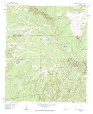
Dead Indian Mountain Topo Map Texas
To zoom in, hover over the map of Dead Indian Mountain
USGS Topo Quad 32100a7 - 1:24,000 scale
| Topo Map Name: | Dead Indian Mountain |
| USGS Topo Quad ID: | 32100a7 |
| Print Size: | ca. 21 1/4" wide x 27" high |
| Southeast Coordinates: | 32° N latitude / 100.75° W longitude |
| Map Center Coordinates: | 32.0625° N latitude / 100.8125° W longitude |
| U.S. State: | TX |
| Filename: | o32100a7.jpg |
| Download Map JPG Image: | Dead Indian Mountain topo map 1:24,000 scale |
| Map Type: | Topographic |
| Topo Series: | 7.5´ |
| Map Scale: | 1:24,000 |
| Source of Map Images: | United States Geological Survey (USGS) |
| Alternate Map Versions: |
Dead Indian Mountain TX 1959, updated 1960 Download PDF Buy paper map Dead Indian Mountain TX 2010 Download PDF Buy paper map Dead Indian Mountain TX 2012 Download PDF Buy paper map Dead Indian Mountain TX 2016 Download PDF Buy paper map |
1:24,000 Topo Quads surrounding Dead Indian Mountain
> Back to 32100a1 at 1:100,000 scale
> Back to 32100a1 at 1:250,000 scale
> Back to U.S. Topo Maps home
Dead Indian Mountain topo map: Gazetteer
Dead Indian Mountain: Dams
Nan Hatty Tank Dam elevation 614m 2014′Dead Indian Mountain: Oilfields
Jameson Oil Field elevation 599m 1965′Dead Indian Mountain: Reservoirs
Catclaw Tank elevation 653m 2142′Cedar Tank elevation 674m 2211′
County Line Tank elevation 665m 2181′
Double Tanks elevation 651m 2135′
East Trap Tank elevation 680m 2230′
Gasconades Tank elevation 639m 2096′
Harvey Martin Tank elevation 653m 2142′
Helfer Creek Tank elevation 611m 2004′
Nan Hatty Tank elevation 616m 2020′
North Tank elevation 642m 2106′
Old McWhorter Tank elevation 669m 2194′
Powell Tank elevation 647m 2122′
Pyramid Tank elevation 604m 1981′
Scudday Tank elevation 663m 2175′
Shinney Tank elevation 635m 2083′
Snake Mountain Tank elevation 621m 2037′
Southeast Antelope Tank elevation 662m 2171′
Southwest Peter Lake Tank elevation 658m 2158′
Walnut Creek Tank elevation 616m 2020′
Dead Indian Mountain: Streams
Gasconades Creek elevation 581m 1906′Heifer Creek elevation 585m 1919′
North Gasconades Creek elevation 604m 1981′
South Gasconades Creek elevation 604m 1981′
Dead Indian Mountain: Summits
Dead Indian Mountain elevation 639m 2096′Snake Mountain elevation 675m 2214′
Wilson Mountain elevation 647m 2122′
Dead Indian Mountain: Valleys
Westfall Draw elevation 594m 1948′Dead Indian Mountain digital topo map on disk
Buy this Dead Indian Mountain topo map showing relief, roads, GPS coordinates and other geographical features, as a high-resolution digital map file on DVD:


