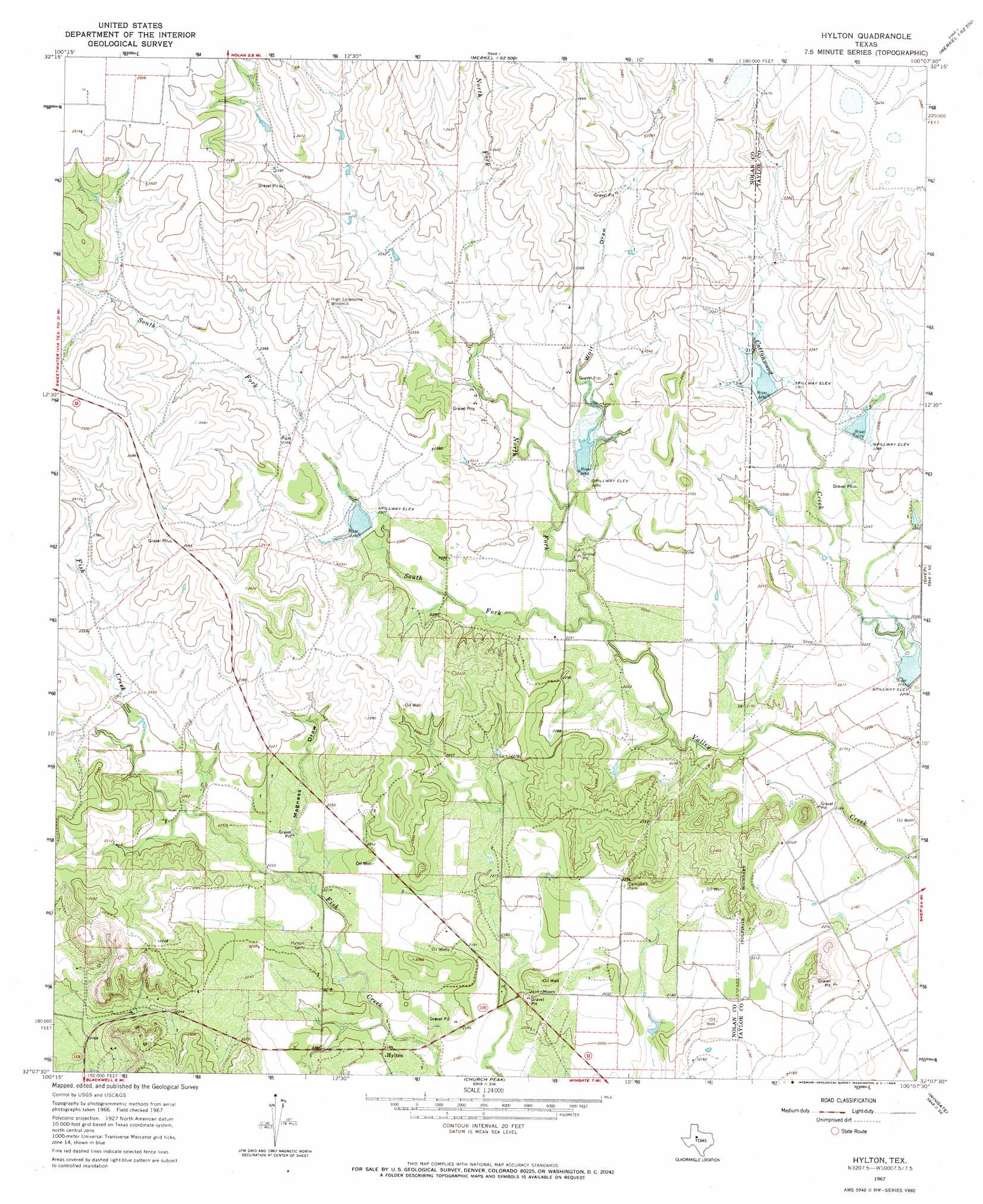
Hylton Topo Map Texas
To zoom in, hover over the map of Hylton
USGS Topo Quad 32100b2 - 1:24,000 scale
| Topo Map Name: | Hylton |
| USGS Topo Quad ID: | 32100b2 |
| Print Size: | ca. 21 1/4" wide x 27" high |
| Southeast Coordinates: | 32.125° N latitude / 100.125° W longitude |
| Map Center Coordinates: | 32.1875° N latitude / 100.1875° W longitude |
| U.S. State: | TX |
| Filename: | o32100b2.jpg |
| Download Map JPG Image: | Hylton topo map 1:24,000 scale |
| Map Type: | Topographic |
| Topo Series: | 7.5´ |
| Map Scale: | 1:24,000 |
| Source of Map Images: | United States Geological Survey (USGS) |
| Alternate Map Versions: |
Hylton TX 1967, updated 1969 Download PDF Buy paper map Hylton TX 2010 Download PDF Buy paper map Hylton TX 2012 Download PDF Buy paper map Hylton TX 2016 Download PDF Buy paper map |
1:24,000 Topo Quads surrounding Hylton
Sweetwater |
Lake Sweetwater |
Chalk Peak |
Merkel West |
Merkel East |
Lake Trammell |
Holder Creek |
Nolan |
Mountain Pass |
View |
Maryneal |
Blackwell Ne |
Hylton |
Shep |
Lake Abilene |
Blackwell Sw |
Blackwell |
Church Peak |
Wingate |
Bradshaw |
Robert Lee |
Bronte |
Hog Mountain |
Wilmeth |
Winters |
> Back to 32100a1 at 1:100,000 scale
> Back to 32100a1 at 1:250,000 scale
> Back to U.S. Topo Maps home
Hylton topo map: Gazetteer
Hylton: Airports
Flying W Airport elevation 684m 2244′Hylton: Dams
Soil Conservation Service Site 4a Dam elevation 697m 2286′Soil Conservation Service Site 5 Dam elevation 689m 2260′
Soil Conservation Service Site 6 Dam elevation 694m 2276′
Soil Conservation Service Site 7 Dam elevation 706m 2316′
Soil Conservation Service Site 8 Dam elevation 694m 2276′
Soil Conservation Service Site 9 Dam elevation 670m 2198′
Hylton: Populated Places
Hylton elevation 667m 2188′Hylton: Reservoirs
Soil Conservation Service Site 4a Reservoir elevation 697m 2286′Soil Conservation Service Site 5 Reservoir elevation 689m 2260′
Soil Conservation Service Site 6 Reservoir elevation 694m 2276′
Soil Conservation Service Site 7 Reservoir elevation 706m 2316′
Soil Conservation Service Site 8 Reservoir elevation 694m 2276′
Soil Conservation Service Site 9 Reservoir elevation 670m 2198′
Hylton: Streams
North Fork Valley Creek elevation 677m 2221′South Fork Valley Creek elevation 677m 2221′
Hylton: Valleys
Magness Draw elevation 676m 2217′Wolf Draw elevation 694m 2276′
Hylton digital topo map on disk
Buy this Hylton topo map showing relief, roads, GPS coordinates and other geographical features, as a high-resolution digital map file on DVD: