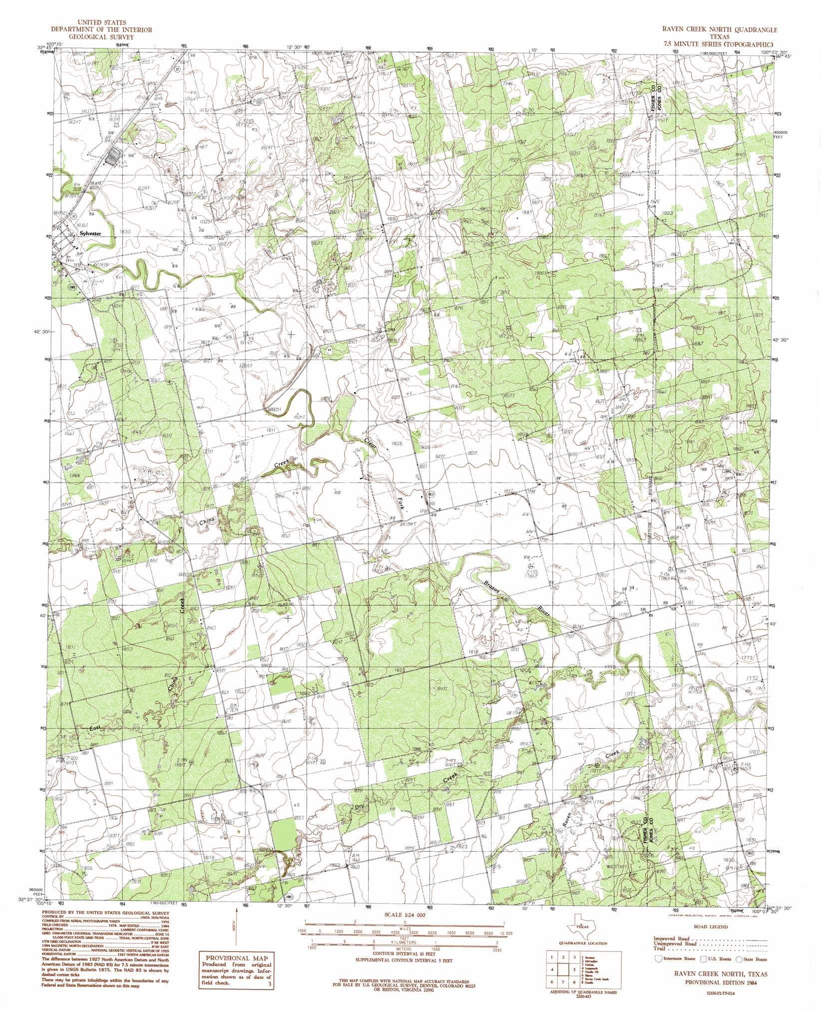
Raven Creek North Topo Map Texas
To zoom in, hover over the map of Raven Creek North
USGS Topo Quad 32100f2 - 1:24,000 scale
| Topo Map Name: | Raven Creek North |
| USGS Topo Quad ID: | 32100f2 |
| Print Size: | ca. 21 1/4" wide x 27" high |
| Southeast Coordinates: | 32.625° N latitude / 100.125° W longitude |
| Map Center Coordinates: | 32.6875° N latitude / 100.1875° W longitude |
| U.S. State: | TX |
| Filename: | o32100f2.jpg |
| Download Map JPG Image: | Raven Creek North topo map 1:24,000 scale |
| Map Type: | Topographic |
| Topo Series: | 7.5´ |
| Map Scale: | 1:24,000 |
| Source of Map Images: | United States Geological Survey (USGS) |
| Alternate Map Versions: |
Raven Creek North TX 1984, updated 1984 Download PDF Buy paper map Raven Creek North TX 1984, updated 1992 Download PDF Buy paper map Raven Creek North TX 2010 Download PDF Buy paper map Raven Creek North TX 2012 Download PDF Buy paper map Raven Creek North TX 2016 Download PDF Buy paper map |
1:24,000 Topo Quads surrounding Raven Creek North
White Canyon |
Poke Mountain |
Hamlin Nw |
Hamlin Ne |
Tuxedo |
Rotan |
Royston |
Mccaulley |
Neinda |
Anson |
Roby |
Longworth |
Raven Creek North |
Noodle Ne |
Truby |
Busby |
Eskota |
Raven Creek South |
Noodle |
Stith |
Sweetwater |
Lake Sweetwater |
Chalk Peak |
Merkel West |
Merkel East |
> Back to 32100e1 at 1:100,000 scale
> Back to 32100a1 at 1:250,000 scale
> Back to U.S. Topo Maps home
Raven Creek North topo map: Gazetteer
Raven Creek North: Streams
China Creek elevation 547m 1794′Dry Creek elevation 540m 1771′
East China Creek elevation 553m 1814′
Raven Creek elevation 540m 1771′
Raven Creek North digital topo map on disk
Buy this Raven Creek North topo map showing relief, roads, GPS coordinates and other geographical features, as a high-resolution digital map file on DVD: