Bull Creek Topo Map Texas
To zoom in, hover over the map of Bull Creek
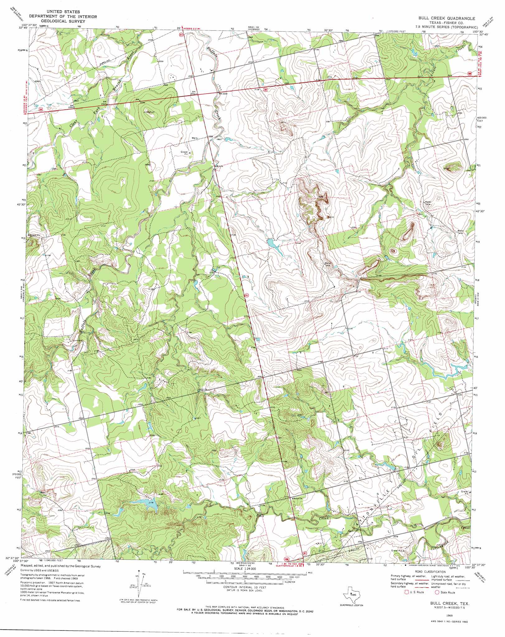
USGS Topo Quad 32100f5 - 1:24,000 scale
| Topo Map Name: | Bull Creek |
| USGS Topo Quad ID: | 32100f5 |
| Print Size: | ca. 21 1/4" wide x 27" high |
| Southeast Coordinates: | 32.625° N latitude / 100.5° W longitude |
| Map Center Coordinates: | 32.6875° N latitude / 100.5625° W longitude |
| U.S. State: | TX |
| Filename: | o32100f5.jpg |
| Download Map JPG Image: | Bull Creek topo map 1:24,000 scale |
| Map Type: | Topographic |
| Topo Series: | 7.5´ |
| Map Scale: | 1:24,000 |
| Source of Map Images: | United States Geological Survey (USGS) |
| Alternate Map Versions: |
Bull Creek TX 1969, updated 1972 Download PDF Buy paper map Bull Creek TX 2010 Download PDF Buy paper map Bull Creek TX 2012 Download PDF Buy paper map Bull Creek TX 2016 Download PDF Buy paper map |
1:24,000 Topo Quads surrounding Bull Creek
Maverick Creek |
Hudd |
Tige Canyon |
White Canyon |
Poke Mountain |
Lloyd Mountain |
Camp Springs |
Hobbs |
Rotan |
Royston |
Hermleigh |
Inadale Nw |
Bull Creek |
Roby |
Longworth |
China Grove |
Inadale |
Bernecker |
Busby |
Eskota |
Colorado City |
Loraine |
Roscoe |
Sweetwater |
Lake Sweetwater |
> Back to 32100e1 at 1:100,000 scale
> Back to 32100a1 at 1:250,000 scale
> Back to U.S. Topo Maps home
Bull Creek topo map: Gazetteer
Bull Creek: Dams
Davenport Lake Dam elevation 663m 2175′Gober Lake Dam elevation 634m 2080′
Bull Creek: Reservoirs
Davenport Lake elevation 663m 2175′Gober Lake elevation 634m 2080′
Bull Creek: Streams
Bull Creek elevation 625m 2050′Bull Creek digital topo map on disk
Buy this Bull Creek topo map showing relief, roads, GPS coordinates and other geographical features, as a high-resolution digital map file on DVD: