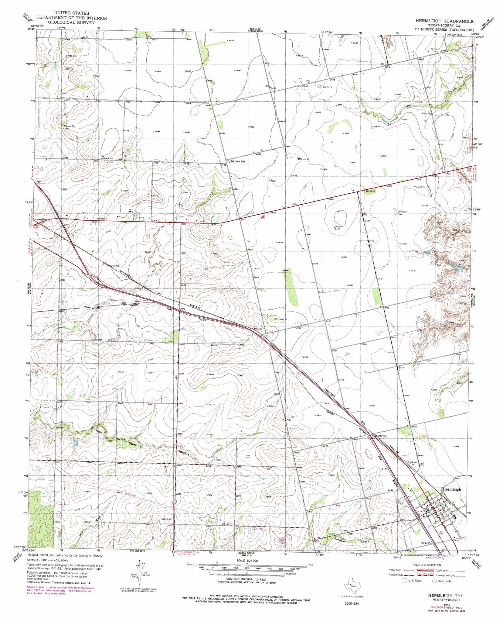
Hermleigh Topo Map Texas
To zoom in, hover over the map of Hermleigh
USGS Topo Quad 32100f7 - 1:24,000 scale
| Topo Map Name: | Hermleigh |
| USGS Topo Quad ID: | 32100f7 |
| Print Size: | ca. 21 1/4" wide x 27" high |
| Southeast Coordinates: | 32.625° N latitude / 100.75° W longitude |
| Map Center Coordinates: | 32.6875° N latitude / 100.8125° W longitude |
| U.S. State: | TX |
| Filename: | o32100f7.jpg |
| Download Map JPG Image: | Hermleigh topo map 1:24,000 scale |
| Map Type: | Topographic |
| Topo Series: | 7.5´ |
| Map Scale: | 1:24,000 |
| Source of Map Images: | United States Geological Survey (USGS) |
| Alternate Map Versions: |
Hermleigh TX 1952, updated 1953 Download PDF Buy paper map Hermleigh TX 1952, updated 1979 Download PDF Buy paper map Hermleigh TX 2010 Download PDF Buy paper map Hermleigh TX 2012 Download PDF Buy paper map Hermleigh TX 2016 Download PDF Buy paper map |
1:24,000 Topo Quads surrounding Hermleigh
Flat Top Mountain |
Mckenzie Mountains |
Maverick Creek |
Hudd |
Tige Canyon |
Dermott |
Brand |
Lloyd Mountain |
Camp Springs |
Hobbs |
Ira Ne |
Snyder |
Hermleigh |
Inadale Nw |
Bull Creek |
Ira |
Dunn |
China Grove |
Inadale |
Bernecker |
Cuthbert |
Cedar Bend |
Colorado City |
Loraine |
Roscoe |
> Back to 32100e1 at 1:100,000 scale
> Back to 32100a1 at 1:250,000 scale
> Back to U.S. Topo Maps home
Hermleigh digital topo map on disk
Buy this Hermleigh topo map showing relief, roads, GPS coordinates and other geographical features, as a high-resolution digital map file on DVD: