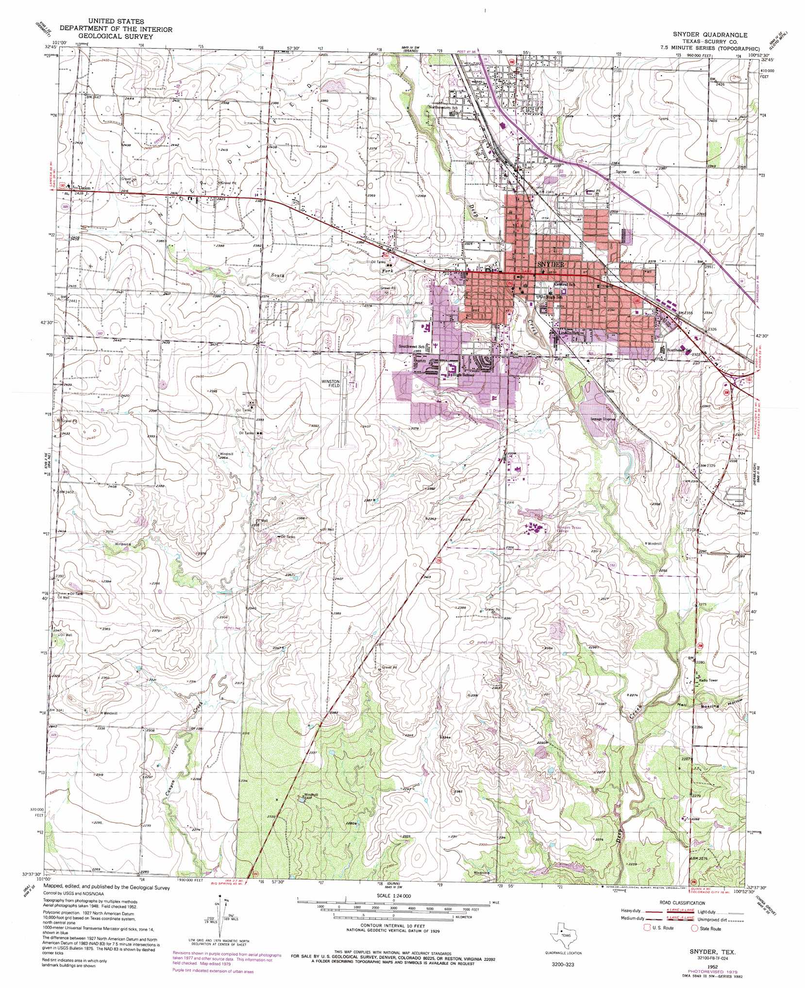
Snyder Topo Map Texas
To zoom in, hover over the map of Snyder
USGS Topo Quad 32100f8 - 1:24,000 scale
| Topo Map Name: | Snyder |
| USGS Topo Quad ID: | 32100f8 |
| Print Size: | ca. 21 1/4" wide x 27" high |
| Southeast Coordinates: | 32.625° N latitude / 100.875° W longitude |
| Map Center Coordinates: | 32.6875° N latitude / 100.9375° W longitude |
| U.S. State: | TX |
| Filename: | o32100f8.jpg |
| Download Map JPG Image: | Snyder topo map 1:24,000 scale |
| Map Type: | Topographic |
| Topo Series: | 7.5´ |
| Map Scale: | 1:24,000 |
| Source of Map Images: | United States Geological Survey (USGS) |
| Alternate Map Versions: |
Snyder TX 1952, updated 1953 Download PDF Buy paper map Snyder TX 1952, updated 1980 Download PDF Buy paper map Snyder TX 1952, updated 1991 Download PDF Buy paper map Snyder TX 2010 Download PDF Buy paper map Snyder TX 2012 Download PDF Buy paper map Snyder TX 2016 Download PDF Buy paper map |
1:24,000 Topo Quads surrounding Snyder
Fluvanna |
Flat Top Mountain |
Mckenzie Mountains |
Maverick Creek |
Hudd |
Arah |
Dermott |
Brand |
Lloyd Mountain |
Camp Springs |
Ira Nw |
Ira Ne |
Snyder |
Hermleigh |
Inadale Nw |
Ira Sw |
Ira |
Dunn |
China Grove |
Inadale |
Vincent |
Cuthbert |
Cedar Bend |
Colorado City |
Loraine |
> Back to 32100e1 at 1:100,000 scale
> Back to 32100a1 at 1:250,000 scale
> Back to U.S. Topo Maps home
Snyder topo map: Gazetteer
Snyder: Airports
Winston Field elevation 735m 2411′Snyder: Parks
North East Park elevation 710m 2329′Tiger Stadium elevation 725m 2378′
Winston Park elevation 702m 2303′
Snyder: Populated Places
Snyder elevation 707m 2319′Union elevation 741m 2431′
Snyder: Streams
South Fork Deep Creek elevation 705m 2312′Snyder: Valleys
Hell Roaring Hollow elevation 686m 2250′Snyder digital topo map on disk
Buy this Snyder topo map showing relief, roads, GPS coordinates and other geographical features, as a high-resolution digital map file on DVD: