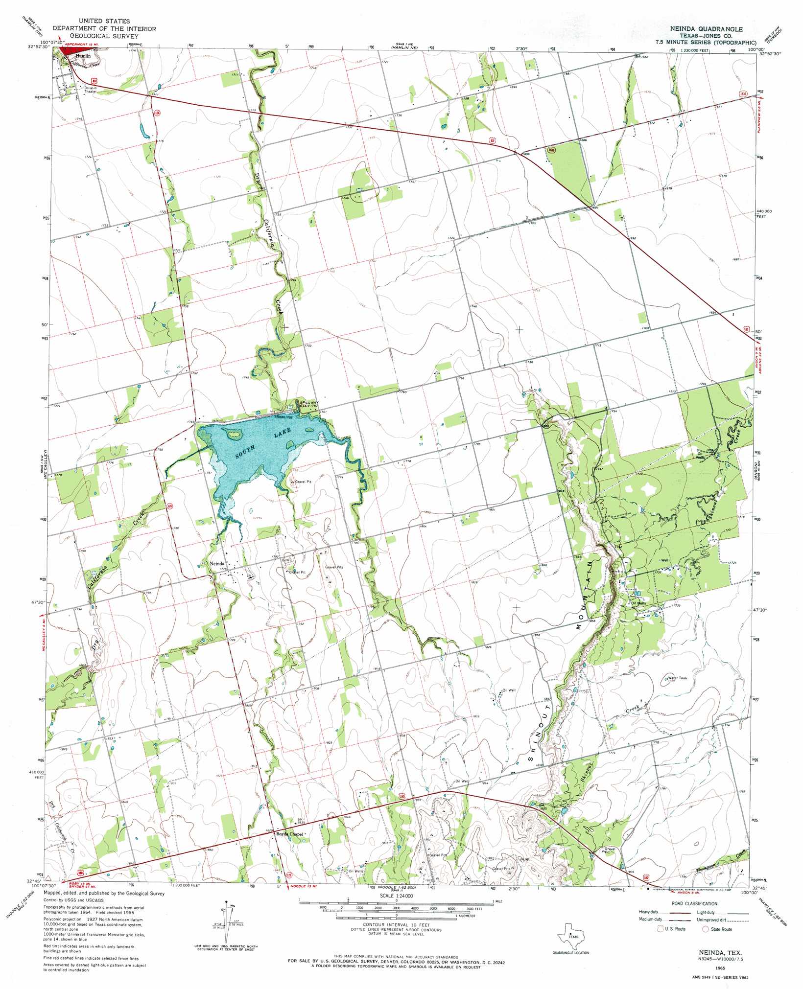
Neinda Topo Map Texas
To zoom in, hover over the map of Neinda
USGS Topo Quad 32100g1 - 1:24,000 scale
| Topo Map Name: | Neinda |
| USGS Topo Quad ID: | 32100g1 |
| Print Size: | ca. 21 1/4" wide x 27" high |
| Southeast Coordinates: | 32.75° N latitude / 100° W longitude |
| Map Center Coordinates: | 32.8125° N latitude / 100.0625° W longitude |
| U.S. State: | TX |
| Filename: | o32100g1.jpg |
| Download Map JPG Image: | Neinda topo map 1:24,000 scale |
| Map Type: | Topographic |
| Topo Series: | 7.5´ |
| Map Scale: | 1:24,000 |
| Source of Map Images: | United States Geological Survey (USGS) |
| Alternate Map Versions: |
Neinda TX 1965, updated 1967 Download PDF Buy paper map Neinda TX 2010 Download PDF Buy paper map Neinda TX 2012 Download PDF Buy paper map Neinda TX 2016 Download PDF Buy paper map |
1:24,000 Topo Quads surrounding Neinda
Coon Hollow |
Aspermont Lake |
Frog Mountain |
Sagerton |
Dudleys Creek |
Poke Mountain |
Hamlin Nw |
Hamlin Ne |
Tuxedo |
Stamford |
Royston |
Mccaulley |
Neinda |
Anson |
Funston |
Longworth |
Raven Creek North |
Noodle Ne |
Truby |
Hawley Ne |
Eskota |
Raven Creek South |
Noodle |
Stith |
Hawley |
> Back to 32100e1 at 1:100,000 scale
> Back to 32100a1 at 1:250,000 scale
> Back to U.S. Topo Maps home
Neinda topo map: Gazetteer
Neinda: Dams
South Lake Dam elevation 536m 1758′Neinda: Populated Places
Neinda elevation 542m 1778′Neinda: Reservoirs
South Lake elevation 533m 1748′Neinda: Summits
Skinout Mountain elevation 571m 1873′Neinda digital topo map on disk
Buy this Neinda topo map showing relief, roads, GPS coordinates and other geographical features, as a high-resolution digital map file on DVD: