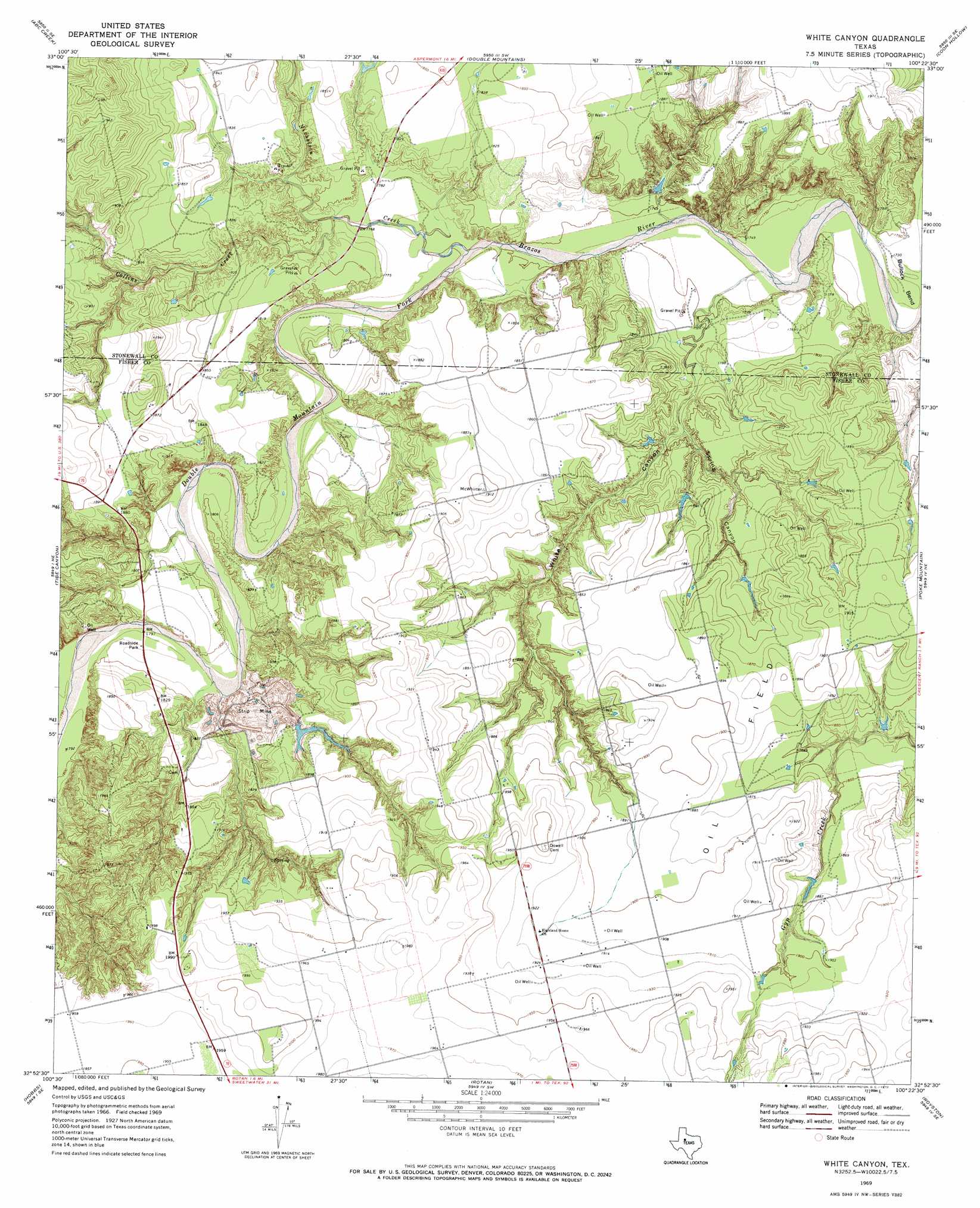
White Canyon Topo Map Texas
To zoom in, hover over the map of White Canyon
USGS Topo Quad 32100h4 - 1:24,000 scale
| Topo Map Name: | White Canyon |
| USGS Topo Quad ID: | 32100h4 |
| Print Size: | ca. 21 1/4" wide x 27" high |
| Southeast Coordinates: | 32.875° N latitude / 100.375° W longitude |
| Map Center Coordinates: | 32.9375° N latitude / 100.4375° W longitude |
| U.S. State: | TX |
| Filename: | o32100h4.jpg |
| Download Map JPG Image: | White Canyon topo map 1:24,000 scale |
| Map Type: | Topographic |
| Topo Series: | 7.5´ |
| Map Scale: | 1:24,000 |
| Source of Map Images: | United States Geological Survey (USGS) |
| Alternate Map Versions: |
White Canyon TX 1969, updated 1972 Download PDF Buy paper map White Canyon TX 2010 Download PDF Buy paper map White Canyon TX 2012 Download PDF Buy paper map White Canyon TX 2016 Download PDF Buy paper map |
1:24,000 Topo Quads surrounding White Canyon
Clairemont East |
Jayton South |
Peacock |
Swenson |
Aspermont |
Gant Hills |
A B C Creek |
Double Mountains |
Coon Hollow |
Aspermont Lake |
Hudd |
Tige Canyon |
White Canyon |
Poke Mountain |
Hamlin Nw |
Camp Springs |
Hobbs |
Rotan |
Royston |
Mccaulley |
Inadale Nw |
Bull Creek |
Roby |
Longworth |
Raven Creek North |
> Back to 32100e1 at 1:100,000 scale
> Back to 32100a1 at 1:250,000 scale
> Back to U.S. Topo Maps home
White Canyon topo map: Gazetteer
White Canyon: Bends
Bullock Bend elevation 527m 1729′White Canyon: Streams
Collins Creek elevation 539m 1768′Nicholson Creek elevation 531m 1742′
White Canyon: Valleys
Spring Canyon elevation 542m 1778′White Canyon elevation 531m 1742′
White Canyon digital topo map on disk
Buy this White Canyon topo map showing relief, roads, GPS coordinates and other geographical features, as a high-resolution digital map file on DVD: