Tige Canyon Topo Map Texas
To zoom in, hover over the map of Tige Canyon
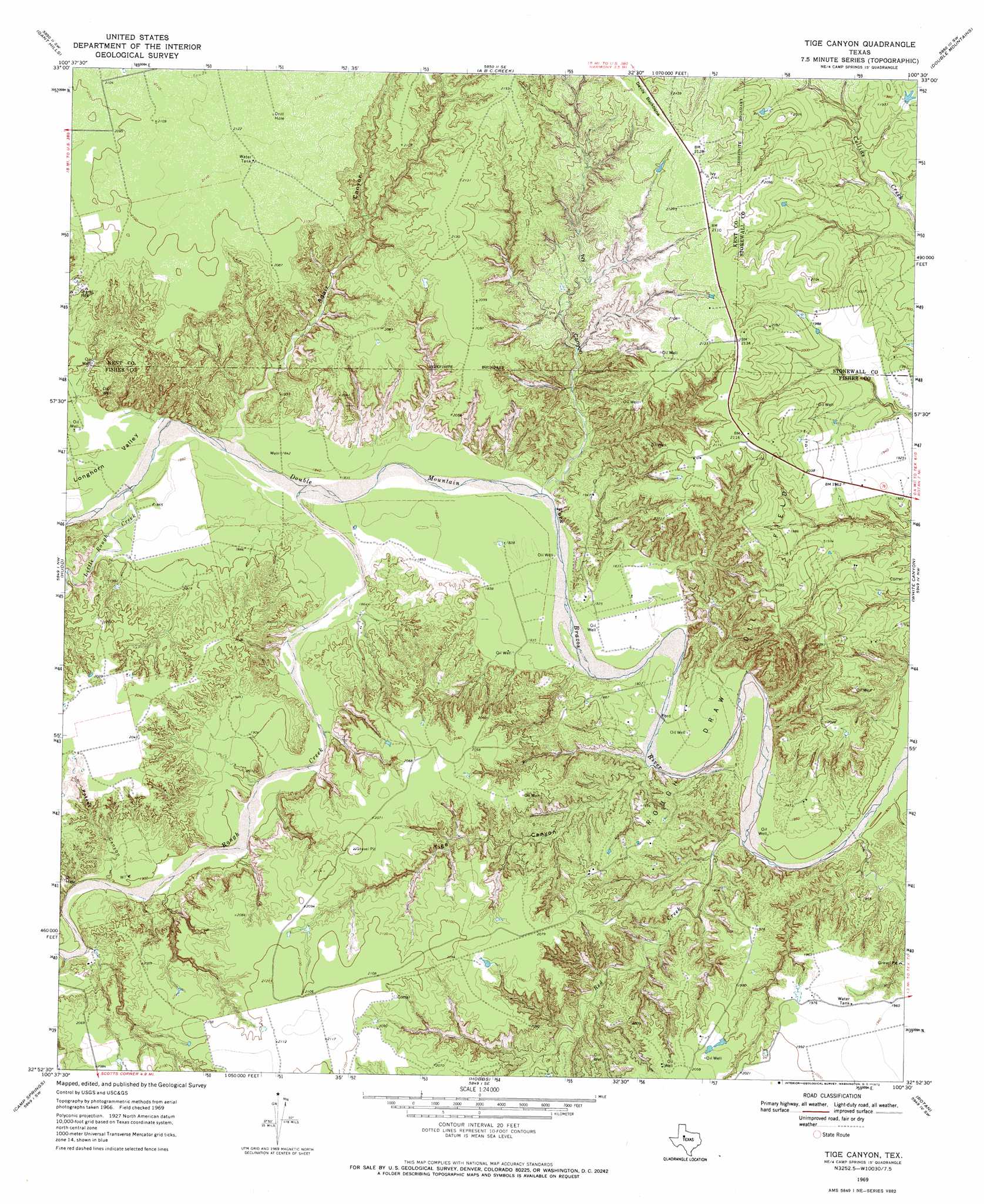
USGS Topo Quad 32100h5 - 1:24,000 scale
| Topo Map Name: | Tige Canyon |
| USGS Topo Quad ID: | 32100h5 |
| Print Size: | ca. 21 1/4" wide x 27" high |
| Southeast Coordinates: | 32.875° N latitude / 100.5° W longitude |
| Map Center Coordinates: | 32.9375° N latitude / 100.5625° W longitude |
| U.S. State: | TX |
| Filename: | o32100h5.jpg |
| Download Map JPG Image: | Tige Canyon topo map 1:24,000 scale |
| Map Type: | Topographic |
| Topo Series: | 7.5´ |
| Map Scale: | 1:24,000 |
| Source of Map Images: | United States Geological Survey (USGS) |
| Alternate Map Versions: |
Tige Canyon TX 1969, updated 1972 Download PDF Buy paper map Tige Canyon TX 2010 Download PDF Buy paper map Tige Canyon TX 2012 Download PDF Buy paper map Tige Canyon TX 2016 Download PDF Buy paper map |
1:24,000 Topo Quads surrounding Tige Canyon
Clairemont West |
Clairemont East |
Jayton South |
Peacock |
Swenson |
Cooper Mountain |
Gant Hills |
A B C Creek |
Double Mountains |
Coon Hollow |
Maverick Creek |
Hudd |
Tige Canyon |
White Canyon |
Poke Mountain |
Lloyd Mountain |
Camp Springs |
Hobbs |
Rotan |
Royston |
Hermleigh |
Inadale Nw |
Bull Creek |
Roby |
Longworth |
> Back to 32100e1 at 1:100,000 scale
> Back to 32100a1 at 1:250,000 scale
> Back to U.S. Topo Maps home
Tige Canyon topo map: Gazetteer
Tige Canyon: Oilfields
Rough Draw Oil Field elevation 552m 1811′Tige Canyon: Streams
Little Rough Creek elevation 564m 1850′Red Creek elevation 549m 1801′
Rough Creek elevation 560m 1837′
Tige Canyon: Valleys
Adair Canyon elevation 564m 1850′Ivy Canyon elevation 561m 1840′
Longhorn Valley elevation 561m 1840′
Poteet Canyon elevation 577m 1893′
Tige Canyon elevation 551m 1807′
Tige Canyon digital topo map on disk
Buy this Tige Canyon topo map showing relief, roads, GPS coordinates and other geographical features, as a high-resolution digital map file on DVD: