Big Spring North Topo Map Texas
To zoom in, hover over the map of Big Spring North
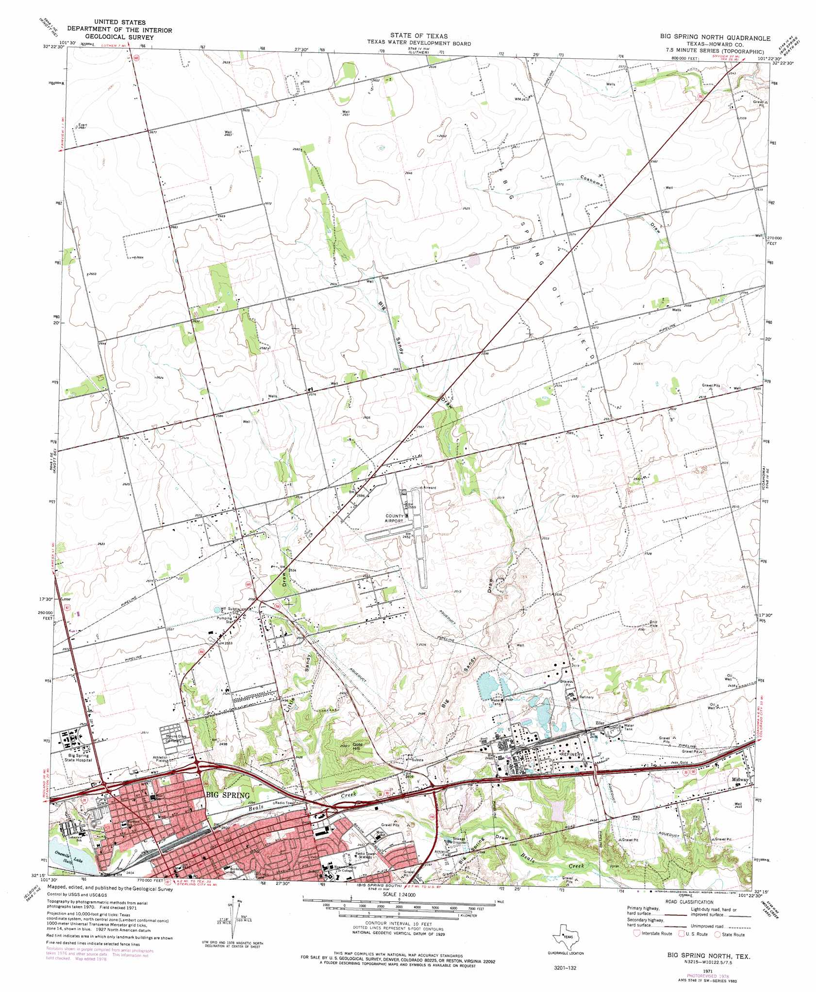
USGS Topo Quad 32101c4 - 1:24,000 scale
| Topo Map Name: | Big Spring North |
| USGS Topo Quad ID: | 32101c4 |
| Print Size: | ca. 21 1/4" wide x 27" high |
| Southeast Coordinates: | 32.25° N latitude / 101.375° W longitude |
| Map Center Coordinates: | 32.3125° N latitude / 101.4375° W longitude |
| U.S. State: | TX |
| Filename: | o32101c4.jpg |
| Download Map JPG Image: | Big Spring North topo map 1:24,000 scale |
| Map Type: | Topographic |
| Topo Series: | 7.5´ |
| Map Scale: | 1:24,000 |
| Source of Map Images: | United States Geological Survey (USGS) |
| Alternate Map Versions: |
Big Spring North TX 1954, updated 1976 Download PDF Buy paper map Big Spring North TX 1965 Download PDF Buy paper map Big Spring North TX 2010 Download PDF Buy paper map Big Spring North TX 2012 Download PDF Buy paper map Big Spring North TX 2016 Download PDF Buy paper map |
1:24,000 Topo Quads surrounding Big Spring North
Ackerly |
Vealmoor |
Gunsight Draw |
Gunsight Draw Se |
Ira Sw |
Knott |
Knott Ne |
Luther |
Big Spring North Ne |
Vincent |
Knott Sw |
Knott Se |
Big Spring North |
Coahoma |
Iatan |
Natural Dam Lake |
Elbow |
Big Spring South |
Moss Creek Lake |
Hyman |
Houston Ranch |
Lucian Wells Ranch |
Lees |
Forsan |
Hayrick Mountain |
> Back to 32101a1 at 1:100,000 scale
> Back to 32100a1 at 1:250,000 scale
> Back to U.S. Topo Maps home
Big Spring North topo map: Gazetteer
Big Spring North: Dams
Refinery Dam elevation 732m 2401′Big Spring North: Lakes
Onemile Lake elevation 733m 2404′Big Spring North: Oilfields
Big Spring Oil Field elevation 788m 2585′Big Spring North: Populated Places
Big Spring elevation 744m 2440′Ziler elevation 756m 2480′
Big Spring North: Reservoirs
Refinery Lake elevation 732m 2401′Big Spring North: Summits
Gold Hill elevation 769m 2522′Big Spring North: Valleys
Big Sandy Draw elevation 735m 2411′Big Spring Draw elevation 723m 2372′
Little Sandy Draw elevation 737m 2417′
Big Spring North digital topo map on disk
Buy this Big Spring North topo map showing relief, roads, GPS coordinates and other geographical features, as a high-resolution digital map file on DVD: