Big Spring North Ne Topo Map Texas
To zoom in, hover over the map of Big Spring North Ne
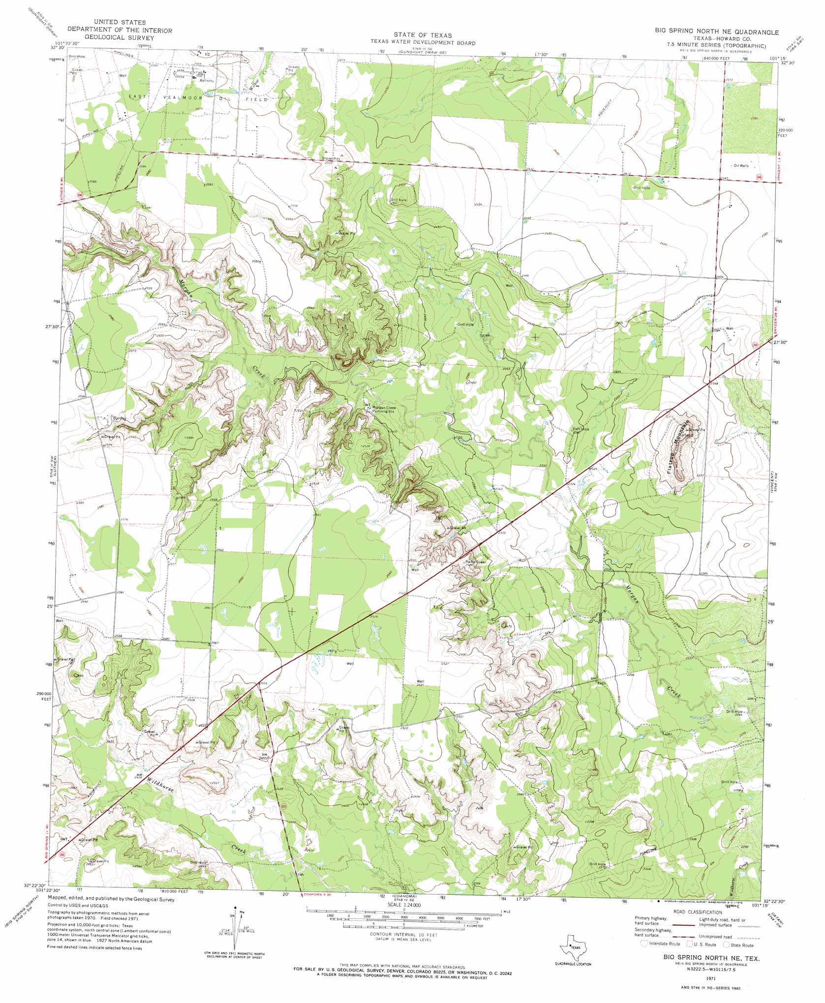
USGS Topo Quad 32101d3 - 1:24,000 scale
| Topo Map Name: | Big Spring North Ne |
| USGS Topo Quad ID: | 32101d3 |
| Print Size: | ca. 21 1/4" wide x 27" high |
| Southeast Coordinates: | 32.375° N latitude / 101.25° W longitude |
| Map Center Coordinates: | 32.4375° N latitude / 101.3125° W longitude |
| U.S. State: | TX |
| Filename: | o32101d3.jpg |
| Download Map JPG Image: | Big Spring North Ne topo map 1:24,000 scale |
| Map Type: | Topographic |
| Topo Series: | 7.5´ |
| Map Scale: | 1:24,000 |
| Source of Map Images: | United States Geological Survey (USGS) |
| Alternate Map Versions: |
Big Spring North NE TX 1954, updated 1984 Download PDF Buy paper map Big Spring North NE TX 2010 Download PDF Buy paper map Big Spring North NE TX 2012 Download PDF Buy paper map Big Spring North NE TX 2016 Download PDF Buy paper map |
1:24,000 Topo Quads surrounding Big Spring North Ne
Long Draw |
Mushaway Peak |
Gunsight Draw Ne |
Ira Nw |
Ira Ne |
Vealmoor |
Gunsight Draw |
Gunsight Draw Se |
Ira Sw |
Ira |
Knott Ne |
Luther |
Big Spring North Ne |
Vincent |
Cuthbert |
Knott Se |
Big Spring North |
Coahoma |
Iatan |
Westbrook |
Elbow |
Big Spring South |
Moss Creek Lake |
Hyman |
Hyman Ne |
> Back to 32101a1 at 1:100,000 scale
> Back to 32100a1 at 1:250,000 scale
> Back to U.S. Topo Maps home
Big Spring North Ne topo map: Gazetteer
Big Spring North Ne: Summits
Flattop Mountain elevation 765m 2509′Big Spring North Ne digital topo map on disk
Buy this Big Spring North Ne topo map showing relief, roads, GPS coordinates and other geographical features, as a high-resolution digital map file on DVD: