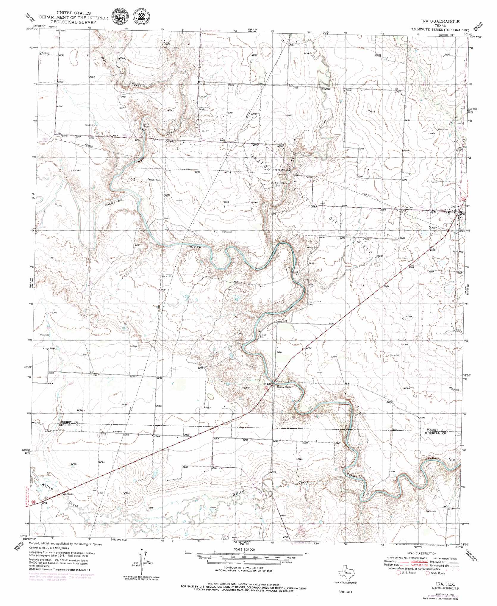
Ira Topo Map Texas
To zoom in, hover over the map of Ira
USGS Topo Quad 32101e1 - 1:24,000 scale
| Topo Map Name: | Ira |
| USGS Topo Quad ID: | 32101e1 |
| Print Size: | ca. 21 1/4" wide x 27" high |
| Southeast Coordinates: | 32.5° N latitude / 101° W longitude |
| Map Center Coordinates: | 32.5625° N latitude / 101.0625° W longitude |
| U.S. State: | TX |
| Filename: | o32101e1.jpg |
| Download Map JPG Image: | Ira topo map 1:24,000 scale |
| Map Type: | Topographic |
| Topo Series: | 7.5´ |
| Map Scale: | 1:24,000 |
| Source of Map Images: | United States Geological Survey (USGS) |
| Alternate Map Versions: |
Ira TX 1951 Download PDF Buy paper map Ira TX 1951, updated 1979 Download PDF Buy paper map Ira TX 2010 Download PDF Buy paper map Ira TX 2012 Download PDF Buy paper map Ira TX 2016 Download PDF Buy paper map |
1:24,000 Topo Quads surrounding Ira
Fivemile Creek |
Arah |
Dermott |
Brand |
Lloyd Mountain |
Gunsight Draw Ne |
Ira Nw |
Ira Ne |
Snyder |
Hermleigh |
Gunsight Draw Se |
Ira Sw |
Ira |
Dunn |
China Grove |
Big Spring North Ne |
Vincent |
Cuthbert |
Cedar Bend |
Colorado City |
Coahoma |
Iatan |
Westbrook |
Lake Colorado City |
Colorado City Se |
> Back to 32101e1 at 1:100,000 scale
> Back to 32100a1 at 1:250,000 scale
> Back to U.S. Topo Maps home
Ira topo map: Gazetteer
Ira: Populated Places
Ira elevation 692m 2270′Ira: Streams
Bluff Creek elevation 656m 2152′Bull Creek elevation 660m 2165′
Willow Creek elevation 643m 2109′
Ira: Valleys
Cedar Canyon elevation 651m 2135′Ira digital topo map on disk
Buy this Ira topo map showing relief, roads, GPS coordinates and other geographical features, as a high-resolution digital map file on DVD: