Holloway Canyon Topo Map Texas
To zoom in, hover over the map of Holloway Canyon
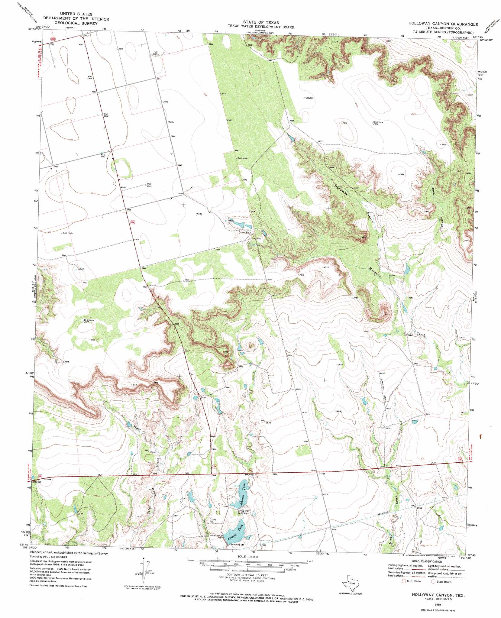
USGS Topo Quad 32101g5 - 1:24,000 scale
| Topo Map Name: | Holloway Canyon |
| USGS Topo Quad ID: | 32101g5 |
| Print Size: | ca. 21 1/4" wide x 27" high |
| Southeast Coordinates: | 32.75° N latitude / 101.5° W longitude |
| Map Center Coordinates: | 32.8125° N latitude / 101.5625° W longitude |
| U.S. State: | TX |
| Filename: | o32101g5.jpg |
| Download Map JPG Image: | Holloway Canyon topo map 1:24,000 scale |
| Map Type: | Topographic |
| Topo Series: | 7.5´ |
| Map Scale: | 1:24,000 |
| Source of Map Images: | United States Geological Survey (USGS) |
| Alternate Map Versions: |
Holloway Canyon TX 1969, updated 1972 Download PDF Buy paper map Holloway Canyon TX 2010 Download PDF Buy paper map Holloway Canyon TX 2012 Download PDF Buy paper map Holloway Canyon TX 2016 Download PDF Buy paper map |
1:24,000 Topo Quads surrounding Holloway Canyon
Skeen Lake |
Draw |
Grassland Se |
Middle Creek |
Cooper Creek |
O'Donnell |
Indian Canyon Nw |
Indian Canyon Ne |
Beal Hollow |
Gail Ne |
Hancock |
Indian Canyon |
Holloway Canyon |
Gail |
Fivemile Creek |
Key |
Sand Creek |
Long Draw |
Mushaway Peak |
Gunsight Draw Ne |
Sparenberg |
Ackerly |
Vealmoor |
Gunsight Draw |
Gunsight Draw Se |
> Back to 32101e1 at 1:100,000 scale
> Back to 32100a1 at 1:250,000 scale
> Back to U.S. Topo Maps home
Holloway Canyon topo map: Gazetteer
Holloway Canyon: Dams
Coleman Lake Dam elevation 775m 2542′County Tank Dam elevation 778m 2552′
Johnson Tank Dam elevation 784m 2572′
Holloway Canyon: Reservoirs
Coleman Lake elevation 775m 2542′County Tank elevation 781m 2562′
Johnson Tank elevation 785m 2575′
Holloway Canyon: Valleys
Holloway Canyon elevation 821m 2693′Rock Canyon elevation 821m 2693′
West Draw elevation 774m 2539′
Holloway Canyon digital topo map on disk
Buy this Holloway Canyon topo map showing relief, roads, GPS coordinates and other geographical features, as a high-resolution digital map file on DVD: