Indian Canyon Nw Topo Map Texas
To zoom in, hover over the map of Indian Canyon Nw
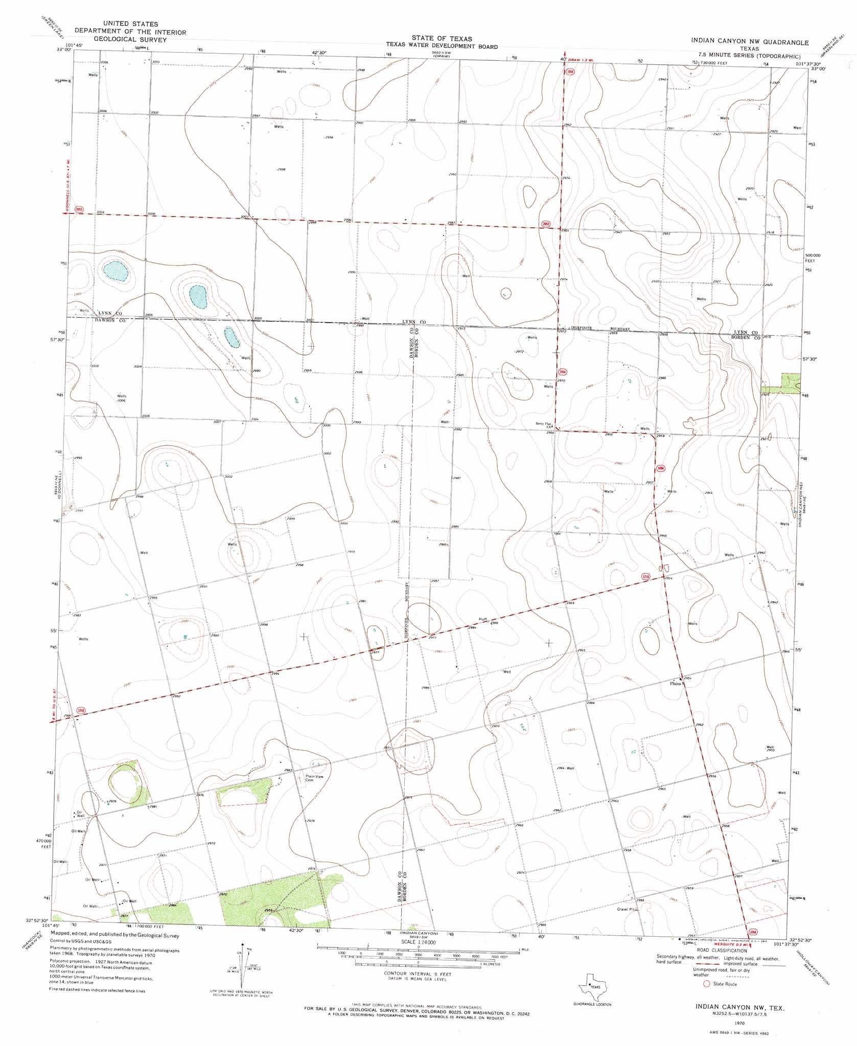
USGS Topo Quad 32101h6 - 1:24,000 scale
| Topo Map Name: | Indian Canyon Nw |
| USGS Topo Quad ID: | 32101h6 |
| Print Size: | ca. 21 1/4" wide x 27" high |
| Southeast Coordinates: | 32.875° N latitude / 101.625° W longitude |
| Map Center Coordinates: | 32.9375° N latitude / 101.6875° W longitude |
| U.S. State: | TX |
| Filename: | o32101h6.jpg |
| Download Map JPG Image: | Indian Canyon Nw topo map 1:24,000 scale |
| Map Type: | Topographic |
| Topo Series: | 7.5´ |
| Map Scale: | 1:24,000 |
| Source of Map Images: | United States Geological Survey (USGS) |
| Alternate Map Versions: |
Indian Canyon NW TX 1970, updated 1971 Download PDF Buy paper map Indian Canyon NW TX 2010 Download PDF Buy paper map Indian Canyon NW TX 2012 Download PDF Buy paper map Indian Canyon NW TX 2016 Download PDF Buy paper map |
1:24,000 Topo Quads surrounding Indian Canyon Nw
Double Lakes |
Tahoka |
New Lynn |
Grassland |
Post West |
Tahoka Sw |
Skeen Lake |
Draw |
Grassland Se |
Middle Creek |
Gooch Lake |
O'Donnell |
Indian Canyon Nw |
Indian Canyon Ne |
Beal Hollow |
Lamesa North |
Hancock |
Indian Canyon |
Holloway Canyon |
Gail |
Lamesa South |
Key |
Sand Creek |
Long Draw |
Mushaway Peak |
> Back to 32101e1 at 1:100,000 scale
> Back to 32100a1 at 1:250,000 scale
> Back to U.S. Topo Maps home
Indian Canyon Nw digital topo map on disk
Buy this Indian Canyon Nw topo map showing relief, roads, GPS coordinates and other geographical features, as a high-resolution digital map file on DVD: