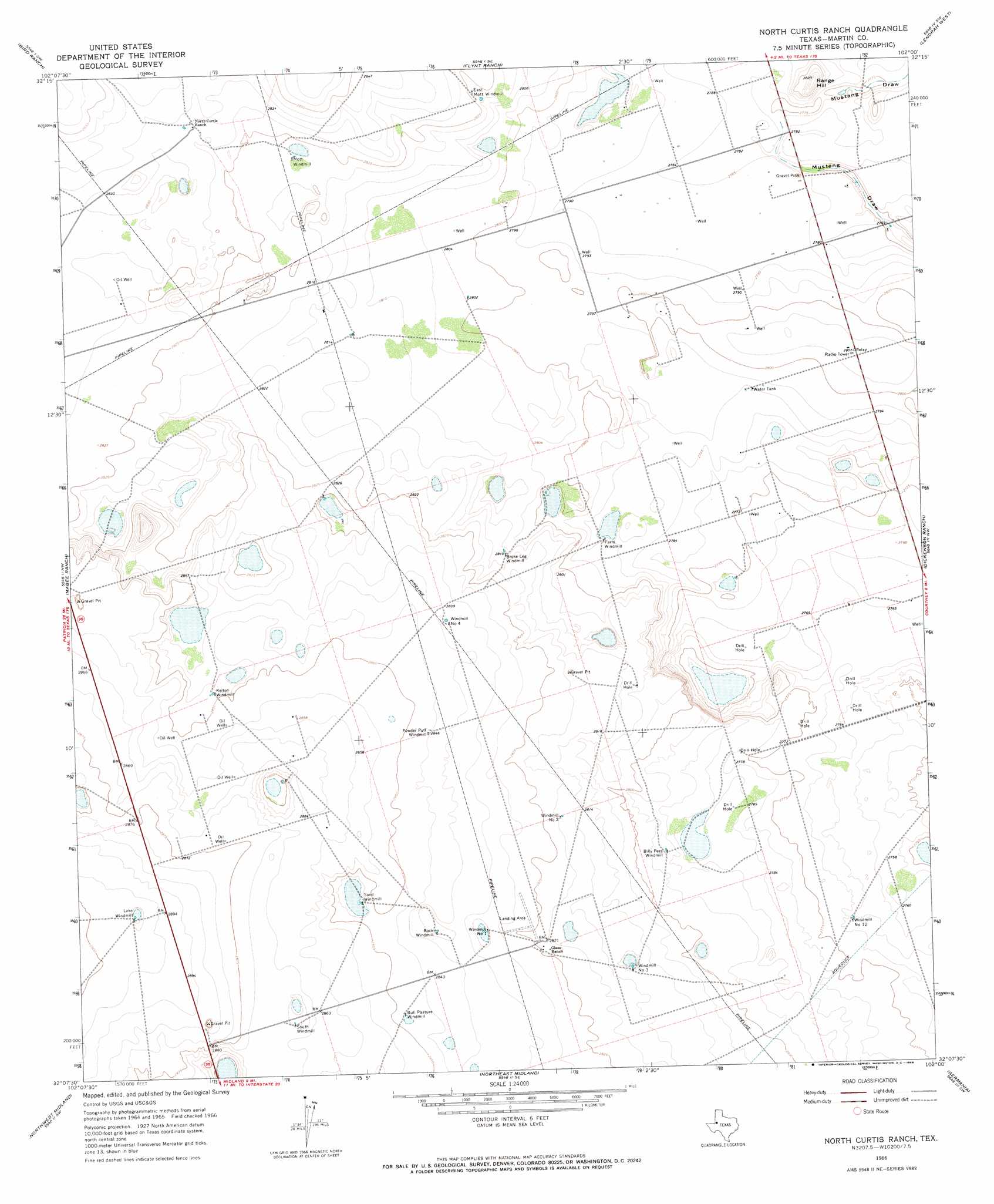
North Curtis Ranch Topo Map Texas
To zoom in, hover over the map of North Curtis Ranch
USGS Topo Quad 32102b1 - 1:24,000 scale
| Topo Map Name: | North Curtis Ranch |
| USGS Topo Quad ID: | 32102b1 |
| Print Size: | ca. 21 1/4" wide x 27" high |
| Southeast Coordinates: | 32.125° N latitude / 102° W longitude |
| Map Center Coordinates: | 32.1875° N latitude / 102.0625° W longitude |
| U.S. State: | TX |
| Filename: | o32102b1.jpg |
| Download Map JPG Image: | North Curtis Ranch topo map 1:24,000 scale |
| Map Type: | Topographic |
| Topo Series: | 7.5´ |
| Map Scale: | 1:24,000 |
| Source of Map Images: | United States Geological Survey (USGS) |
| Alternate Map Versions: |
North Curtis Ranch TX 1966, updated 1968 Download PDF Buy paper map North Curtis Ranch TX 2010 Download PDF Buy paper map North Curtis Ranch TX 2012 Download PDF Buy paper map North Curtis Ranch TX 2016 Download PDF Buy paper map |
1:24,000 Topo Quads surrounding North Curtis Ranch
Five Wells Ranch |
Scharbauer Ranch |
Wolcott Ranch |
Flower Grove |
Merrick |
Five Wells Ranch Se |
Bird Ranch |
Flynt Ranch |
Lenorah West |
Lenorah East |
Baird Lake |
Mabee Ranch |
North Curtis Ranch |
Dickenson Ranch |
Stanton |
Hackberry Lake |
Northwest Midland |
Northeast Midland |
Germania |
Stanton Se |
Odessa Ne |
Southwest Midland |
Southeast Midland |
Stephenson Lake |
Spraberry |
> Back to 32102a1 at 1:100,000 scale
> Back to 32102a1 at 1:250,000 scale
> Back to U.S. Topo Maps home
North Curtis Ranch digital topo map on disk
Buy this North Curtis Ranch topo map showing relief, roads, GPS coordinates and other geographical features, as a high-resolution digital map file on DVD: