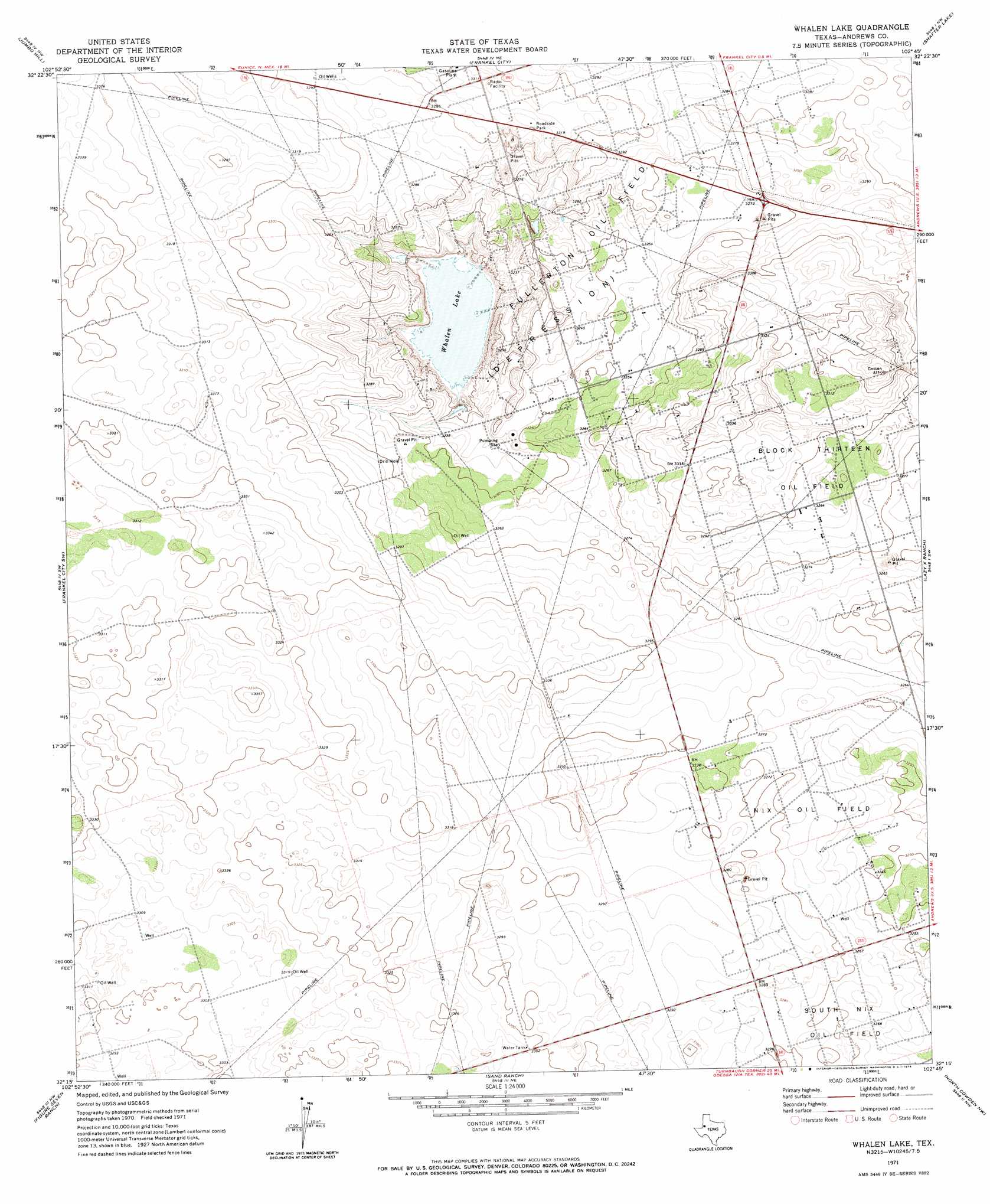
Whalen Lake Topo Map Texas
To zoom in, hover over the map of Whalen Lake
USGS Topo Quad 32102c7 - 1:24,000 scale
| Topo Map Name: | Whalen Lake |
| USGS Topo Quad ID: | 32102c7 |
| Print Size: | ca. 21 1/4" wide x 27" high |
| Southeast Coordinates: | 32.25° N latitude / 102.75° W longitude |
| Map Center Coordinates: | 32.3125° N latitude / 102.8125° W longitude |
| U.S. State: | TX |
| Filename: | o32102c7.jpg |
| Download Map JPG Image: | Whalen Lake topo map 1:24,000 scale |
| Map Type: | Topographic |
| Topo Series: | 7.5´ |
| Map Scale: | 1:24,000 |
| Source of Map Images: | United States Geological Survey (USGS) |
| Alternate Map Versions: |
Whalen Lake TX 1971, updated 1974 Download PDF Buy paper map Whalen Lake TX 2010 Download PDF Buy paper map Whalen Lake TX 2012 Download PDF Buy paper map Whalen Lake TX 2016 Download PDF Buy paper map |
1:24,000 Topo Quads surrounding Whalen Lake
Hobbs Se |
Brinson Ranch |
Paynes Corner Se |
Seminole Sw |
Seminole Se |
Eunice Ne |
Jumbo Hill |
Frankel City |
Shafter Lake |
Florey |
Eunice Se |
Frankel City Sw |
Whalen Lake |
Lazy X Ranch |
Andrews |
Jal Ne |
Figure Seven Ranch |
Sand Ranch |
North Cowden Nw |
Clabber Hill Ranch |
Jal Se |
Yt Ranch |
Bedford Ranch |
Coyote Corner |
North Cowden |
> Back to 32102a1 at 1:100,000 scale
> Back to 32102a1 at 1:250,000 scale
> Back to U.S. Topo Maps home
Whalen Lake topo map: Gazetteer
Whalen Lake: Lakes
Whalen Lake elevation 977m 3205′Whalen Lake: Oilfields
Block Thirteen Oil Field elevation 999m 3277′Nix Oil Field elevation 997m 3270′
Whalen Lake digital topo map on disk
Buy this Whalen Lake topo map showing relief, roads, GPS coordinates and other geographical features, as a high-resolution digital map file on DVD: