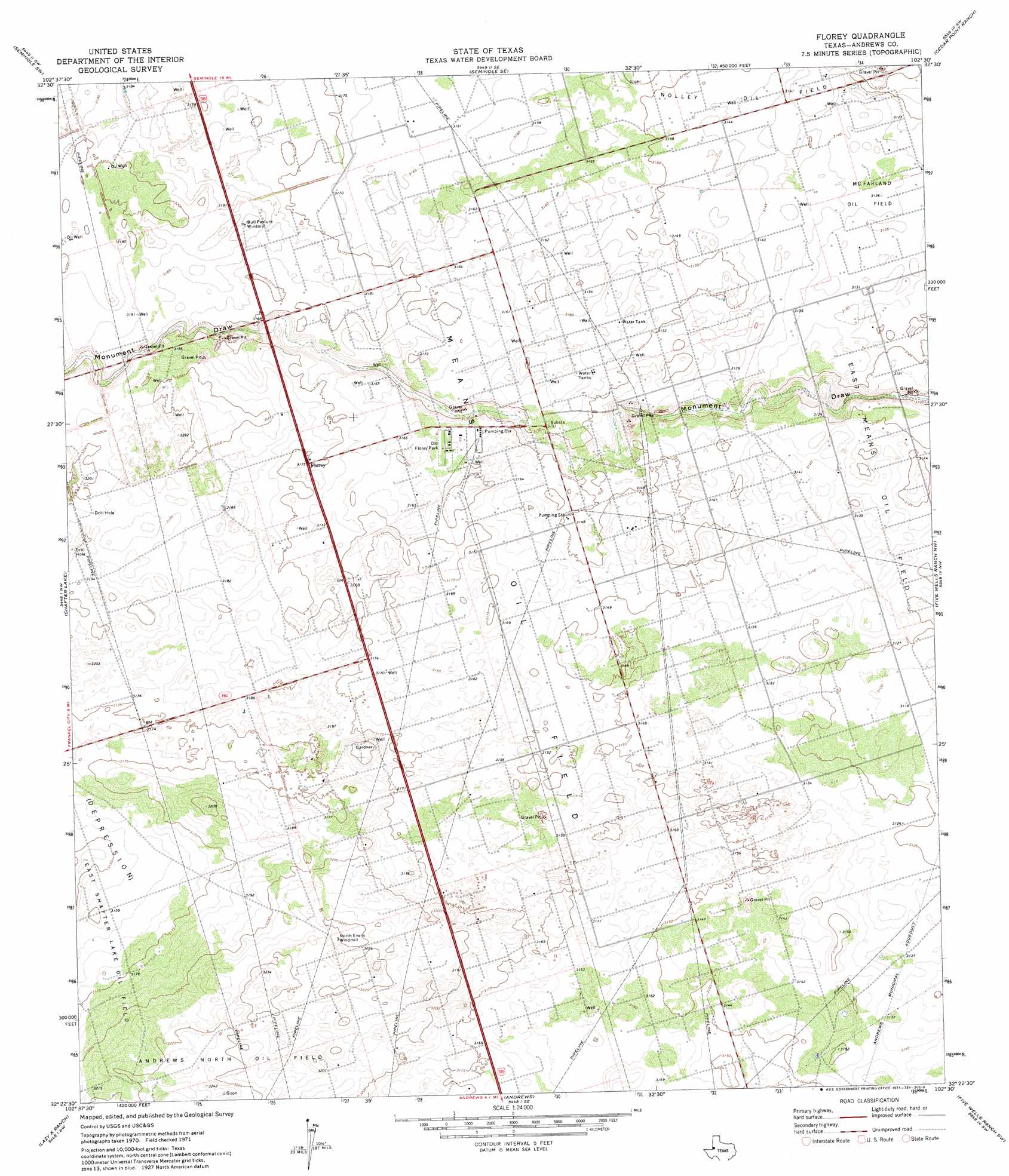
Florey Topo Map Texas
To zoom in, hover over the map of Florey
USGS Topo Quad 32102d5 - 1:24,000 scale
| Topo Map Name: | Florey |
| USGS Topo Quad ID: | 32102d5 |
| Print Size: | ca. 21 1/4" wide x 27" high |
| Southeast Coordinates: | 32.375° N latitude / 102.5° W longitude |
| Map Center Coordinates: | 32.4375° N latitude / 102.5625° W longitude |
| U.S. State: | TX |
| Filename: | o32102d5.jpg |
| Download Map JPG Image: | Florey topo map 1:24,000 scale |
| Map Type: | Topographic |
| Topo Series: | 7.5´ |
| Map Scale: | 1:24,000 |
| Source of Map Images: | United States Geological Survey (USGS) |
| Alternate Map Versions: |
Florey TX 1971, updated 1974 Download PDF Buy paper map Florey TX 2010 Download PDF Buy paper map Florey TX 2012 Download PDF Buy paper map Florey TX 2016 Download PDF Buy paper map |
1:24,000 Topo Quads surrounding Florey
Paynes Corner |
Seminole |
Seminole Ne |
Mckenzie Lake Nw |
Mckenzie Lake |
Paynes Corner Se |
Seminole Sw |
Seminole Se |
Cedar Point Ranch |
Mckenzie Lake Se |
Frankel City |
Shafter Lake |
Florey |
Five Wells Ranch Nw |
Five Wells Ranch |
Whalen Lake |
Lazy X Ranch |
Andrews |
Five Wells Ranch Sw |
Five Wells Ranch Se |
Sand Ranch |
North Cowden Nw |
Clabber Hill Ranch |
Gardendale Nw |
Baird Lake |
> Back to 32102a1 at 1:100,000 scale
> Back to 32102a1 at 1:250,000 scale
> Back to U.S. Topo Maps home
Florey topo map: Gazetteer
Florey: Oilfields
East Shafter Lake Oil Field elevation 965m 3166′Means Oil Field elevation 963m 3159′
Florey: Parks
Old Florey Park elevation 964m 3162′Florey: Populated Places
Florey elevation 969m 3179′Florey digital topo map on disk
Buy this Florey topo map showing relief, roads, GPS coordinates and other geographical features, as a high-resolution digital map file on DVD: