Seminole Topo Map Texas
To zoom in, hover over the map of Seminole
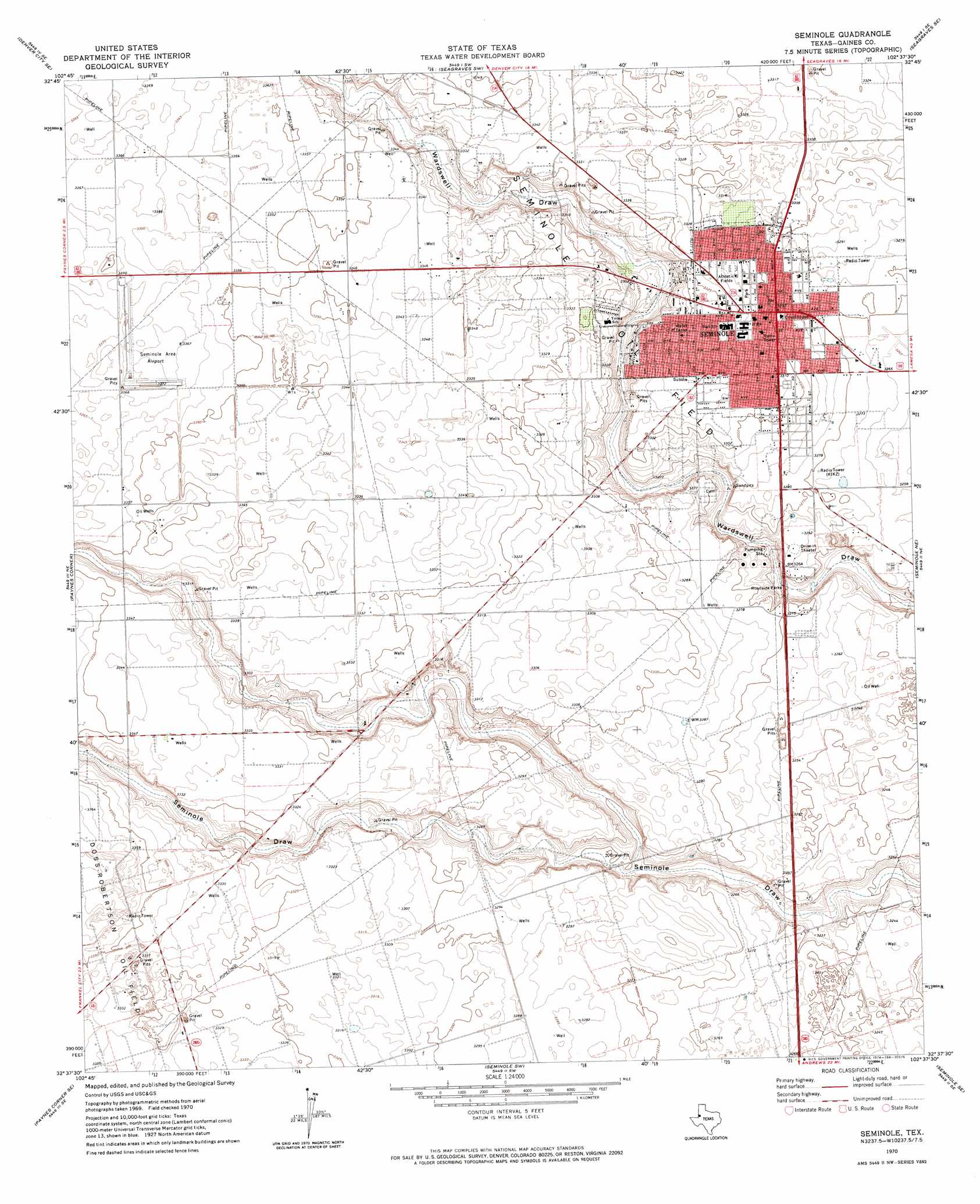
USGS Topo Quad 32102f6 - 1:24,000 scale
| Topo Map Name: | Seminole |
| USGS Topo Quad ID: | 32102f6 |
| Print Size: | ca. 21 1/4" wide x 27" high |
| Southeast Coordinates: | 32.625° N latitude / 102.625° W longitude |
| Map Center Coordinates: | 32.6875° N latitude / 102.6875° W longitude |
| U.S. State: | TX |
| Filename: | o32102f6.jpg |
| Download Map JPG Image: | Seminole topo map 1:24,000 scale |
| Map Type: | Topographic |
| Topo Series: | 7.5´ |
| Map Scale: | 1:24,000 |
| Source of Map Images: | United States Geological Survey (USGS) |
| Alternate Map Versions: |
Seminole TX 1970, updated 1974 Download PDF Buy paper map Seminole TX 2010 Download PDF Buy paper map Seminole TX 2012 Download PDF Buy paper map Seminole TX 2016 Download PDF Buy paper map |
1:24,000 Topo Quads surrounding Seminole
Higginbotham |
Denver City |
Seagraves Nw |
Seagraves |
Loop |
Denver City Sw |
Denver City Se |
Seagraves Sw |
Seagraves Se |
Loop Sw |
Paynes Corner Nw |
Paynes Corner |
Seminole |
Seminole Ne |
Mckenzie Lake Nw |
Brinson Ranch |
Paynes Corner Se |
Seminole Sw |
Seminole Se |
Cedar Point Ranch |
Jumbo Hill |
Frankel City |
Shafter Lake |
Florey |
Five Wells Ranch Nw |
> Back to 32102e1 at 1:100,000 scale
> Back to 32102a1 at 1:250,000 scale
> Back to U.S. Topo Maps home
Seminole topo map: Gazetteer
Seminole: Airports
Gaines County Airport elevation 1002m 3287′Seminole Spraying Service Airport elevation 1026m 3366′
Seminole: Populated Places
Seminole elevation 1005m 3297′Seminole digital topo map on disk
Buy this Seminole topo map showing relief, roads, GPS coordinates and other geographical features, as a high-resolution digital map file on DVD: